Washington Topo Map Arkansas
To zoom in, hover over the map of Washington
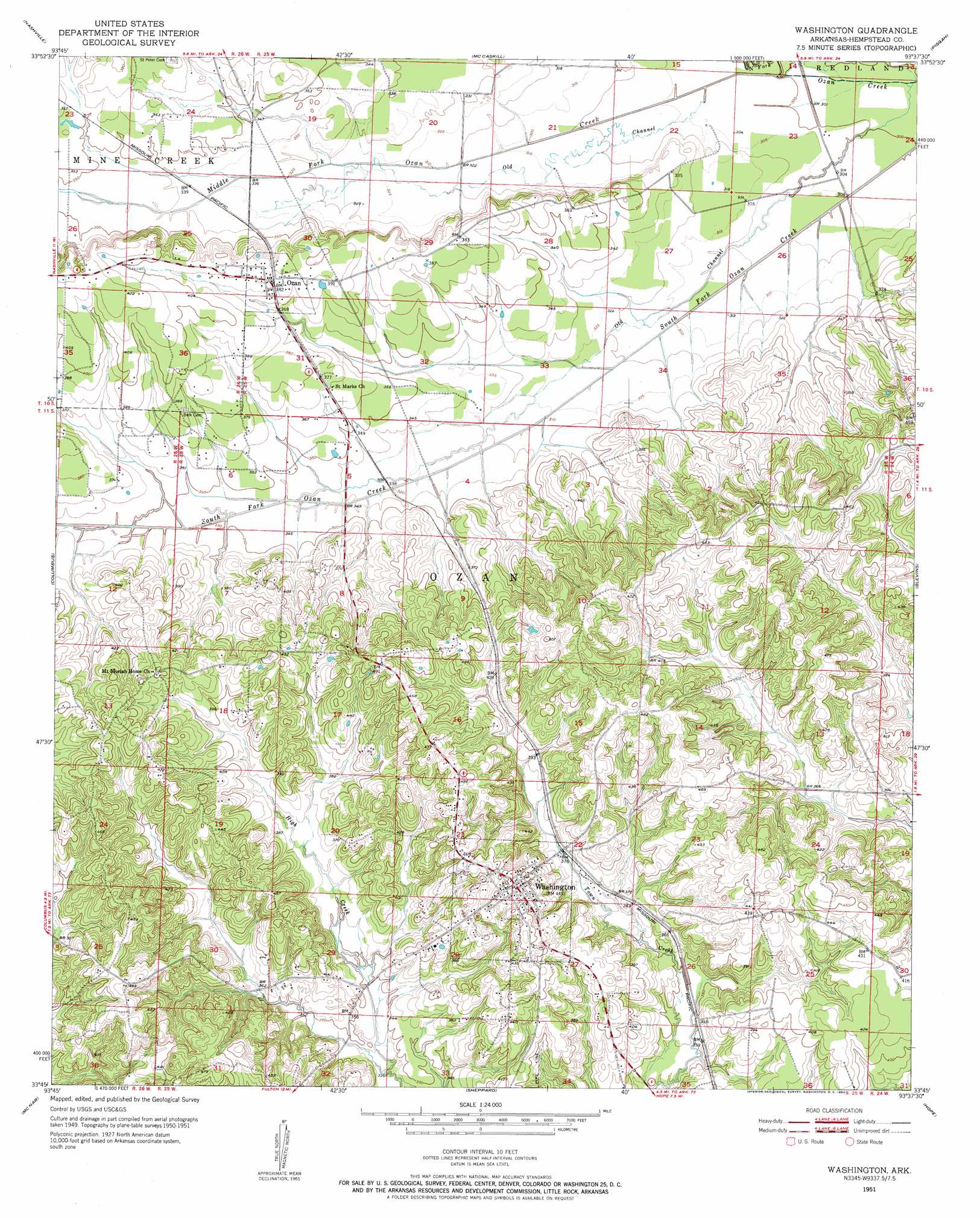
USGS Topo Quad 33093g6 - 1:24,000 scale
| Topo Map Name: | Washington |
| USGS Topo Quad ID: | 33093g6 |
| Print Size: | ca. 21 1/4" wide x 27" high |
| Southeast Coordinates: | 33.75° N latitude / 93.625° W longitude |
| Map Center Coordinates: | 33.8125° N latitude / 93.6875° W longitude |
| U.S. State: | AR |
| Filename: | o33093g6.jpg |
| Download Map JPG Image: | Washington topo map 1:24,000 scale |
| Map Type: | Topographic |
| Topo Series: | 7.5´ |
| Map Scale: | 1:24,000 |
| Source of Map Images: | United States Geological Survey (USGS) |
| Alternate Map Versions: |
Washington AR 1951, updated 1952 Download PDF Buy paper map Washington AR 2011 Download PDF Buy paper map Washington AR 2014 Download PDF Buy paper map |
1:24,000 Topo Quads surrounding Washington
Center Point |
Nathan |
Murfreesboro |
Delight |
Antoine |
Mineral Springs North |
Nashville |
Mccaskill |
Pisgah |
Piney Grove |
Mineral Springs South |
Columbus |
Washington |
Blevins |
Prescott West |
Red Bluff |
Mcnab |
Sheppard |
Hope |
Emmet |
Homan |
Fulton |
Spring Hill |
Patmos |
Bodcaw |
> Back to 33093e1 at 1:100,000 scale
> Back to 33092a1 at 1:250,000 scale
> Back to U.S. Topo Maps home
Washington topo map: Gazetteer
Washington: Channels
Old Channel elevation 94m 308′Old Channel elevation 96m 314′
Washington: Parks
Hope State Wildlife Management Area elevation 131m 429′Old Washington Historic State Park elevation 138m 452′
Washington Historic District elevation 141m 462′
Washington: Populated Places
Academy (historical) elevation 133m 436′Jakajones (historical) elevation 135m 442′
Ozan elevation 120m 393′
Washington elevation 138m 452′
Washington: Streams
Middle Fork Ozan Creek elevation 96m 314′North Fork Ozan Creek elevation 96m 314′
Washington digital topo map on disk
Buy this Washington topo map showing relief, roads, GPS coordinates and other geographical features, as a high-resolution digital map file on DVD: