Curtis Topo Map Arkansas
To zoom in, hover over the map of Curtis
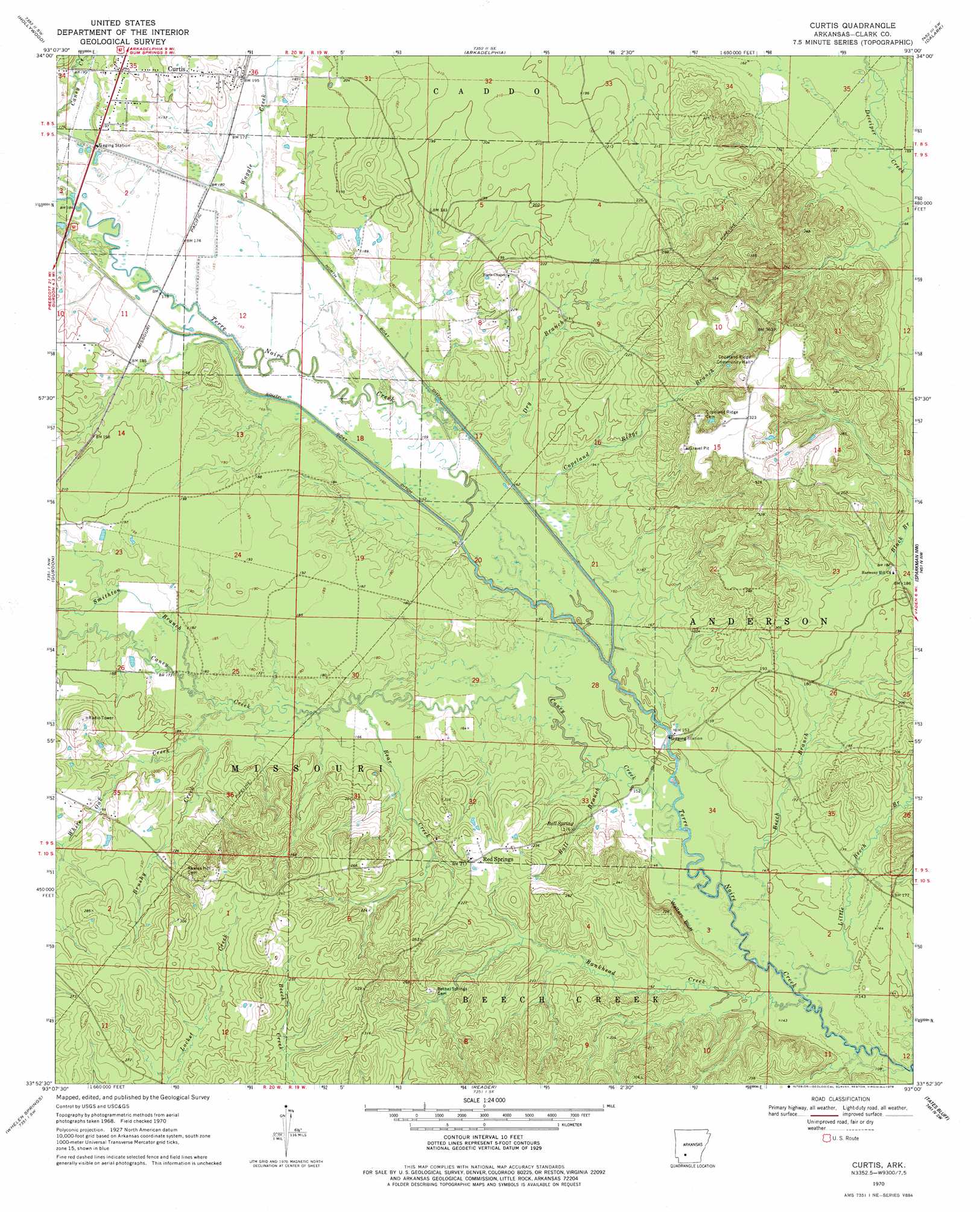
USGS Topo Quad 33093h1 - 1:24,000 scale
| Topo Map Name: | Curtis |
| USGS Topo Quad ID: | 33093h1 |
| Print Size: | ca. 21 1/4" wide x 27" high |
| Southeast Coordinates: | 33.875° N latitude / 93° W longitude |
| Map Center Coordinates: | 33.9375° N latitude / 93.0625° W longitude |
| U.S. State: | AR |
| Filename: | o33093h1.jpg |
| Download Map JPG Image: | Curtis topo map 1:24,000 scale |
| Map Type: | Topographic |
| Topo Series: | 7.5´ |
| Map Scale: | 1:24,000 |
| Source of Map Images: | United States Geological Survey (USGS) |
| Alternate Map Versions: |
Curtis AR 1970, updated 1972 Download PDF Buy paper map Curtis AR 1970, updated 1978 Download PDF Buy paper map Curtis AR 2011 Download PDF Buy paper map Curtis AR 2014 Download PDF Buy paper map |
1:24,000 Topo Quads surrounding Curtis
Chalybeate Mountain East |
De Gray |
Caddo Valley |
Donaldson |
Round Hill |
Okolona North |
Hollywood |
Arkadelphia |
Dalark |
Manning |
Okolona South |
Gurdon |
Curtis |
Sparkman Nw |
Sparkman |
Prescott East |
Whelen Springs |
Reader |
Tates Bluff |
Ouachita |
Laneburg |
Bluff City |
Chidester |
Bragg City |
Harmony Grove |
> Back to 33093e1 at 1:100,000 scale
> Back to 33092a1 at 1:250,000 scale
> Back to U.S. Topo Maps home
Curtis topo map: Gazetteer
Curtis: Cliffs
Walters Bluff elevation 51m 167′Curtis: Populated Places
Curtis elevation 74m 242′Red Springs elevation 67m 219′
Curtis: Springs
Ball Spring elevation 55m 180′Curtis: Streams
Ball Branch elevation 49m 160′Bankhead Creek elevation 45m 147′
Bear Creek elevation 50m 164′
Beech Branch elevation 46m 150′
Brushy Creek elevation 54m 177′
Caney Creek elevation 48m 157′
Copeland Ridge Branch elevation 53m 173′
Dry Branch elevation 52m 170′
Little Beech Branch elevation 45m 147′
Smithton Branch elevation 54m 177′
Waggle Creek elevation 53m 173′
Curtis digital topo map on disk
Buy this Curtis topo map showing relief, roads, GPS coordinates and other geographical features, as a high-resolution digital map file on DVD: