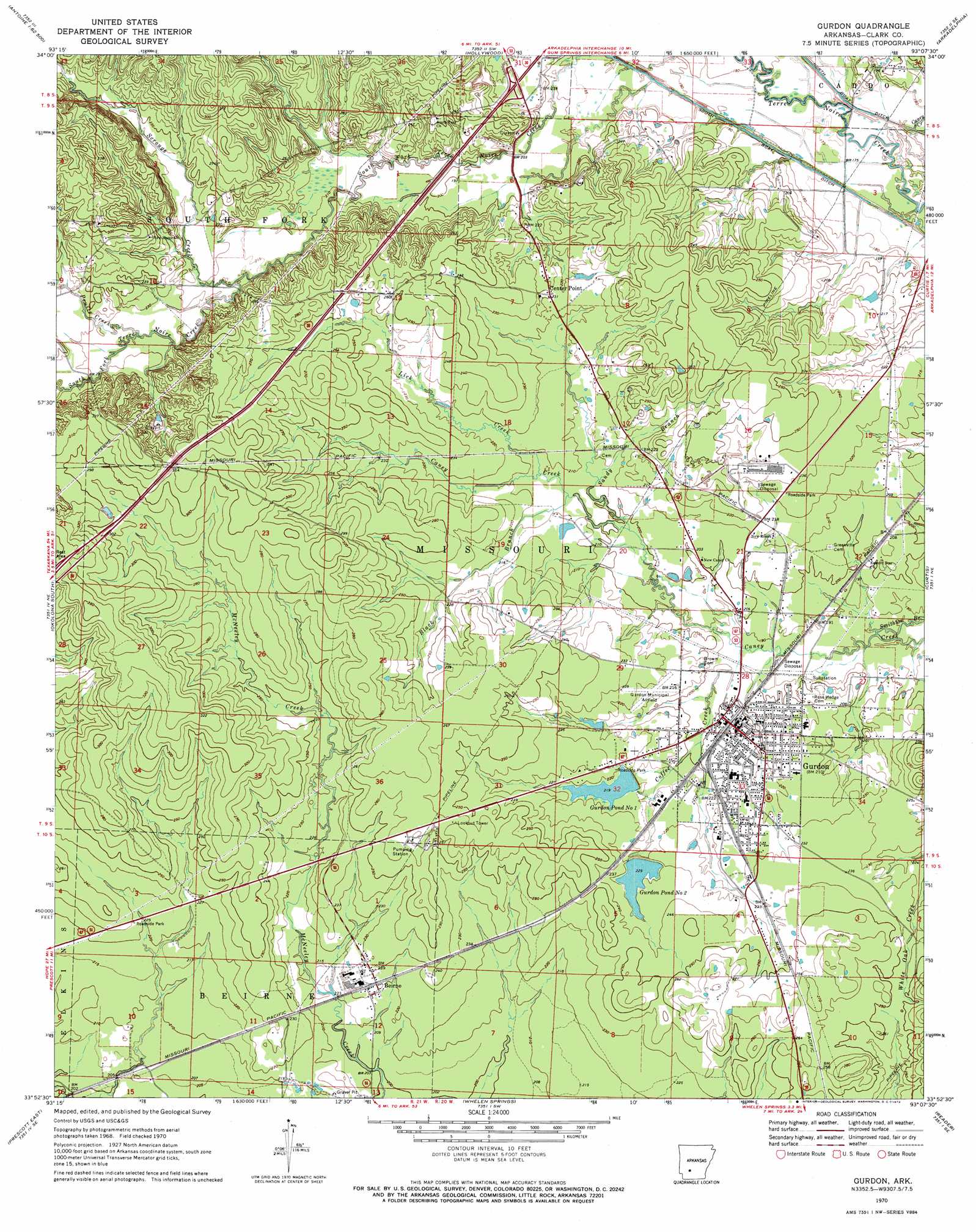
Gurdon Topo Map Arkansas
To zoom in, hover over the map of Gurdon
USGS Topo Quad 33093h2 - 1:24,000 scale
| Topo Map Name: | Gurdon |
| USGS Topo Quad ID: | 33093h2 |
| Print Size: | ca. 21 1/4" wide x 27" high |
| Southeast Coordinates: | 33.875° N latitude / 93.125° W longitude |
| Map Center Coordinates: | 33.9375° N latitude / 93.1875° W longitude |
| U.S. State: | AR |
| Filename: | o33093h2.jpg |
| Download Map JPG Image: | Gurdon topo map 1:24,000 scale |
| Map Type: | Topographic |
| Topo Series: | 7.5´ |
| Map Scale: | 1:24,000 |
| Source of Map Images: | United States Geological Survey (USGS) |
| Alternate Map Versions: |
Gurdon AR 1970, updated 1972 Download PDF Buy paper map Gurdon AR 2011 Download PDF Buy paper map Gurdon AR 2014 Download PDF Buy paper map |
1:24,000 Topo Quads surrounding Gurdon
Chalybeate Mountain West |
Chalybeate Mountain East |
De Gray |
Caddo Valley |
Donaldson |
Antoine |
Okolona North |
Hollywood |
Arkadelphia |
Dalark |
Piney Grove |
Okolona South |
Gurdon |
Curtis |
Sparkman Nw |
Prescott West |
Prescott East |
Whelen Springs |
Reader |
Tates Bluff |
Emmet |
Laneburg |
Bluff City |
Chidester |
Bragg City |
> Back to 33093e1 at 1:100,000 scale
> Back to 33092a1 at 1:250,000 scale
> Back to U.S. Topo Maps home
Gurdon topo map: Gazetteer
Gurdon: Airports
Gurdon Municipal Airport elevation 69m 226′Gurdon: Canals
North Boat Ditch elevation 55m 180′Gurdon: Crossings
Interchange 63 elevation 68m 223′Gurdon: Dams
Gurdon Pond One Dam elevation 66m 216′Gurdon Pond Two Dam elevation 67m 219′
Gurdon: Populated Places
Beirne elevation 68m 223′Gurdon elevation 64m 209′
Keyton (historical) elevation 88m 288′
Smithton elevation 64m 209′
Smithton (historical) elevation 65m 213′
Gurdon: Post Offices
Beirne Post Office elevation 68m 223′Gurdon: Reservoirs
Gurdon Pond One elevation 66m 216′Gurdon Pond Two elevation 67m 219′
Gurdon: Streams
Black Branch elevation 66m 216′Caney Creek elevation 52m 170′
Coffee Creek elevation 60m 196′
Lick Creek elevation 67m 219′
Pruitt Creek elevation 69m 226′
Sandy Branch elevation 64m 209′
Scrouge Creek elevation 67m 219′
White Oak Creek elevation 67m 219′
Gurdon digital topo map on disk
Buy this Gurdon topo map showing relief, roads, GPS coordinates and other geographical features, as a high-resolution digital map file on DVD: