Okolona South Topo Map Arkansas
To zoom in, hover over the map of Okolona South
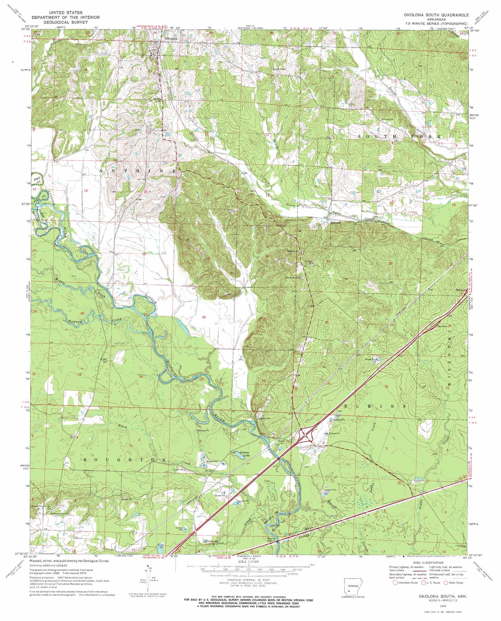
USGS Topo Quad 33093h3 - 1:24,000 scale
| Topo Map Name: | Okolona South |
| USGS Topo Quad ID: | 33093h3 |
| Print Size: | ca. 21 1/4" wide x 27" high |
| Southeast Coordinates: | 33.875° N latitude / 93.25° W longitude |
| Map Center Coordinates: | 33.9375° N latitude / 93.3125° W longitude |
| U.S. State: | AR |
| Filename: | o33093h3.jpg |
| Download Map JPG Image: | Okolona South topo map 1:24,000 scale |
| Map Type: | Topographic |
| Topo Series: | 7.5´ |
| Map Scale: | 1:24,000 |
| Source of Map Images: | United States Geological Survey (USGS) |
| Alternate Map Versions: |
Okolona South AR 1970, updated 1972 Download PDF Buy paper map Okolona South AR 2011 Download PDF Buy paper map Okolona South AR 2014 Download PDF Buy paper map |
1:24,000 Topo Quads surrounding Okolona South
Murfreesboro Ne |
Chalybeate Mountain West |
Chalybeate Mountain East |
De Gray |
Caddo Valley |
Delight |
Antoine |
Okolona North |
Hollywood |
Arkadelphia |
Pisgah |
Piney Grove |
Okolona South |
Gurdon |
Curtis |
Blevins |
Prescott West |
Prescott East |
Whelen Springs |
Reader |
Hope |
Emmet |
Laneburg |
Bluff City |
Chidester |
> Back to 33093e1 at 1:100,000 scale
> Back to 33092a1 at 1:250,000 scale
> Back to U.S. Topo Maps home
Okolona South topo map: Gazetteer
Okolona South: Crossings
Interchange 54 elevation 77m 252′Okolona South: Guts
Half Moon Slough elevation 63m 206′Okolona South: Lakes
Grassy Lake elevation 60m 196′Okolona South: Populated Places
Burtsell elevation 82m 269′Native (historical) elevation 117m 383′
Okolona elevation 117m 383′
Okolona South: Streams
Antoine River elevation 67m 219′Black Creek elevation 58m 190′
Howard Creek elevation 62m 203′
Middle Creek elevation 64m 209′
Sandy Creek elevation 62m 203′
Wilson Creek elevation 58m 190′
Okolona South digital topo map on disk
Buy this Okolona South topo map showing relief, roads, GPS coordinates and other geographical features, as a high-resolution digital map file on DVD: