Mineral Springs North Topo Map Arkansas
To zoom in, hover over the map of Mineral Springs North
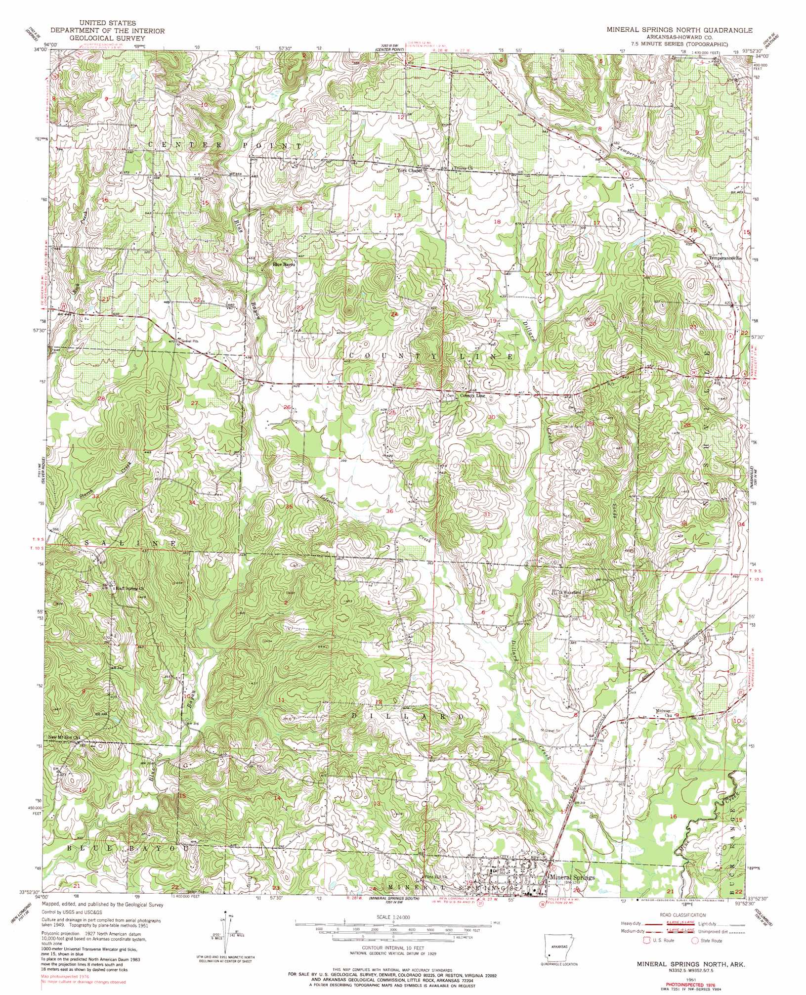
USGS Topo Quad 33093h8 - 1:24,000 scale
| Topo Map Name: | Mineral Springs North |
| USGS Topo Quad ID: | 33093h8 |
| Print Size: | ca. 21 1/4" wide x 27" high |
| Southeast Coordinates: | 33.875° N latitude / 93.875° W longitude |
| Map Center Coordinates: | 33.9375° N latitude / 93.9375° W longitude |
| U.S. State: | AR |
| Filename: | o33093h8.jpg |
| Download Map JPG Image: | Mineral Springs North topo map 1:24,000 scale |
| Map Type: | Topographic |
| Topo Series: | 7.5´ |
| Map Scale: | 1:24,000 |
| Source of Map Images: | United States Geological Survey (USGS) |
| Alternate Map Versions: |
Mineral Springs North AR 1951, updated 1952 Download PDF Buy paper map Mineral Springs North AR 1951, updated 1983 Download PDF Buy paper map Mineral Springs North AR 2011 Download PDF Buy paper map Mineral Springs North AR 2014 Download PDF Buy paper map |
1:24,000 Topo Quads surrounding Mineral Springs North
Gillham Dam |
Dierks Dam |
Newhope |
Center Point Ne |
Narrows Dam |
Geneva |
Dierks |
Center Point |
Nathan |
Murfreesboro |
Lockesburg |
Silver Ridge |
Mineral Springs North |
Nashville |
Mccaskill |
Falls Chapel |
Ben Lomond |
Mineral Springs South |
Columbus |
Washington |
Ashdown West |
Ashdown East |
Red Bluff |
Mcnab |
Sheppard |
> Back to 33093e1 at 1:100,000 scale
> Back to 33092a1 at 1:250,000 scale
> Back to U.S. Topo Maps home
Mineral Springs North topo map: Gazetteer
Mineral Springs North: Populated Places
Amity (historical) elevation 128m 419′Blue Bayou elevation 153m 501′
Forgy (historical) elevation 138m 452′
Midway elevation 105m 344′
Mineral Springs elevation 105m 344′
Mount Olive (historical) elevation 139m 456′
Temperanceville elevation 135m 442′
Wakefield (historical) elevation 107m 351′
Mineral Springs North: Streams
Lefever Creek elevation 102m 334′Little Bayou elevation 146m 479′
Sandy Branch elevation 96m 314′
Mineral Springs North digital topo map on disk
Buy this Mineral Springs North topo map showing relief, roads, GPS coordinates and other geographical features, as a high-resolution digital map file on DVD: