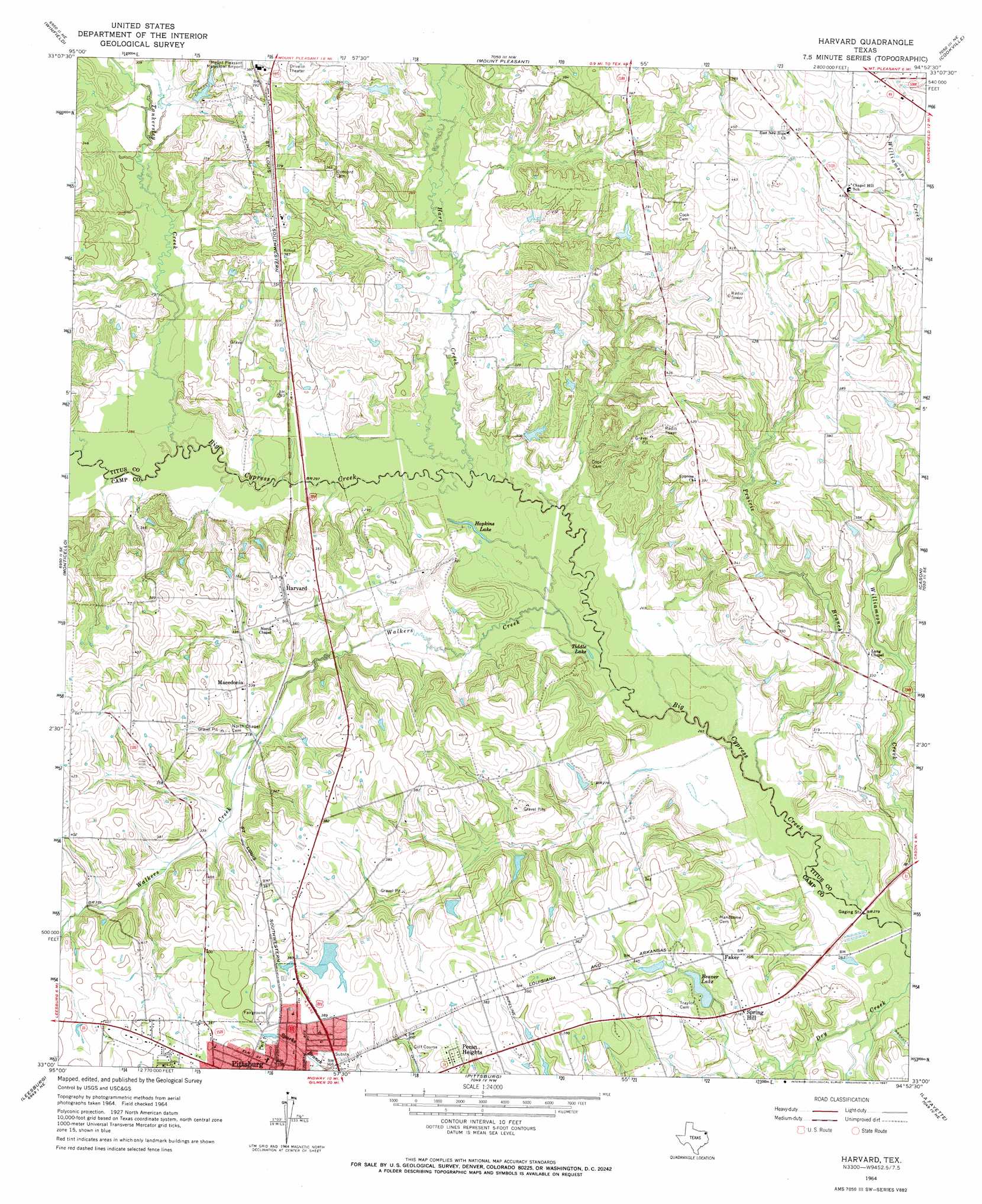
Harvard Topo Map Texas
To zoom in, hover over the map of Harvard
USGS Topo Quad 33094a8 - 1:24,000 scale
| Topo Map Name: | Harvard |
| USGS Topo Quad ID: | 33094a8 |
| Print Size: | ca. 21 1/4" wide x 27" high |
| Southeast Coordinates: | 33° N latitude / 94.875° W longitude |
| Map Center Coordinates: | 33.0625° N latitude / 94.9375° W longitude |
| U.S. State: | TX |
| Filename: | o33094a8.jpg |
| Download Map JPG Image: | Harvard topo map 1:24,000 scale |
| Map Type: | Topographic |
| Topo Series: | 7.5´ |
| Map Scale: | 1:24,000 |
| Source of Map Images: | United States Geological Survey (USGS) |
| Alternate Map Versions: |
Harvard TX 1964, updated 1967 Download PDF Buy paper map Harvard TX 2010 Download PDF Buy paper map Harvard TX 2013 Download PDF Buy paper map Harvard TX 2016 Download PDF Buy paper map |
1:24,000 Topo Quads surrounding Harvard
Hagansport |
Talco |
Wilkinson |
Coopers Chapel |
Dalby Springs |
Mount Vernon |
Winfield |
Mount Pleasant |
Cookville |
Naples |
New Hope |
Monticello |
Harvard |
Cason |
Daingerfield |
Newsome |
Leesburg |
Pittsburg |
Lafayette |
Lone Star |
Rhonesboro |
Thomas |
Bettie |
Coffeeville |
Ore City |
> Back to 33094a1 at 1:100,000 scale
> Back to 33094a1 at 1:250,000 scale
> Back to U.S. Topo Maps home
Harvard topo map: Gazetteer
Harvard: Airports
Polk Ranch Airport elevation 105m 344′Harvard: Dams
Beaver Club Dam elevation 96m 314′J H Milligan Estate Dam elevation 116m 380′
Sandlin Lake Dam elevation 101m 331′
Harvard: Lakes
Hopkins Lake elevation 82m 269′Tiddle Lake elevation 81m 265′
Harvard: Populated Places
Harvard elevation 109m 357′Macedonia elevation 103m 337′
Pecan Heights elevation 113m 370′
Spring Hill elevation 95m 311′
Harvard: Reservoirs
Beaver Club Lake elevation 96m 314′Beaver Lake elevation 90m 295′
J H Milligan Estate Lake elevation 116m 380′
Sandlin Lake elevation 101m 331′
Harvard: Streams
Hart Creek elevation 84m 275′Prairie Branch elevation 79m 259′
Tankersley Creek elevation 85m 278′
Walkers Creek elevation 81m 265′
Harvard digital topo map on disk
Buy this Harvard topo map showing relief, roads, GPS coordinates and other geographical features, as a high-resolution digital map file on DVD: