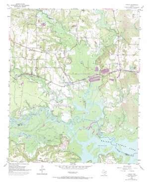
Corley Topo Map Texas
To zoom in, hover over the map of Corley
USGS Topo Quad 33094c4 - 1:24,000 scale
| Topo Map Name: | Corley |
| USGS Topo Quad ID: | 33094c4 |
| Print Size: | ca. 21 1/4" wide x 27" high |
| Southeast Coordinates: | 33.25° N latitude / 94.375° W longitude |
| Map Center Coordinates: | 33.3125° N latitude / 94.4375° W longitude |
| U.S. State: | TX |
| Filename: | o33094c4.jpg |
| Download Map JPG Image: | Corley topo map 1:24,000 scale |
| Map Type: | Topographic |
| Topo Series: | 7.5´ |
| Map Scale: | 1:24,000 |
| Source of Map Images: | United States Geological Survey (USGS) |
| Alternate Map Versions: |
Corley TX 1955, updated 1955 Download PDF Buy paper map Corley TX 1955, updated 1971 Download PDF Buy paper map Corley TX 1955, updated 1985 Download PDF Buy paper map Corley TX 2010 Download PDF Buy paper map Corley TX 2013 Download PDF Buy paper map Corley TX 2016 Download PDF Buy paper map |
1:24,000 Topo Quads surrounding Corley
> Back to 33094a1 at 1:100,000 scale
> Back to 33094a1 at 1:250,000 scale
> Back to U.S. Topo Maps home
Corley topo map: Gazetteer
Corley: Airports
Ashford Field elevation 90m 295′Corley: Dams
Ashford Lake Dam elevation 84m 275′Crystal Springs Dam elevation 86m 282′
Corley: Lakes
Thomas Lake elevation 69m 226′Corley: Parks
Thomas Lake Park elevation 71m 232′Corley: Populated Places
Carbondale elevation 78m 255′Corley elevation 91m 298′
Old Union elevation 98m 321′
Corley: Reservoirs
Ashford Lake elevation 84m 275′Crystal Springs Lake elevation 89m 291′
Corley: Ridges
White Oak Ridge elevation 80m 262′Corley: Springs
Moss Springs elevation 92m 301′Corley: Streams
Anderson Creek elevation 69m 226′Big Branch elevation 73m 239′
Brooks Creek elevation 69m 226′
Dody Branch elevation 75m 246′
Moss Creek elevation 73m 239′
Panther Creek elevation 71m 232′
Rice Creek elevation 70m 229′
Thomas Creek elevation 69m 226′
Corley digital topo map on disk
Buy this Corley topo map showing relief, roads, GPS coordinates and other geographical features, as a high-resolution digital map file on DVD:


