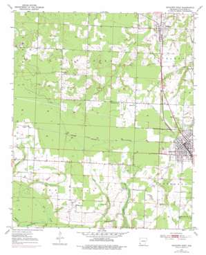
Ashdown West Topo Map Arkansas
To zoom in, hover over the map of Ashdown West
USGS Topo Quad 33094f2 - 1:24,000 scale
| Topo Map Name: | Ashdown West |
| USGS Topo Quad ID: | 33094f2 |
| Print Size: | ca. 21 1/4" wide x 27" high |
| Southeast Coordinates: | 33.625° N latitude / 94.125° W longitude |
| Map Center Coordinates: | 33.6875° N latitude / 94.1875° W longitude |
| U.S. State: | AR |
| Filename: | o33094f2.jpg |
| Download Map JPG Image: | Ashdown West topo map 1:24,000 scale |
| Map Type: | Topographic |
| Topo Series: | 7.5´ |
| Map Scale: | 1:24,000 |
| Source of Map Images: | United States Geological Survey (USGS) |
| Alternate Map Versions: |
Ashdown West AR 1950, updated 1956 Download PDF Buy paper map Ashdown West AR 1950, updated 1976 Download PDF Buy paper map Ashdown West AR 1951 Download PDF Buy paper map Ashdown West AR 2011 Download PDF Buy paper map Ashdown West AR 2014 Download PDF Buy paper map |
1:24,000 Topo Quads surrounding Ashdown West
> Back to 33094e1 at 1:100,000 scale
> Back to 33094a1 at 1:250,000 scale
> Back to U.S. Topo Maps home
Ashdown West topo map: Gazetteer
Ashdown West: Dams
Haney Creek Watershed Site Two Dam elevation 89m 291′Ashdown West: Parks
Ashdown City Park elevation 101m 331′Ashdown West: Populated Places
Ashdown elevation 102m 334′Comet elevation 105m 344′
Oak Grove elevation 102m 334′
Rankin (historical) elevation 98m 321′
Richmond elevation 102m 334′
Wilton elevation 98m 321′
Ashdown West: Post Offices
Ashdown Post Office elevation 103m 337′Ashdown West: Reservoirs
Haney Creek Watershed Site Two Reservoir elevation 89m 291′Ashdown West: Swamps
Beaver Pond elevation 92m 301′Tyler Slough elevation 93m 305′
Ashdown West digital topo map on disk
Buy this Ashdown West topo map showing relief, roads, GPS coordinates and other geographical features, as a high-resolution digital map file on DVD:


