English Topo Map Texas
To zoom in, hover over the map of English
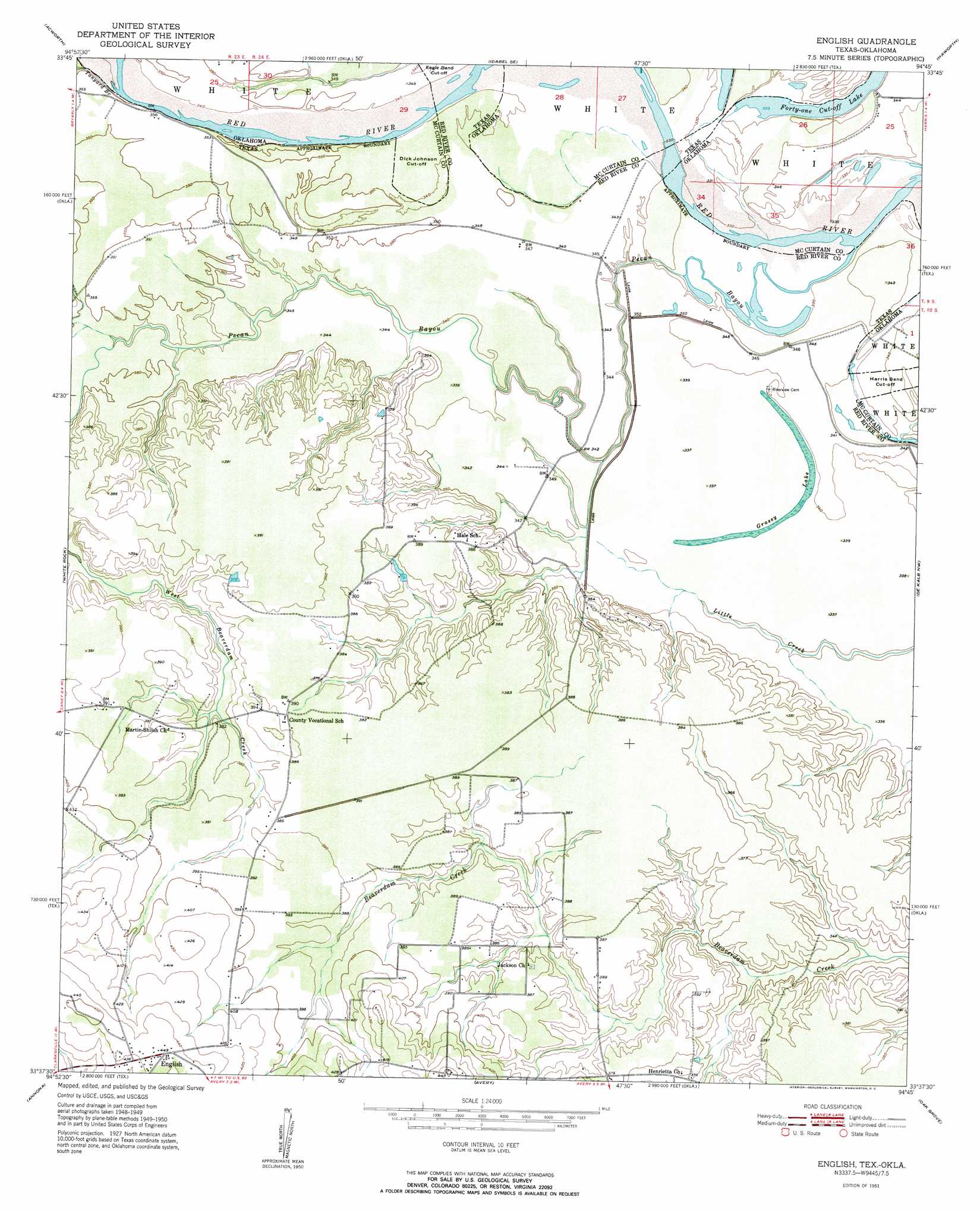
USGS Topo Quad 33094f7 - 1:24,000 scale
| Topo Map Name: | English |
| USGS Topo Quad ID: | 33094f7 |
| Print Size: | ca. 21 1/4" wide x 27" high |
| Southeast Coordinates: | 33.625° N latitude / 94.75° W longitude |
| Map Center Coordinates: | 33.6875° N latitude / 94.8125° W longitude |
| U.S. States: | TX, OK |
| Filename: | o33094f7.jpg |
| Download Map JPG Image: | English topo map 1:24,000 scale |
| Map Type: | Topographic |
| Topo Series: | 7.5´ |
| Map Scale: | 1:24,000 |
| Source of Map Images: | United States Geological Survey (USGS) |
| Alternate Map Versions: |
English TX 1951 Download PDF Buy paper map English TX 1951 Download PDF Buy paper map English TX 2010 Download PDF Buy paper map English TX 2013 Download PDF Buy paper map English TX 2016 Download PDF Buy paper map |
1:24,000 Topo Quads surrounding English
Millerton |
Garvin |
Idabel |
Shults |
Goodwater |
Negley |
Acworth |
Idabel Se |
Haworth |
Bokhoma |
Dimple |
White Rock |
English |
De Kalb Nw |
Tom |
Clarksville |
Annona |
Avery |
Oak Grove |
De Kalb |
Cuthand |
Boxelder |
Lydia |
Hodgson |
Malta |
> Back to 33094e1 at 1:100,000 scale
> Back to 33094a1 at 1:250,000 scale
> Back to U.S. Topo Maps home
English topo map: Gazetteer
English: Bends
Dick Johnson Cut-Off elevation 104m 341′English: Lakes
Grassy Lake elevation 102m 334′English: Populated Places
English elevation 135m 442′English: Springs
Pecan Springs elevation 104m 341′English: Streams
Pecan Bayou elevation 100m 328′Tanyard Branch elevation 103m 337′
Tanyard Branch elevation 103m 337′
English digital topo map on disk
Buy this English topo map showing relief, roads, GPS coordinates and other geographical features, as a high-resolution digital map file on DVD: