White Rock Topo Map Texas
To zoom in, hover over the map of White Rock
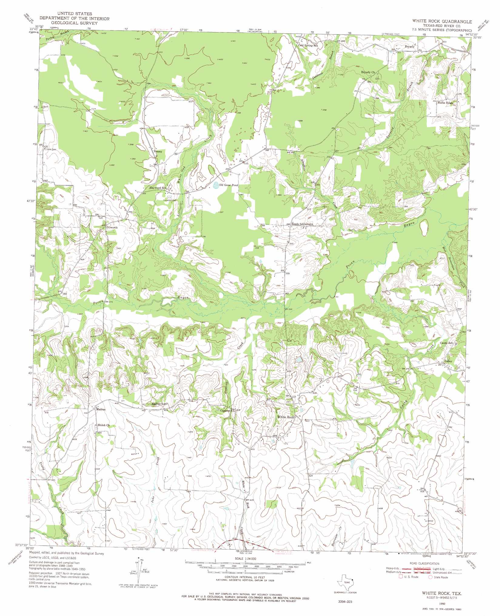
USGS Topo Quad 33094f8 - 1:24,000 scale
| Topo Map Name: | White Rock |
| USGS Topo Quad ID: | 33094f8 |
| Print Size: | ca. 21 1/4" wide x 27" high |
| Southeast Coordinates: | 33.625° N latitude / 94.875° W longitude |
| Map Center Coordinates: | 33.6875° N latitude / 94.9375° W longitude |
| U.S. State: | TX |
| Filename: | o33094f8.jpg |
| Download Map JPG Image: | White Rock topo map 1:24,000 scale |
| Map Type: | Topographic |
| Topo Series: | 7.5´ |
| Map Scale: | 1:24,000 |
| Source of Map Images: | United States Geological Survey (USGS) |
| Alternate Map Versions: |
White Rock TX 1950, updated 1973 Download PDF Buy paper map White Rock TX 1950, updated 1978 Download PDF Buy paper map White Rock TX 1951 Download PDF Buy paper map White Rock TX 2010 Download PDF Buy paper map White Rock TX 2012 Download PDF Buy paper map White Rock TX 2016 Download PDF Buy paper map |
1:24,000 Topo Quads surrounding White Rock
Kiomatia |
Millerton |
Garvin |
Idabel |
Shults |
Manchester |
Negley |
Acworth |
Idabel Se |
Haworth |
Bagwell |
Dimple |
White Rock |
English |
De Kalb Nw |
Line Branch |
Clarksville |
Annona |
Avery |
Oak Grove |
Bogata |
Cuthand |
Boxelder |
Lydia |
Hodgson |
> Back to 33094e1 at 1:100,000 scale
> Back to 33094a1 at 1:250,000 scale
> Back to U.S. Topo Maps home
White Rock topo map: Gazetteer
White Rock: Lakes
Old Goose Pond elevation 121m 396′White Rock: Populated Places
Bryarly elevation 115m 377′Caney elevation 119m 390′
Dilworth elevation 126m 413′
Madras elevation 150m 492′
Reeds Settlement elevation 120m 393′
Vessey elevation 122m 400′
White Rock elevation 131m 429′
White Rock: Streams
Caney Creek elevation 105m 344′Concord Creek elevation 108m 354′
Little White Oak Creek elevation 108m 354′
Schaffline Creek elevation 105m 344′
West Beaverdam Creek elevation 104m 341′
White Oak Bayou elevation 112m 367′
White Rock digital topo map on disk
Buy this White Rock topo map showing relief, roads, GPS coordinates and other geographical features, as a high-resolution digital map file on DVD: