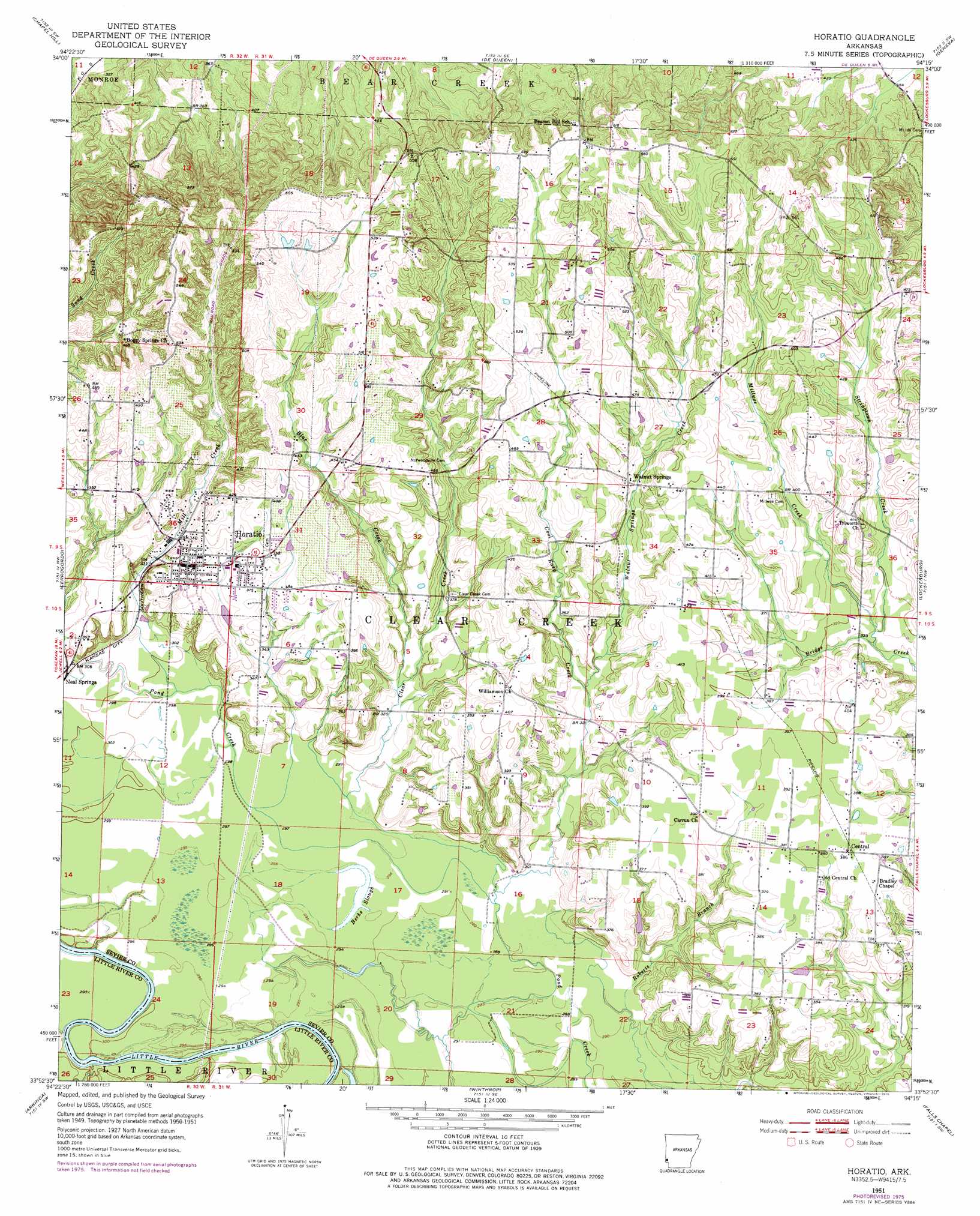
Horatio Topo Map Arkansas
To zoom in, hover over the map of Horatio
USGS Topo Quad 33094h3 - 1:24,000 scale
| Topo Map Name: | Horatio |
| USGS Topo Quad ID: | 33094h3 |
| Print Size: | ca. 21 1/4" wide x 27" high |
| Southeast Coordinates: | 33.875° N latitude / 94.25° W longitude |
| Map Center Coordinates: | 33.9375° N latitude / 94.3125° W longitude |
| U.S. State: | AR |
| Filename: | o33094h3.jpg |
| Download Map JPG Image: | Horatio topo map 1:24,000 scale |
| Map Type: | Topographic |
| Topo Series: | 7.5´ |
| Map Scale: | 1:24,000 |
| Source of Map Images: | United States Geological Survey (USGS) |
| Alternate Map Versions: |
Horatio AR 1951, updated 1952 Download PDF Buy paper map Horatio AR 1951, updated 1976 Download PDF Buy paper map Horatio AR 2011 Download PDF Buy paper map Horatio AR 2014 Download PDF Buy paper map |
1:24,000 Topo Quads surrounding Horatio
Toblerville |
De Queen Nw |
Gillham |
Gillham Dam |
Dierks Dam |
Eagletown |
Chapel Hill |
De Queen |
Geneva |
Dierks |
Goodwater |
Cerrogordo |
Horatio |
Lockesburg |
Silver Ridge |
Bokhoma |
Arkinda |
Winthrop |
Falls Chapel |
Ben Lomond |
Tom |
Foreman |
Arden |
Ashdown West |
Ashdown East |
> Back to 33094e1 at 1:100,000 scale
> Back to 33094a1 at 1:250,000 scale
> Back to U.S. Topo Maps home
Horatio topo map: Gazetteer
Horatio: Crossings
Norris Ferry (historical) elevation 86m 282′Stallion Ford elevation 84m 275′
Horatio: Dams
Double K Lake Dam elevation 101m 331′Horatio: Guts
Berks Slough elevation 96m 314′Horatio: Populated Places
Horatio elevation 126m 413′Neal Springs elevation 95m 311′
Norwoodville elevation 143m 469′
Walnut Springs elevation 124m 406′
Williamson elevation 130m 426′
Horatio: Reservoirs
Double K Lake elevation 101m 331′Horatio: Streams
Blue Creek elevation 103m 337′Clear Creek elevation 93m 305′
Cool Easy Creek elevation 90m 295′
Mill Creek elevation 96m 314′
Millwee Creek elevation 107m 351′
Stringtown Creek elevation 105m 344′
Walnut Springs Creek elevation 105m 344′
Horatio digital topo map on disk
Buy this Horatio topo map showing relief, roads, GPS coordinates and other geographical features, as a high-resolution digital map file on DVD: