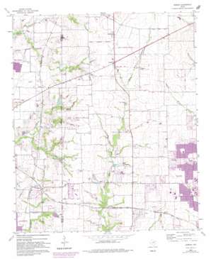
Hebron Topo Map Texas
To zoom in, hover over the map of Hebron
USGS Topo Quad 33096a7 - 1:24,000 scale
| Topo Map Name: | Hebron |
| USGS Topo Quad ID: | 33096a7 |
| Print Size: | ca. 21 1/4" wide x 27" high |
| Southeast Coordinates: | 33° N latitude / 96.75° W longitude |
| Map Center Coordinates: | 33.0625° N latitude / 96.8125° W longitude |
| U.S. State: | TX |
| Filename: | o33096a7.jpg |
| Download Map JPG Image: | Hebron topo map 1:24,000 scale |
| Map Type: | Topographic |
| Topo Series: | 7.5´ |
| Map Scale: | 1:24,000 |
| Source of Map Images: | United States Geological Survey (USGS) |
| Alternate Map Versions: |
Hebron TX 1960, updated 1962 Download PDF Buy paper map Hebron TX 1960, updated 1967 Download PDF Buy paper map Hebron TX 1960, updated 1969 Download PDF Buy paper map Hebron TX 1960, updated 1974 Download PDF Buy paper map Hebron TX 1960, updated 1982 Download PDF Buy paper map Hebron TX 1960, updated 1982 Download PDF Buy paper map Hebron TX 2010 Download PDF Buy paper map Hebron TX 2013 Download PDF Buy paper map Hebron TX 2016 Download PDF Buy paper map |
1:24,000 Topo Quads surrounding Hebron
> Back to 33096a1 at 1:100,000 scale
> Back to 33096a1 at 1:250,000 scale
> Back to U.S. Topo Maps home
Hebron topo map: Gazetteer
Hebron: Airports
Air Park-Dallas elevation 212m 695′Childrens Presbyterian Health Center of North Texas Heliport elevation 200m 656′
E D S Heliport elevation 212m 695′
Mcp Heliport elevation 226m 741′
Hebron: Dams
Quisenberry Lake Dam elevation 189m 620′Shiff Lake Dam elevation 162m 531′
Shirley Phillips Mead Dam elevation 199m 652′
Willow Bend Lake Number 1 Dam elevation 197m 646′
Willow Bend Lake Number 2 Dam elevation 195m 639′
Hebron: Parks
Buckhorn Park elevation 226m 741′Cheyenne Park elevation 222m 728′
Evans Park elevation 210m 688′
Hebron High School Baseball Field elevation 183m 600′
Hebron High School Football Stadium elevation 178m 583′
Hebron High School Softball Stadium elevation 182m 597′
Hebron: Populated Places
Camey elevation 189m 620′Cowley elevation 213m 698′
Hebron elevation 176m 577′
Lebanon elevation 229m 751′
Lolaville elevation 215m 705′
Shepton elevation 211m 692′
Hebron: Post Offices
Wildcat Post Office elevation 213m 698′Hebron: Reservoirs
Quisenberry Lake elevation 189m 620′Shiff Lake elevation 162m 531′
Shirley Phillips Mead Lake elevation 199m 652′
Willow Bend Lake Number 1 elevation 197m 646′
Willow Bend Lake Number 2 elevation 195m 639′
Hebron: Trails
Arbor Hills Nature Preserve Trail elevation 193m 633′Carpenter Park Trail elevation 218m 715′
Russell Creek Park Trail elevation 222m 728′
White Rock Trail elevation 180m 590′
Hebron digital topo map on disk
Buy this Hebron topo map showing relief, roads, GPS coordinates and other geographical features, as a high-resolution digital map file on DVD:


