Celeste Topo Map Texas
To zoom in, hover over the map of Celeste
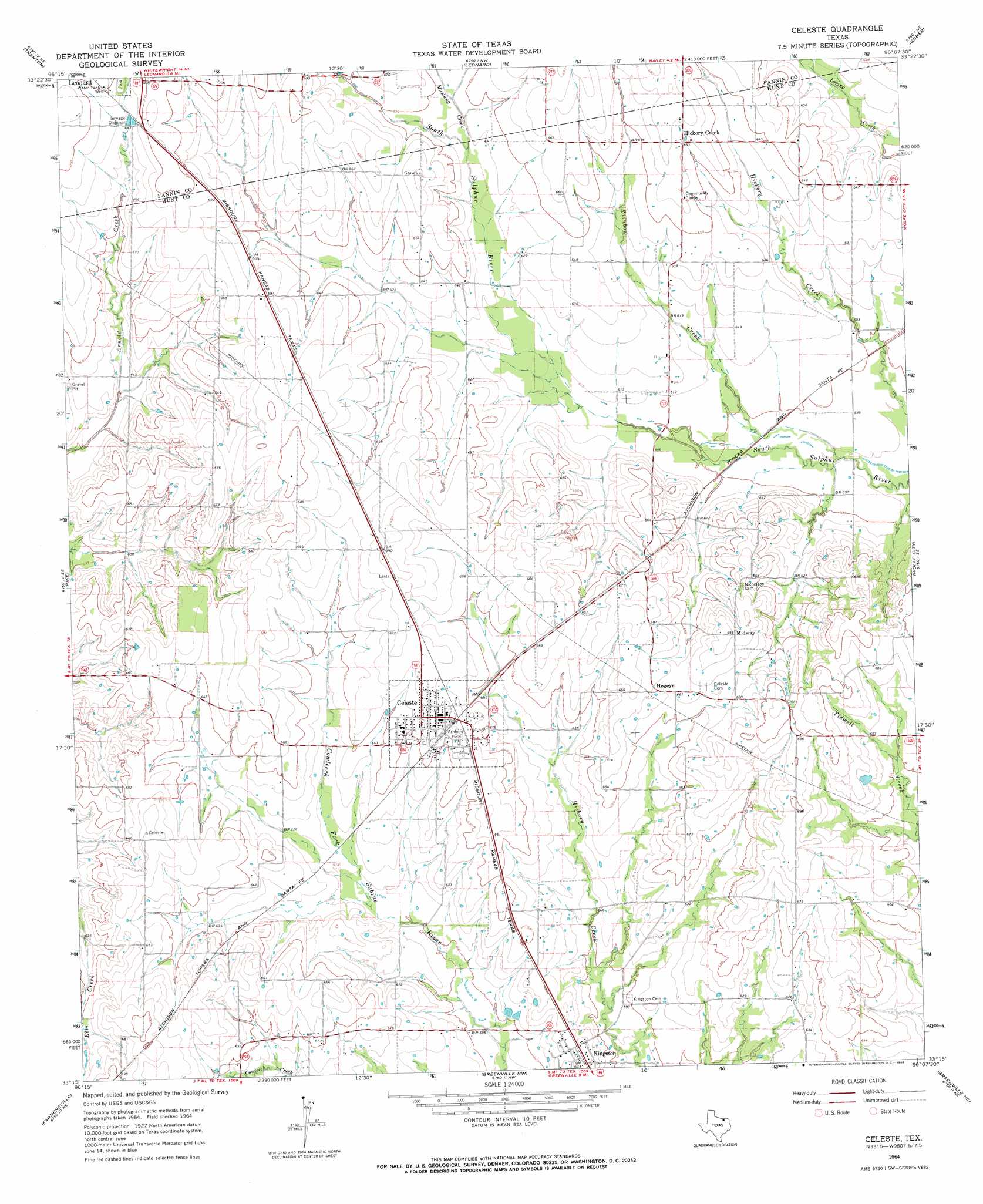
USGS Topo Quad 33096c2 - 1:24,000 scale
| Topo Map Name: | Celeste |
| USGS Topo Quad ID: | 33096c2 |
| Print Size: | ca. 21 1/4" wide x 27" high |
| Southeast Coordinates: | 33.25° N latitude / 96.125° W longitude |
| Map Center Coordinates: | 33.3125° N latitude / 96.1875° W longitude |
| U.S. State: | TX |
| Filename: | o33096c2.jpg |
| Download Map JPG Image: | Celeste topo map 1:24,000 scale |
| Map Type: | Topographic |
| Topo Series: | 7.5´ |
| Map Scale: | 1:24,000 |
| Source of Map Images: | United States Geological Survey (USGS) |
| Alternate Map Versions: |
Celeste TX 1964, updated 1968 Download PDF Buy paper map Celeste TX 2010 Download PDF Buy paper map Celeste TX 2013 Download PDF Buy paper map Celeste TX 2016 Download PDF Buy paper map |
1:24,000 Topo Quads surrounding Celeste
Whitewright |
Ector |
Bonham |
Dodd City |
Honey Grove |
Pilot Grove |
Trenton |
Leonard |
Gober |
Ladonia |
Blue Ridge |
Pike |
Celeste |
Wolfe City |
Commerce North |
Culleoka |
Farmersville |
Greenville Nw |
Greenville Ne |
Commerce South |
Lavon |
Josephine |
Greenville Sw |
Greenville Se |
Lone Oak North |
> Back to 33096a1 at 1:100,000 scale
> Back to 33096a1 at 1:250,000 scale
> Back to U.S. Topo Maps home
Celeste topo map: Gazetteer
Celeste: Airports
Chambers Airport elevation 205m 672′Celeste: Dams
Soil Conservation Service Site 59 Dam elevation 199m 652′Soil Conservation Service Site 64a Dam elevation 186m 610′
Soil Conservation Service Site 65 Dam elevation 193m 633′
Celeste: Populated Places
Celeste elevation 204m 669′Hickory Creek elevation 201m 659′
Hogeye elevation 203m 666′
Kingston elevation 193m 633′
Midway elevation 210m 688′
Celeste: Reservoirs
Soil Conservation Service Site 59 Reservoir elevation 199m 652′Soil Conservation Service Site 64a Reservoir elevation 186m 610′
Soil Conservation Service Site 65 Reservoir elevation 193m 633′
Celeste: Streams
Mustang Creek elevation 195m 639′Rainbow Creek elevation 180m 590′
Celeste digital topo map on disk
Buy this Celeste topo map showing relief, roads, GPS coordinates and other geographical features, as a high-resolution digital map file on DVD: