Celina Topo Map Texas
To zoom in, hover over the map of Celina
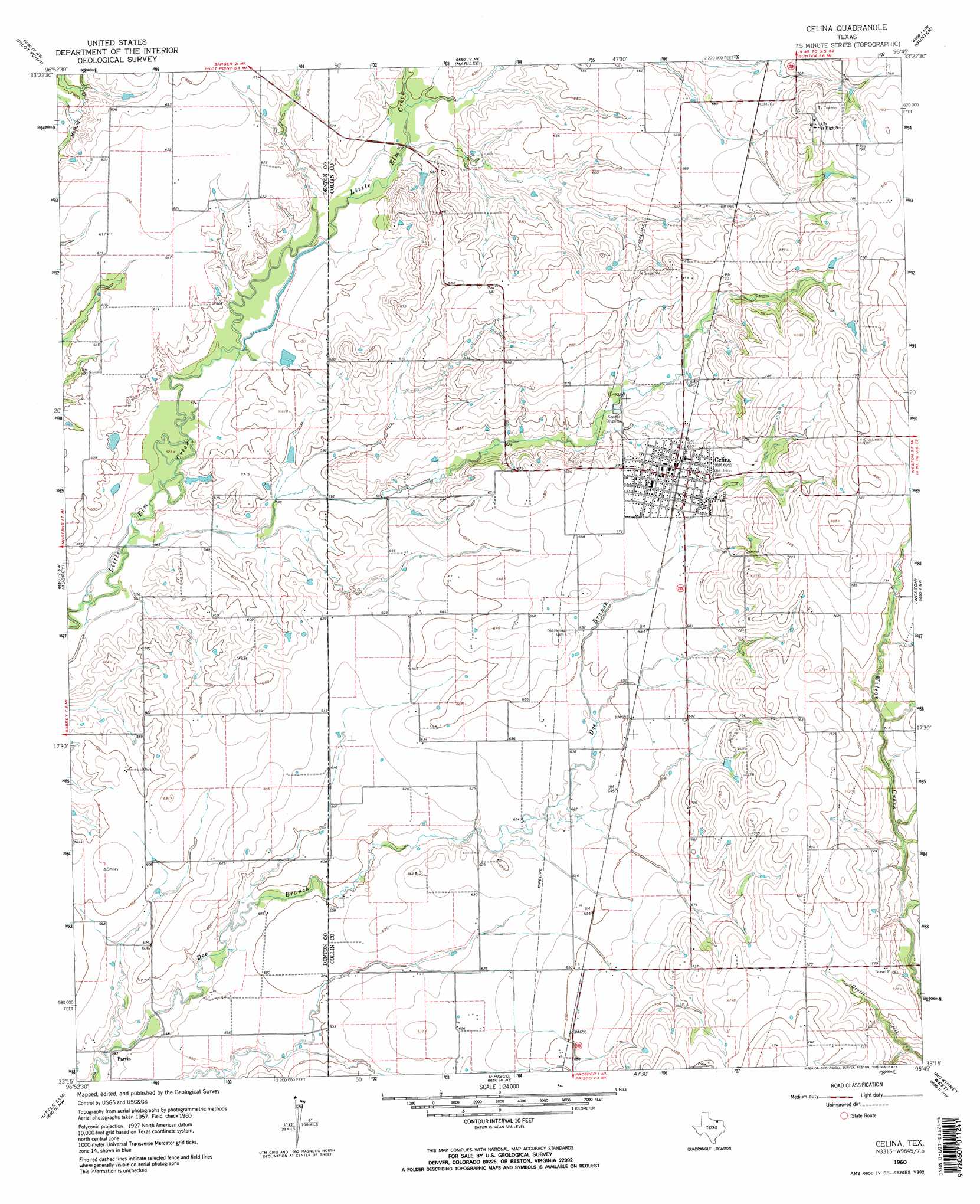
USGS Topo Quad 33096c7 - 1:24,000 scale
| Topo Map Name: | Celina |
| USGS Topo Quad ID: | 33096c7 |
| Print Size: | ca. 21 1/4" wide x 27" high |
| Southeast Coordinates: | 33.25° N latitude / 96.75° W longitude |
| Map Center Coordinates: | 33.3125° N latitude / 96.8125° W longitude |
| U.S. State: | TX |
| Filename: | o33096c7.jpg |
| Download Map JPG Image: | Celina topo map 1:24,000 scale |
| Map Type: | Topographic |
| Topo Series: | 7.5´ |
| Map Scale: | 1:24,000 |
| Source of Map Images: | United States Geological Survey (USGS) |
| Alternate Map Versions: |
Celina TX 1960, updated 1961 Download PDF Buy paper map Celina TX 1960, updated 1973 Download PDF Buy paper map Celina TX 1960, updated 1973 Download PDF Buy paper map Celina TX 2010 Download PDF Buy paper map Celina TX 2013 Download PDF Buy paper map Celina TX 2016 Download PDF Buy paper map |
1:24,000 Topo Quads surrounding Celina
Woodbine |
Collinsville |
Ethel |
Dorchester |
Howe |
Mountain Springs |
Pilot Point |
Marilee |
Gunter |
Van Alstyne |
Green Valley |
Aubrey |
Celina |
Weston |
Anna |
Denton East |
Little Elm |
Frisco |
Mckinney West |
Mckinney East |
Lewisville West |
Lewisville East |
Hebron |
Plano |
Wylie |
> Back to 33096a1 at 1:100,000 scale
> Back to 33096a1 at 1:250,000 scale
> Back to U.S. Topo Maps home
Celina topo map: Gazetteer
Celina: Airports
Aero Estates Airport elevation 182m 597′Cavanaugh Ranch Airport elevation 241m 790′
Celina: Dams
Soil Conservation Service Site 16 Dam elevation 189m 620′Soil Conservation Service Site 17 Dam elevation 180m 590′
Soil Conservation Service Site 18a Dam elevation 219m 718′
Soil Conservation Service Site 19 Dam elevation 181m 593′
Soil Conservation Service Site 1da Dam elevation 204m 669′
Soil Conservation Service Site 20 Dam elevation 186m 610′
Celina: Parks
Bobcat Stadium elevation 213m 698′Celina: Populated Places
Celina elevation 211m 692′Parvin elevation 172m 564′
Celina: Reservoirs
Soil Conservation Service Site 10-A Reservoir elevation 204m 669′Soil Conservation Service Site 16 Reservoir elevation 189m 620′
Soil Conservation Service Site 17 Reservoir elevation 180m 590′
Soil Conservation Service Site 18a Reservoir elevation 219m 718′
Soil Conservation Service Site 19 Reservoir elevation 181m 593′
Soil Conservation Service Site 20 Reservoir elevation 186m 610′
Celina digital topo map on disk
Buy this Celina topo map showing relief, roads, GPS coordinates and other geographical features, as a high-resolution digital map file on DVD: