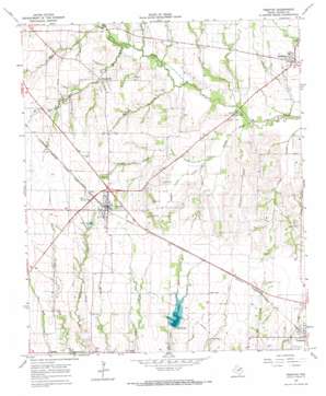
Trenton Topo Map Texas
To zoom in, hover over the map of Trenton
USGS Topo Quad 33096d3 - 1:24,000 scale
| Topo Map Name: | Trenton |
| USGS Topo Quad ID: | 33096d3 |
| Print Size: | ca. 21 1/4" wide x 27" high |
| Southeast Coordinates: | 33.375° N latitude / 96.25° W longitude |
| Map Center Coordinates: | 33.4375° N latitude / 96.3125° W longitude |
| U.S. State: | TX |
| Filename: | o33096d3.jpg |
| Download Map JPG Image: | Trenton topo map 1:24,000 scale |
| Map Type: | Topographic |
| Topo Series: | 7.5´ |
| Map Scale: | 1:24,000 |
| Source of Map Images: | United States Geological Survey (USGS) |
| Alternate Map Versions: |
Trenton TX 1964, updated 1967 Download PDF Buy paper map Trenton TX 2010 Download PDF Buy paper map Trenton TX 2013 Download PDF Buy paper map Trenton TX 2016 Download PDF Buy paper map |
1:24,000 Topo Quads surrounding Trenton
> Back to 33096a1 at 1:100,000 scale
> Back to 33096a1 at 1:250,000 scale
> Back to U.S. Topo Maps home
Trenton topo map: Gazetteer
Trenton: Airports
Casey Field elevation 211m 692′Red Wing Airport elevation 228m 748′
Trenton: Dams
Gods Delight Lake Dam elevation 200m 656′Soil Conservation Service Site 38 Dam elevation 192m 629′
Soil Conservation Service Site 39 Dam elevation 191m 626′
Soil Conservation Service Site 45 Dam elevation 203m 666′
Texas No Name Number 36 Dam elevation 205m 672′
Trenton: Populated Places
Delba elevation 203m 666′Nobility elevation 203m 666′
Orangeville elevation 212m 695′
Randolph elevation 202m 662′
Trenton elevation 232m 761′
Union Hill elevation 197m 646′
Trenton: Reservoirs
Gods Delight Lake elevation 200m 656′Soil Conservation Service Site 38 Reservoir elevation 192m 629′
Soil Conservation Service Site 39 Reservoir elevation 191m 626′
Soil Conservation Service Site 45 Reservoir elevation 203m 666′
Thornton Lake elevation 203m 666′
Trenton: Streams
Blanton Creek elevation 192m 629′Brushy Creek elevation 186m 610′
Chinquapin Creek elevation 195m 639′
Cottonwood Creek elevation 186m 610′
Foster Valley Creek elevation 191m 626′
Pace Creek elevation 189m 620′
Porter Creek elevation 195m 639′
Rock Creek elevation 197m 646′
Trenton digital topo map on disk
Buy this Trenton topo map showing relief, roads, GPS coordinates and other geographical features, as a high-resolution digital map file on DVD:


