Pilot Point Topo Map Texas
To zoom in, hover over the map of Pilot Point
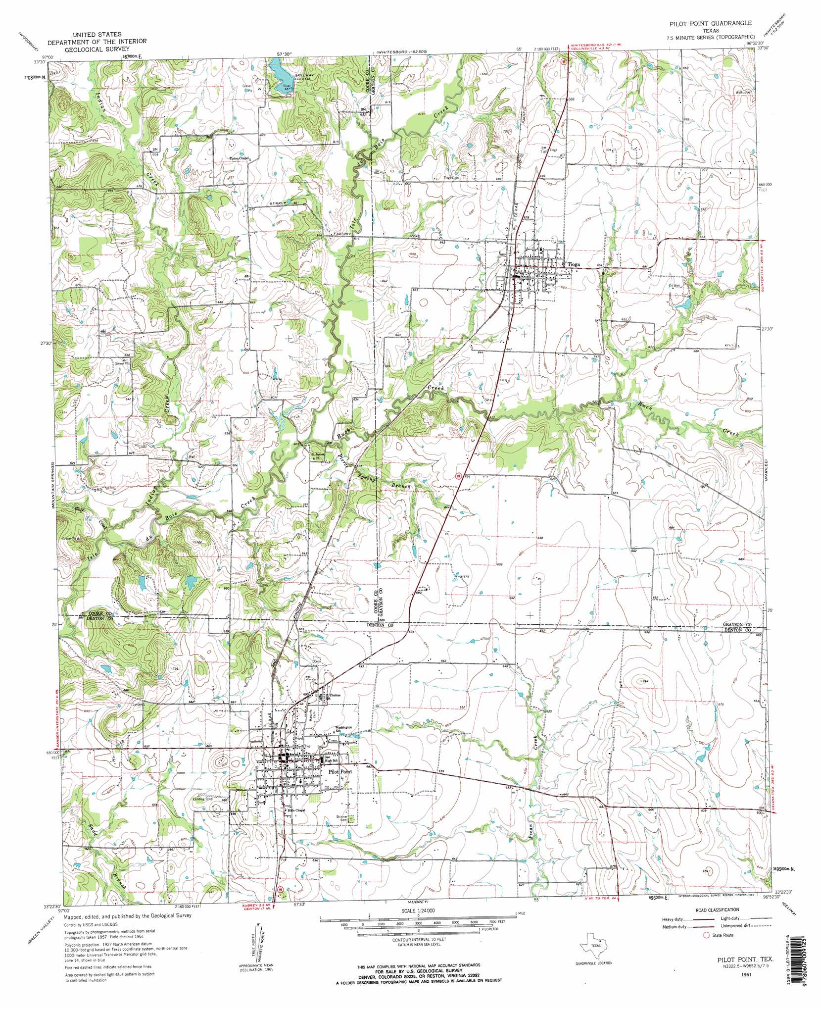
USGS Topo Quad 33096d8 - 1:24,000 scale
| Topo Map Name: | Pilot Point |
| USGS Topo Quad ID: | 33096d8 |
| Print Size: | ca. 21 1/4" wide x 27" high |
| Southeast Coordinates: | 33.375° N latitude / 96.875° W longitude |
| Map Center Coordinates: | 33.4375° N latitude / 96.9375° W longitude |
| U.S. State: | TX |
| Filename: | o33096d8.jpg |
| Download Map JPG Image: | Pilot Point topo map 1:24,000 scale |
| Map Type: | Topographic |
| Topo Series: | 7.5´ |
| Map Scale: | 1:24,000 |
| Source of Map Images: | United States Geological Survey (USGS) |
| Alternate Map Versions: |
Pilot Point TX 1961, updated 1963 Download PDF Buy paper map Pilot Point TX 1961, updated 1963 Download PDF Buy paper map Pilot Point TX 1961, updated 1963 Download PDF Buy paper map Pilot Point TX 2010 Download PDF Buy paper map Pilot Point TX 2013 Download PDF Buy paper map Pilot Point TX 2016 Download PDF Buy paper map |
1:24,000 Topo Quads surrounding Pilot Point
Gainesville North |
Callisburg |
Whitesboro |
Sadler |
Sherman Nw |
Gainesville South |
Woodbine |
Collinsville |
Ethel |
Dorchester |
Valley View |
Mountain Springs |
Pilot Point |
Marilee |
Gunter |
Sanger |
Green Valley |
Aubrey |
Celina |
Weston |
Denton West |
Denton East |
Little Elm |
Frisco |
Mckinney West |
> Back to 33096a1 at 1:100,000 scale
> Back to 33096a1 at 1:250,000 scale
> Back to U.S. Topo Maps home
Pilot Point topo map: Gazetteer
Pilot Point: Dams
B and L Ranch Dam elevation 200m 656′Caldwell Lake Dam elevation 197m 646′
Fair Lake Dam elevation 209m 685′
Hammond Lake Dam elevation 197m 646′
Robert W Henzler Dam elevation 194m 636′
Pilot Point: Parks
Massey Stadium elevation 213m 698′Pilot Point Commercial Historic District elevation 220m 721′
Pilot Point: Populated Places
Pilot Point elevation 220m 721′Tioga elevation 205m 672′
Pilot Point: Reservoirs
B and L Ranch Lake elevation 200m 656′Caldwell Lake elevation 197m 646′
Fair Lake elevation 209m 685′
Hammond Lake elevation 197m 646′
Robert W Henzler Lake elevation 194m 636′
Pilot Point: Streams
Buck Creek elevation 183m 600′Indian Creek elevation 183m 600′
Pierce Spring Branch elevation 183m 600′
Wolf Creek elevation 183m 600′
Pilot Point digital topo map on disk
Buy this Pilot Point topo map showing relief, roads, GPS coordinates and other geographical features, as a high-resolution digital map file on DVD: