Ethel Topo Map Texas
To zoom in, hover over the map of Ethel
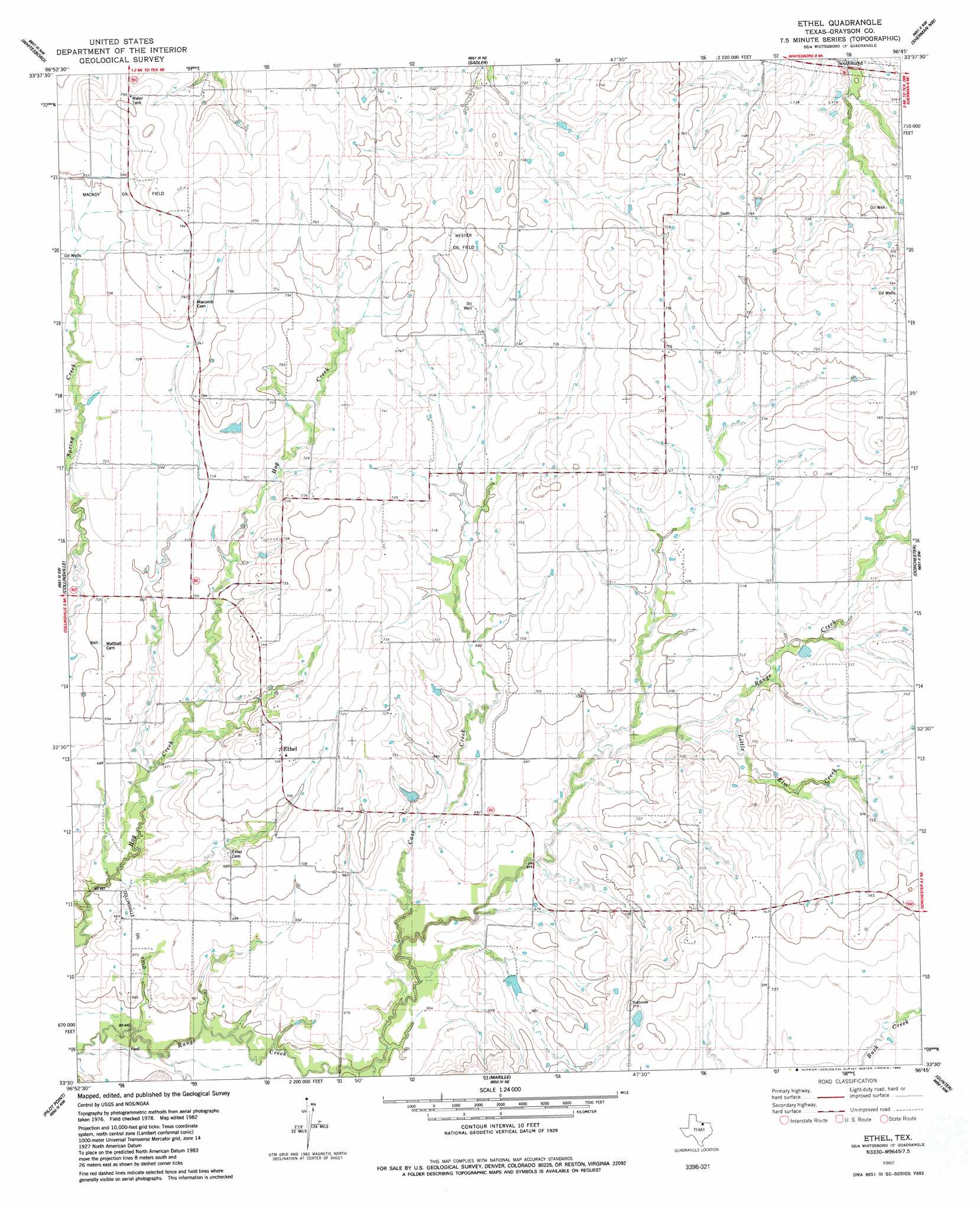
USGS Topo Quad 33096e7 - 1:24,000 scale
| Topo Map Name: | Ethel |
| USGS Topo Quad ID: | 33096e7 |
| Print Size: | ca. 21 1/4" wide x 27" high |
| Southeast Coordinates: | 33.5° N latitude / 96.75° W longitude |
| Map Center Coordinates: | 33.5625° N latitude / 96.8125° W longitude |
| U.S. State: | TX |
| Filename: | o33096e7.jpg |
| Download Map JPG Image: | Ethel topo map 1:24,000 scale |
| Map Type: | Topographic |
| Topo Series: | 7.5´ |
| Map Scale: | 1:24,000 |
| Source of Map Images: | United States Geological Survey (USGS) |
| Alternate Map Versions: |
Ethel TX 1982, updated 1983 Download PDF Buy paper map Ethel TX 2010 Download PDF Buy paper map Ethel TX 2013 Download PDF Buy paper map Ethel TX 2016 Download PDF Buy paper map |
1:24,000 Topo Quads surrounding Ethel
Horseshoe Bend |
Dexter |
Gordonville |
Pottsboro |
Denison Dam |
Callisburg |
Whitesboro |
Sadler |
Sherman Nw |
Sherman |
Woodbine |
Collinsville |
Ethel |
Dorchester |
Howe |
Mountain Springs |
Pilot Point |
Marilee |
Gunter |
Van Alstyne |
Green Valley |
Aubrey |
Celina |
Weston |
Anna |
> Back to 33096e1 at 1:100,000 scale
> Back to 33096a1 at 1:250,000 scale
> Back to U.S. Topo Maps home
Ethel topo map: Gazetteer
Ethel: Dams
Gressett Lake Dam elevation 225m 738′Touchstone Lake Dam elevation 210m 688′
Ethel: Oilfields
Collinsville Oil Field elevation 205m 672′Hester Oil Field elevation 230m 754′
Mackoy Oil Field elevation 231m 757′
Ethel: Populated Places
Ethel elevation 225m 738′Macomb elevation 233m 764′
Ethel: Reservoirs
Gressett Lake elevation 225m 738′Touchstone Lake elevation 210m 688′
Ethel: Streams
Case Creek elevation 199m 652′Little Elm Creek elevation 208m 682′
Ethel digital topo map on disk
Buy this Ethel topo map showing relief, roads, GPS coordinates and other geographical features, as a high-resolution digital map file on DVD: