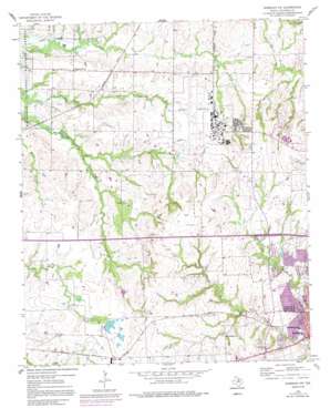
Sherman Nw Topo Map Texas
To zoom in, hover over the map of Sherman Nw
USGS Topo Quad 33096f6 - 1:24,000 scale
| Topo Map Name: | Sherman Nw |
| USGS Topo Quad ID: | 33096f6 |
| Print Size: | ca. 21 1/4" wide x 27" high |
| Southeast Coordinates: | 33.625° N latitude / 96.625° W longitude |
| Map Center Coordinates: | 33.6875° N latitude / 96.6875° W longitude |
| U.S. State: | TX |
| Filename: | o33096f6.jpg |
| Download Map JPG Image: | Sherman Nw topo map 1:24,000 scale |
| Map Type: | Topographic |
| Topo Series: | 7.5´ |
| Map Scale: | 1:24,000 |
| Source of Map Images: | United States Geological Survey (USGS) |
| Alternate Map Versions: |
Sherman NW TX 1958, updated 1959 Download PDF Buy paper map Sherman NW TX 1958, updated 1975 Download PDF Buy paper map Sherman NW TX 1958, updated 1991 Download PDF Buy paper map Sherman NW TX 2010 Download PDF Buy paper map Sherman NW TX 2013 Download PDF Buy paper map Sherman NW TX 2016 Download PDF Buy paper map |
1:24,000 Topo Quads surrounding Sherman Nw
> Back to 33096e1 at 1:100,000 scale
> Back to 33096a1 at 1:250,000 scale
> Back to U.S. Topo Maps home
Sherman Nw topo map: Gazetteer
Sherman Nw: Airports
Butler Airport elevation 254m 833′Grayson County Airport elevation 228m 748′
McKeon Aviation Airport elevation 216m 708′
Sherman Nw: Dams
Sherman Country Club Lake Dam elevation 231m 757′Sherman Nw: Oilfields
Sherman Oil Field elevation 238m 780′Sherman Nw: Parks
Fairview Park elevation 229m 751′Sherman Nw: Reservoirs
Sherman Country Club Lake elevation 231m 757′Sherman Nw: Streams
Myer Branch elevation 190m 623′Sherman Nw: Trails
Fairview Park Trail elevation 224m 734′Sherman Nw digital topo map on disk
Buy this Sherman Nw topo map showing relief, roads, GPS coordinates and other geographical features, as a high-resolution digital map file on DVD:


