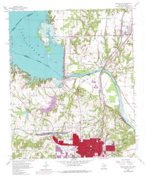
Denison Dam Topo Map Texas
To zoom in, hover over the map of Denison Dam
USGS Topo Quad 33096g5 - 1:24,000 scale
| Topo Map Name: | Denison Dam |
| USGS Topo Quad ID: | 33096g5 |
| Print Size: | ca. 21 1/4" wide x 27" high |
| Southeast Coordinates: | 33.75° N latitude / 96.5° W longitude |
| Map Center Coordinates: | 33.8125° N latitude / 96.5625° W longitude |
| U.S. States: | TX, OK |
| Filename: | o33096g5.jpg |
| Download Map JPG Image: | Denison Dam topo map 1:24,000 scale |
| Map Type: | Topographic |
| Topo Series: | 7.5´ |
| Map Scale: | 1:24,000 |
| Source of Map Images: | United States Geological Survey (USGS) |
| Alternate Map Versions: |
Denison Dam TX 1957, updated 1959 Download PDF Buy paper map Denison Dam TX 1957, updated 1976 Download PDF Buy paper map Denison Dam TX 1957, updated 1976 Download PDF Buy paper map Denison Dam TX 2010 Download PDF Buy paper map Denison Dam TX 2013 Download PDF Buy paper map Denison Dam TX 2016 Download PDF Buy paper map |
1:24,000 Topo Quads surrounding Denison Dam
> Back to 33096e1 at 1:100,000 scale
> Back to 33096a1 at 1:250,000 scale
> Back to U.S. Topo Maps home
Denison Dam topo map: Gazetteer
Denison Dam: Airports
Kidd Airport elevation 221m 725′Denison Dam: Bays
Burns Run elevation 188m 616′Denison Dam: Crossings
Baers Ferry (historical) elevation 197m 646′Denison Dam: Dams
Denison Dam elevation 194m 636′Denison Dam elevation 170m 557′
R and G Lake Dam elevation 200m 656′
Randell Lake Dam elevation 188m 616′
Denison Dam: Lakes
R and G Club Lake elevation 204m 669′Denison Dam: Parks
Eisenhower State Park elevation 217m 711′Forest Park elevation 227m 744′
Forest Park elevation 229m 751′
Munson Park elevation 190m 623′
Denison Dam: Populated Places
Cartwright elevation 203m 666′Colbert elevation 202m 662′
Denison elevation 222m 728′
Joe elevation 170m 557′
Pickwick elevation 207m 679′
Ray elevation 164m 538′
Red River City elevation 165m 541′
Shawnee elevation 157m 515′
Staley elevation 168m 551′
Warner Junction elevation 171m 561′
Denison Dam: Reservoirs
Dennison Club Lake elevation 200m 656′Lake Texoma elevation 194m 636′
Randell Lake elevation 189m 620′
Denison Dam: Streams
Duck Creek elevation 155m 508′Pawpaw Creek elevation 155m 508′
Sand Creek elevation 155m 508′
Sandy Creek elevation 155m 508′
Shawnee Creek elevation 156m 511′
Denison Dam: Trails
Eisenhower State Park Trail elevation 221m 725′Denison Dam digital topo map on disk
Buy this Denison Dam topo map showing relief, roads, GPS coordinates and other geographical features, as a high-resolution digital map file on DVD:


