Justin Topo Map Texas
To zoom in, hover over the map of Justin
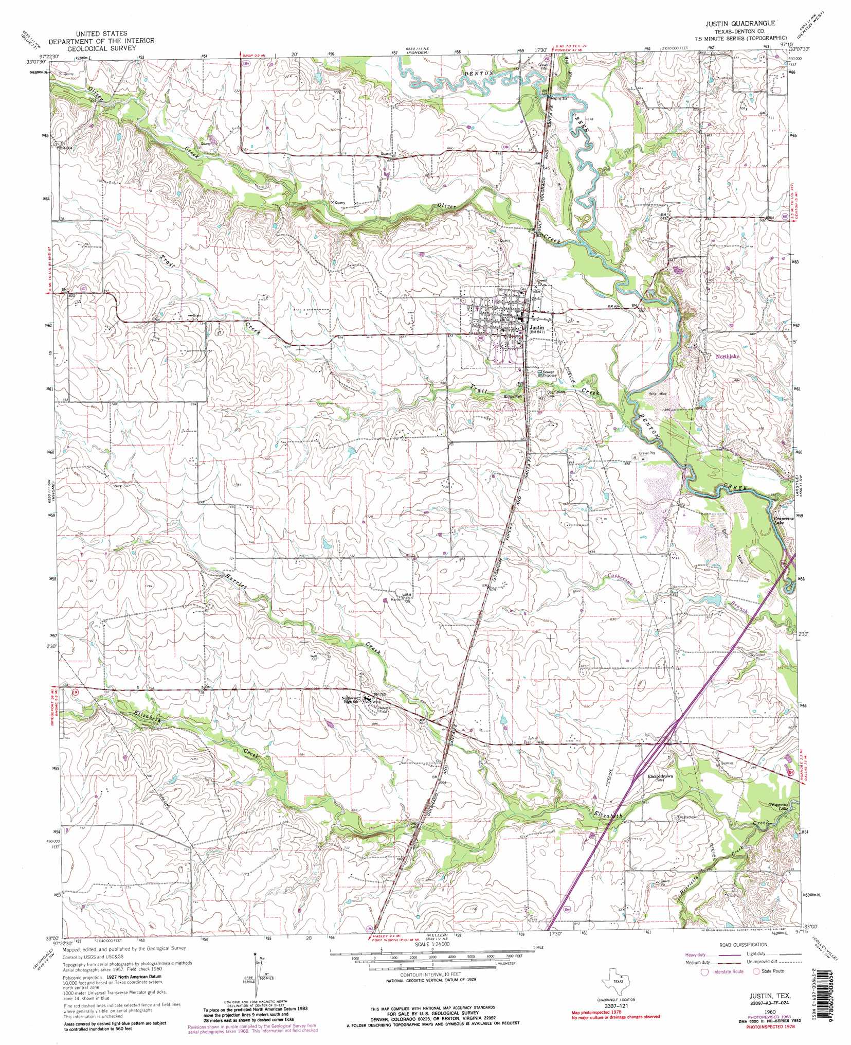
USGS Topo Quad 33097a3 - 1:24,000 scale
| Topo Map Name: | Justin |
| USGS Topo Quad ID: | 33097a3 |
| Print Size: | ca. 21 1/4" wide x 27" high |
| Southeast Coordinates: | 33° N latitude / 97.25° W longitude |
| Map Center Coordinates: | 33.0625° N latitude / 97.3125° W longitude |
| U.S. State: | TX |
| Filename: | o33097a3.jpg |
| Download Map JPG Image: | Justin topo map 1:24,000 scale |
| Map Type: | Topographic |
| Topo Series: | 7.5´ |
| Map Scale: | 1:24,000 |
| Source of Map Images: | United States Geological Survey (USGS) |
| Alternate Map Versions: |
Justin TX 1960, updated 1961 Download PDF Buy paper map Justin TX 1960, updated 1969 Download PDF Buy paper map Justin TX 1960, updated 1987 Download PDF Buy paper map Justin TX 1960, updated 1987 Download PDF Buy paper map Justin TX 2010 Download PDF Buy paper map Justin TX 2013 Download PDF Buy paper map Justin TX 2016 Download PDF Buy paper map |
1:24,000 Topo Quads surrounding Justin
Pecan Creek |
Slidell |
Era Se |
Sanger |
Green Valley |
Decatur |
Bluett |
Ponder |
Denton West |
Denton East |
Boyd |
Rhome |
Justin |
Argyle |
Lewisville West |
Azle |
Avondale |
Keller |
Colleyville |
Grapevine |
Springtown Se |
Lake Worth |
Haltom City |
Hurst |
Euless |
> Back to 33097a1 at 1:100,000 scale
> Back to 33096a1 at 1:250,000 scale
> Back to U.S. Topo Maps home
Justin topo map: Gazetteer
Justin: Airports
Blue Jay Air Field elevation 200m 656′Dooley Airport elevation 198m 649′
Flying S Farm Airport elevation 236m 774′
Propwash Airport elevation 243m 797′
Sitton Field elevation 205m 672′
Justin: Dams
Buchannan Lake Dam elevation 179m 587′Justin: Parks
Bishop Park elevation 200m 656′Justin Park elevation 209m 685′
Texan Stadium elevation 215m 705′
Texas Motor Speedway elevation 195m 639′
Justin: Populated Places
Elizabethtown elevation 191m 626′Justin elevation 196m 643′
Justin: Reservoirs
Buchannan Lake elevation 179m 587′Justin: Streams
Harriet Creek elevation 184m 603′Henrietta Creek elevation 176m 577′
Hog Branch elevation 185m 606′
Oliver Creek elevation 181m 593′
Trail Creek elevation 174m 570′
Justin digital topo map on disk
Buy this Justin topo map showing relief, roads, GPS coordinates and other geographical features, as a high-resolution digital map file on DVD: