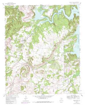
Wizard Wells Topo Map Texas
To zoom in, hover over the map of Wizard Wells
USGS Topo Quad 33097b8 - 1:24,000 scale
| Topo Map Name: | Wizard Wells |
| USGS Topo Quad ID: | 33097b8 |
| Print Size: | ca. 21 1/4" wide x 27" high |
| Southeast Coordinates: | 33.125° N latitude / 97.875° W longitude |
| Map Center Coordinates: | 33.1875° N latitude / 97.9375° W longitude |
| U.S. State: | TX |
| Filename: | o33097b8.jpg |
| Download Map JPG Image: | Wizard Wells topo map 1:24,000 scale |
| Map Type: | Topographic |
| Topo Series: | 7.5´ |
| Map Scale: | 1:24,000 |
| Source of Map Images: | United States Geological Survey (USGS) |
| Alternate Map Versions: |
Wizard Wells TX 1960, updated 1961 Download PDF Buy paper map Wizard Wells TX 1960, updated 1978 Download PDF Buy paper map Wizard Wells TX 2010 Download PDF Buy paper map Wizard Wells TX 2013 Download PDF Buy paper map Wizard Wells TX 2016 Download PDF Buy paper map |
1:24,000 Topo Quads surrounding Wizard Wells
> Back to 33097a1 at 1:100,000 scale
> Back to 33096a1 at 1:250,000 scale
> Back to U.S. Topo Maps home
Wizard Wells topo map: Gazetteer
Wizard Wells: Basins
Devils Den elevation 258m 846′Wizard Wells: Islands
Steele Island elevation 257m 843′Steele Island elevation 256m 839′
Wizard Wells: Populated Places
Runaway Bay elevation 278m 912′Vineyard elevation 289m 948′
Wizard Wells elevation 265m 869′
Wizard Wells: Streams
Beans Creek elevation 252m 826′Boons Creek elevation 253m 830′
Jasper Creek elevation 252m 826′
Little Beans Creek elevation 274m 898′
Pecan Branch elevation 252m 826′
Wizard Wells: Summits
Jim Ned Hill elevation 322m 1056′Wizard Wells: Valleys
Bear Hollow elevation 261m 856′Davis Hollow elevation 259m 849′
Devils Den Hollow elevation 252m 826′
Wizard Wells digital topo map on disk
Buy this Wizard Wells topo map showing relief, roads, GPS coordinates and other geographical features, as a high-resolution digital map file on DVD:


