Brushy Mound Topo Map Texas
To zoom in, hover over the map of Brushy Mound
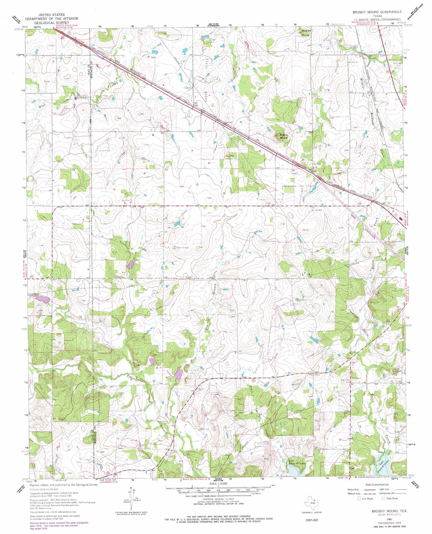
USGS Topo Quad 33097e8 - 1:24,000 scale
| Topo Map Name: | Brushy Mound |
| USGS Topo Quad ID: | 33097e8 |
| Print Size: | ca. 21 1/4" wide x 27" high |
| Southeast Coordinates: | 33.5° N latitude / 97.875° W longitude |
| Map Center Coordinates: | 33.5625° N latitude / 97.9375° W longitude |
| U.S. State: | TX |
| Filename: | o33097e8.jpg |
| Download Map JPG Image: | Brushy Mound topo map 1:24,000 scale |
| Map Type: | Topographic |
| Topo Series: | 7.5´ |
| Map Scale: | 1:24,000 |
| Source of Map Images: | United States Geological Survey (USGS) |
| Alternate Map Versions: |
Brushy Mound TX 1961, updated 1963 Download PDF Buy paper map Brushy Mound TX 1961, updated 1978 Download PDF Buy paper map Brushy Mound TX 2010 Download PDF Buy paper map Brushy Mound TX 2013 Download PDF Buy paper map Brushy Mound TX 2016 Download PDF Buy paper map |
1:24,000 Topo Quads surrounding Brushy Mound
Henrietta |
Dickworsham |
Ringgold |
Belcherville |
Nocona |
Bluegrove |
Bellevue |
Stoneburg |
Buzzard Roost Knob |
Montague |
Joy |
Vashti |
Brushy Mound |
Bowie |
Salona |
Postoak |
Newport |
Selma |
Sunset |
Smyrna |
Johnson Lake |
Cundiff |
Crafton |
Chico |
Alvord |
> Back to 33097e1 at 1:100,000 scale
> Back to 33096a1 at 1:250,000 scale
> Back to U.S. Topo Maps home
Brushy Mound topo map: Gazetteer
Brushy Mound: Dams
Soil Conservation Service Site 5a Dam elevation 302m 990′Soil Conservation Service Site 5b Dam elevation 302m 990′
Soil Conservation Service Site 6 Dam elevation 290m 951′
Brushy Mound: Oilfields
Anson Oil Field elevation 308m 1010′Boedeker Oil Field elevation 324m 1062′
Brushy Mound: Reservoirs
Soil Conservation Service Site 5a Reservoir elevation 302m 990′Soil Conservation Service Site 5b Reservoir elevation 302m 990′
Soil Conservation Service Site 6 Reservoir elevation 290m 951′
Brushy Mound: Streams
East Prairie Branch elevation 285m 935′Brushy Mound: Summits
Brushy Mound elevation 363m 1190′Dead Ox Mound elevation 320m 1049′
Brushy Mound digital topo map on disk
Buy this Brushy Mound topo map showing relief, roads, GPS coordinates and other geographical features, as a high-resolution digital map file on DVD: