Horseshoe Bend Topo Map Texas
To zoom in, hover over the map of Horseshoe Bend
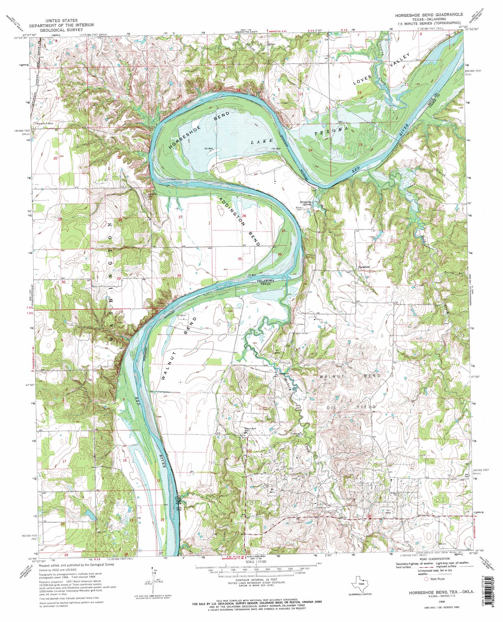
USGS Topo Quad 33097g1 - 1:24,000 scale
| Topo Map Name: | Horseshoe Bend |
| USGS Topo Quad ID: | 33097g1 |
| Print Size: | ca. 21 1/4" wide x 27" high |
| Southeast Coordinates: | 33.75° N latitude / 97° W longitude |
| Map Center Coordinates: | 33.8125° N latitude / 97.0625° W longitude |
| U.S. States: | TX, OK |
| Filename: | o33097g1.jpg |
| Download Map JPG Image: | Horseshoe Bend topo map 1:24,000 scale |
| Map Type: | Topographic |
| Topo Series: | 7.5´ |
| Map Scale: | 1:24,000 |
| Source of Map Images: | United States Geological Survey (USGS) |
| Alternate Map Versions: |
Horseshoe Bend TX 1968, updated 1971 Download PDF Buy paper map Horseshoe Bend TX 1968, updated 1971 Download PDF Buy paper map Horseshoe Bend TX 2010 Download PDF Buy paper map Horseshoe Bend TX 2013 Download PDF Buy paper map Horseshoe Bend TX 2016 Download PDF Buy paper map |
1:24,000 Topo Quads surrounding Horseshoe Bend
Healdton Se |
Overbrook |
Lake Murray |
Mcmillan |
Madill |
Burneyville |
Marietta West |
Marietta East |
Lebanon |
Shay |
Marysville |
Thackerville |
Horseshoe Bend |
Dexter |
Gordonville |
Muenster East |
Gainesville North |
Callisburg |
Whitesboro |
Sadler |
Hood |
Gainesville South |
Woodbine |
Collinsville |
Ethel |
> Back to 33097e1 at 1:100,000 scale
> Back to 33096a1 at 1:250,000 scale
> Back to U.S. Topo Maps home
Horseshoe Bend topo map: Gazetteer
Horseshoe Bend: Bends
Addington Bend elevation 196m 643′Horseshoe Bend elevation 192m 629′
Walnut Bend elevation 196m 643′
Horseshoe Bend: Oilfields
Walnut Bend Oil Field elevation 238m 780′Horseshoe Bend: Parks
Horseshoe Bend Recreation Area elevation 195m 639′Horseshoe Bend: Populated Places
Coesfield elevation 225m 738′Walnut Bend elevation 233m 764′
Horseshoe Bend: Springs
Dripping Spring elevation 193m 633′Horseshoe Bend: Streams
Corcoran Creek elevation 189m 620′Hickory Creek elevation 191m 626′
Rock Creek elevation 188m 616′
Sycamore Creek elevation 189m 620′
Tuttle Branch elevation 201m 659′
Horseshoe Bend digital topo map on disk
Buy this Horseshoe Bend topo map showing relief, roads, GPS coordinates and other geographical features, as a high-resolution digital map file on DVD: