Belcherville Topo Map Texas
To zoom in, hover over the map of Belcherville
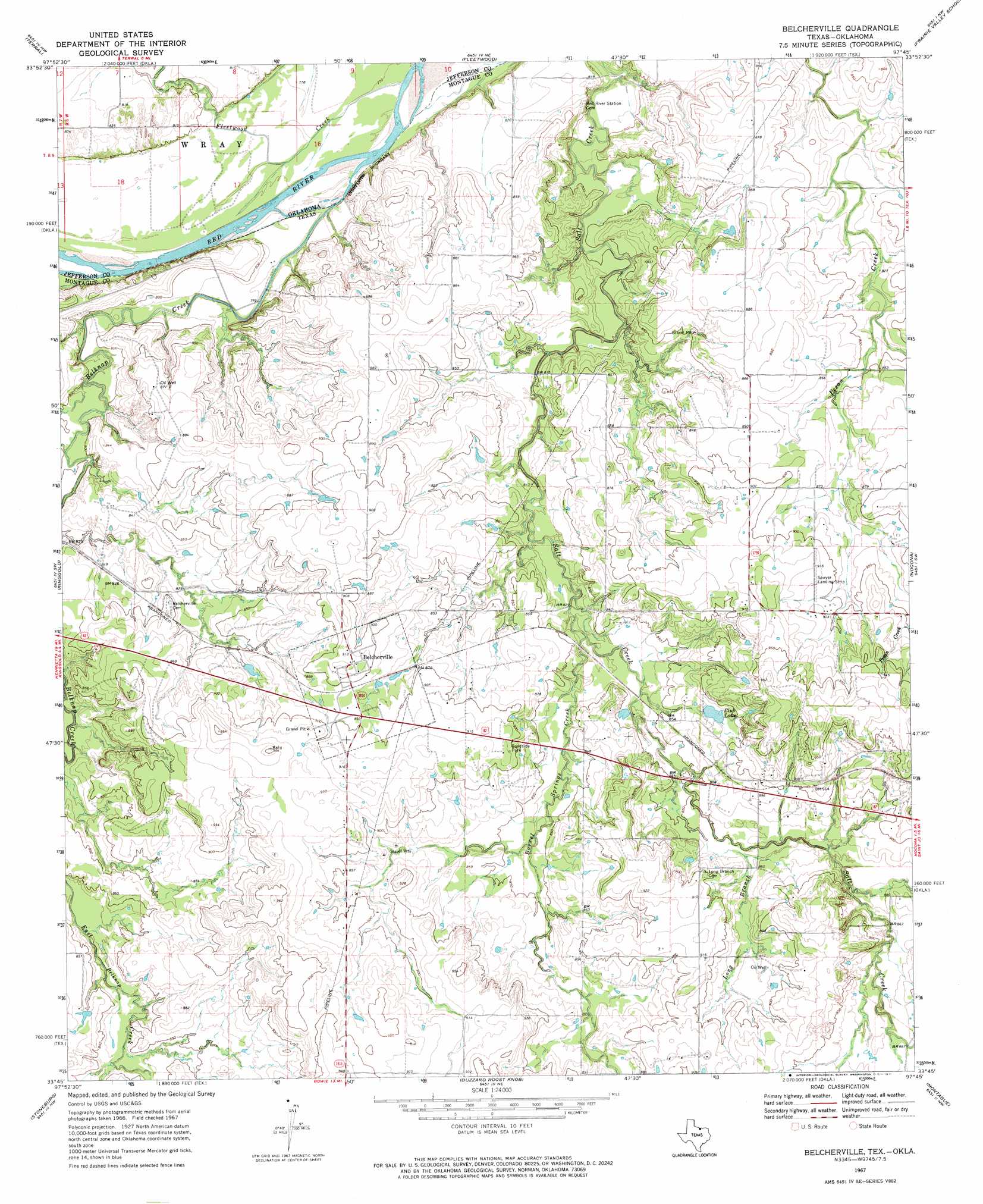
USGS Topo Quad 33097g7 - 1:24,000 scale
| Topo Map Name: | Belcherville |
| USGS Topo Quad ID: | 33097g7 |
| Print Size: | ca. 21 1/4" wide x 27" high |
| Southeast Coordinates: | 33.75° N latitude / 97.75° W longitude |
| Map Center Coordinates: | 33.8125° N latitude / 97.8125° W longitude |
| U.S. States: | TX, OK |
| Filename: | o33097g7.jpg |
| Download Map JPG Image: | Belcherville topo map 1:24,000 scale |
| Map Type: | Topographic |
| Topo Series: | 7.5´ |
| Map Scale: | 1:24,000 |
| Source of Map Images: | United States Geological Survey (USGS) |
| Alternate Map Versions: |
Belcherville TX 2010 Download PDF Buy paper map Belcherville TX 2013 Download PDF Buy paper map Belcherville TX 2016 Download PDF Buy paper map |
1:24,000 Topo Quads surrounding Belcherville
Irving |
Ryan |
Ryan Se |
Grady |
Orr |
Riverland Cemetery |
Terral |
Fleetwood |
Prairie Valley School |
Spanish Fort |
Dickworsham |
Ringgold |
Belcherville |
Nocona |
Bonita |
Bellevue |
Stoneburg |
Buzzard Roost Knob |
Montague |
Saint Jo |
Vashti |
Brushy Mound |
Bowie |
Salona |
Forestburg |
> Back to 33097e1 at 1:100,000 scale
> Back to 33096a1 at 1:250,000 scale
> Back to U.S. Topo Maps home
Belcherville topo map: Gazetteer
Belcherville: Populated Places
Belcherville elevation 276m 905′Belcherville: Reservoirs
Club Lake elevation 268m 879′Belcherville: Streams
Barrel Springs Creek elevation 253m 830′Beaver Creek elevation 237m 777′
Belknap Creek elevation 234m 767′
Fleetwood Creek elevation 235m 770′
Long Branch elevation 253m 830′
Belcherville digital topo map on disk
Buy this Belcherville topo map showing relief, roads, GPS coordinates and other geographical features, as a high-resolution digital map file on DVD: