Bartons Chapel Topo Map Texas
To zoom in, hover over the map of Bartons Chapel
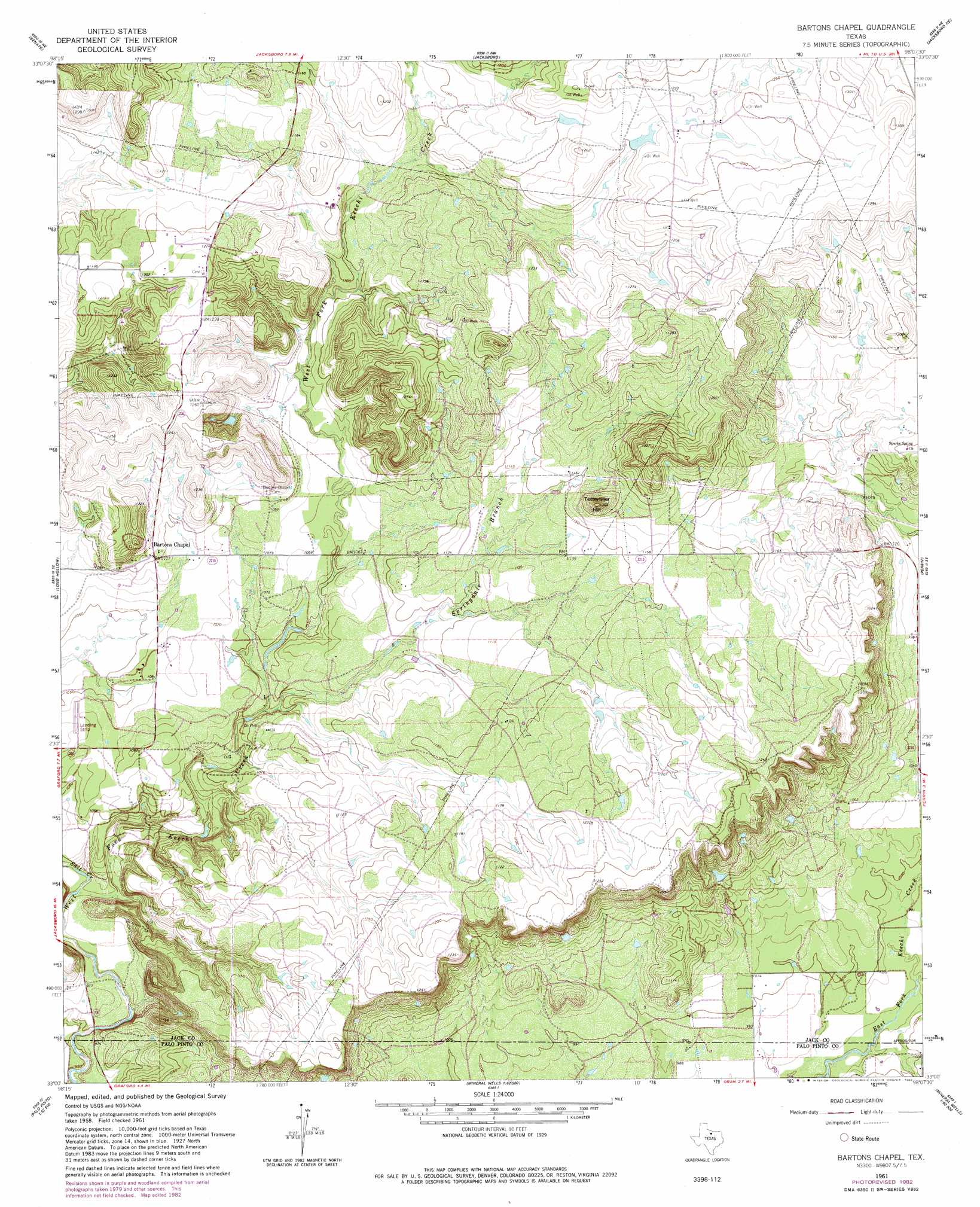
USGS Topo Quad 33098a2 - 1:24,000 scale
| Topo Map Name: | Bartons Chapel |
| USGS Topo Quad ID: | 33098a2 |
| Print Size: | ca. 21 1/4" wide x 27" high |
| Southeast Coordinates: | 33° N latitude / 98.125° W longitude |
| Map Center Coordinates: | 33.0625° N latitude / 98.1875° W longitude |
| U.S. State: | TX |
| Filename: | o33098a2.jpg |
| Download Map JPG Image: | Bartons Chapel topo map 1:24,000 scale |
| Map Type: | Topographic |
| Topo Series: | 7.5´ |
| Map Scale: | 1:24,000 |
| Source of Map Images: | United States Geological Survey (USGS) |
| Alternate Map Versions: |
Bartons Chapel TX 1961, updated 1962 Download PDF Buy paper map Bartons Chapel TX 1982, updated 1982 Download PDF Buy paper map Bartons Chapel TX 2010 Download PDF Buy paper map Bartons Chapel TX 2012 Download PDF Buy paper map Bartons Chapel TX 2016 Download PDF Buy paper map |
1:24,000 Topo Quads surrounding Bartons Chapel
Markley |
Lynn Creek |
Johnson Lake |
Cundiff |
Crafton |
Bryson |
Senate |
Jacksboro |
Jacksboro Ne |
Wizard Wells |
Ross Mountain |
Long Hollow |
Bartons Chapel |
Perrin |
Gibtown |
Costello Island |
Graford West |
Graford East |
Whitt |
Adell |
Fortune Bend |
Palo Pinto |
Mineral Wells West |
Mineral Wells East |
Garner |
> Back to 33098a1 at 1:100,000 scale
> Back to 33098a1 at 1:250,000 scale
> Back to U.S. Topo Maps home
Bartons Chapel topo map: Gazetteer
Bartons Chapel: Airports
One Sixty Four Place Airport elevation 356m 1167′Bartons Chapel: Dams
Richards Lake Dam elevation 366m 1200′Bartons Chapel: Populated Places
Bartons Chapel elevation 336m 1102′Bartons Chapel: Reservoirs
Richards Lake elevation 366m 1200′Bartons Chapel: Streams
Salt Creek elevation 298m 977′Springdale Branch elevation 314m 1030′
Two Bush Branch elevation 299m 980′
Bartons Chapel: Summits
Tettertiller Hill elevation 397m 1302′Bartons Chapel digital topo map on disk
Buy this Bartons Chapel topo map showing relief, roads, GPS coordinates and other geographical features, as a high-resolution digital map file on DVD: