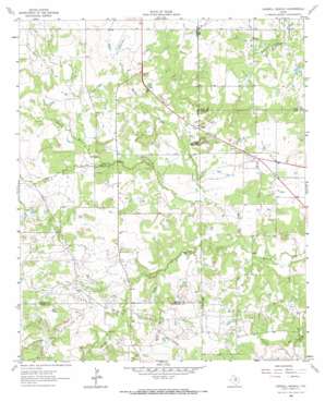
Darnell Branch Topo Map Texas
To zoom in, hover over the map of Darnell Branch
USGS Topo Quad 33098d4 - 1:24,000 scale
| Topo Map Name: | Darnell Branch |
| USGS Topo Quad ID: | 33098d4 |
| Print Size: | ca. 21 1/4" wide x 27" high |
| Southeast Coordinates: | 33.375° N latitude / 98.375° W longitude |
| Map Center Coordinates: | 33.4375° N latitude / 98.4375° W longitude |
| U.S. State: | TX |
| Filename: | o33098d4.jpg |
| Download Map JPG Image: | Darnell Branch topo map 1:24,000 scale |
| Map Type: | Topographic |
| Topo Series: | 7.5´ |
| Map Scale: | 1:24,000 |
| Source of Map Images: | United States Geological Survey (USGS) |
| Alternate Map Versions: |
Darnell Branch TX 1964, updated 1967 Download PDF Buy paper map Darnell Branch TX 2010 Download PDF Buy paper map Darnell Branch TX 2012 Download PDF Buy paper map Darnell Branch TX 2016 Download PDF Buy paper map |
1:24,000 Topo Quads surrounding Darnell Branch
> Back to 33098a1 at 1:100,000 scale
> Back to 33098a1 at 1:250,000 scale
> Back to U.S. Topo Maps home
Darnell Branch topo map: Gazetteer
Darnell Branch: Dams
Antelope Field Lake Dam elevation 324m 1062′Darnell Branch: Oilfields
Prideaux Oil Field elevation 319m 1046′Darnell Branch: Reservoirs
Antelope Field Lake elevation 324m 1062′Darnell Branch: Streams
Brushy Creek elevation 300m 984′Darnell Branch elevation 302m 990′
Dead Horse Creek elevation 308m 1010′
Plum Creek elevation 299m 980′
Prickly Pear Branch elevation 309m 1013′
Sailor Creek elevation 299m 980′
Waters Branch elevation 305m 1000′
Darnell Branch: Summits
Gap Mountain elevation 334m 1095′Spy Knob elevation 348m 1141′
Darnell Branch digital topo map on disk
Buy this Darnell Branch topo map showing relief, roads, GPS coordinates and other geographical features, as a high-resolution digital map file on DVD:


