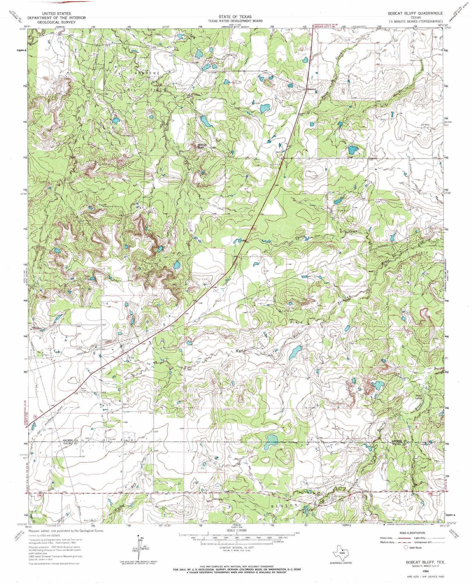
Bobcat Bluff Topo Map Texas
To zoom in, hover over the map of Bobcat Bluff
USGS Topo Quad 33098d6 - 1:24,000 scale
| Topo Map Name: | Bobcat Bluff |
| USGS Topo Quad ID: | 33098d6 |
| Print Size: | ca. 21 1/4" wide x 27" high |
| Southeast Coordinates: | 33.375° N latitude / 98.625° W longitude |
| Map Center Coordinates: | 33.4375° N latitude / 98.6875° W longitude |
| U.S. State: | TX |
| Filename: | o33098d6.jpg |
| Download Map JPG Image: | Bobcat Bluff topo map 1:24,000 scale |
| Map Type: | Topographic |
| Topo Series: | 7.5´ |
| Map Scale: | 1:24,000 |
| Source of Map Images: | United States Geological Survey (USGS) |
| Alternate Map Versions: |
Bobcat Bluff TX 1964, updated 1967 Download PDF Buy paper map Bobcat Bluff TX 2010 Download PDF Buy paper map Bobcat Bluff TX 2012 Download PDF Buy paper map Bobcat Bluff TX 2016 Download PDF Buy paper map |
1:24,000 Topo Quads surrounding Bobcat Bluff
Dundee |
Lake Kickapoo |
Dads Corner |
Archer City Ne |
Scotland |
Dundee Sw |
Dundee Se |
Archer City West |
Archer City East |
Windthorst |
Megargel |
Lake Olney |
Bobcat Bluff |
Prickly Pear Branch |
Darnell Branch |
Padgett |
Olney |
True |
Loving |
Markley |
Proffitt Crossing |
Proffitt |
Newcastle |
Lake Eddleman |
Bryson |
> Back to 33098a1 at 1:100,000 scale
> Back to 33098a1 at 1:250,000 scale
> Back to U.S. Topo Maps home
Bobcat Bluff topo map: Gazetteer
Bobcat Bluff: Cliffs
Bobcat Bluff elevation 349m 1145′Bobcat Bluff: Dams
Calvin Lake Dam elevation 351m 1151′Campbell Lake Dam elevation 363m 1190′
Conner Lake Dam elevation 363m 1190′
Bobcat Bluff: Oilfields
Olney Oil Field elevation 350m 1148′Bobcat Bluff: Populated Places
Anarene elevation 345m 1131′Bobcat Bluff: Reservoirs
Calvin Lake elevation 351m 1151′Campbell Lake elevation 363m 1190′
Conner Lake elevation 363m 1190′
Thief Lakes elevation 338m 1108′
Bobcat Bluff: Springs
Persimmon Springs elevation 349m 1145′Bobcat Bluff: Streams
Curtis Creek elevation 332m 1089′Bobcat Bluff digital topo map on disk
Buy this Bobcat Bluff topo map showing relief, roads, GPS coordinates and other geographical features, as a high-resolution digital map file on DVD: