Dundee Se Topo Map Texas
To zoom in, hover over the map of Dundee Se
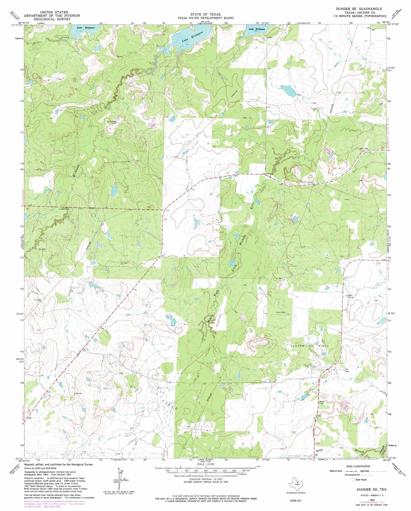
USGS Topo Quad 33098e7 - 1:24,000 scale
| Topo Map Name: | Dundee Se |
| USGS Topo Quad ID: | 33098e7 |
| Print Size: | ca. 21 1/4" wide x 27" high |
| Southeast Coordinates: | 33.5° N latitude / 98.75° W longitude |
| Map Center Coordinates: | 33.5625° N latitude / 98.8125° W longitude |
| U.S. State: | TX |
| Filename: | o33098e7.jpg |
| Download Map JPG Image: | Dundee Se topo map 1:24,000 scale |
| Map Type: | Topographic |
| Topo Series: | 7.5´ |
| Map Scale: | 1:24,000 |
| Source of Map Images: | United States Geological Survey (USGS) |
| Alternate Map Versions: |
Dundee SE TX 1964, updated 1967 Download PDF Buy paper map Dundee SE TX 1964, updated 1982 Download PDF Buy paper map Dundee SE TX 2010 Download PDF Buy paper map Dundee SE TX 2012 Download PDF Buy paper map Dundee SE TX 2016 Download PDF Buy paper map |
1:24,000 Topo Quads surrounding Dundee Se
Franklin Bend |
Lake Diversion |
Mankins |
Holliday |
Lake Wichita |
Fulda |
Dundee |
Lake Kickapoo |
Dads Corner |
Archer City Ne |
Cope Branch |
Dundee Sw |
Dundee Se |
Archer City West |
Archer City East |
Westover |
Megargel |
Lake Olney |
Bobcat Bluff |
Prickly Pear Branch |
Westover Se |
Padgett |
Olney |
True |
Loving |
> Back to 33098e1 at 1:100,000 scale
> Back to 33098a1 at 1:250,000 scale
> Back to U.S. Topo Maps home
Dundee Se topo map: Gazetteer
Dundee Se: Oilfields
Oldham Oil Field elevation 339m 1112′Dundee Se: Streams
Table Branch elevation 320m 1049′Dundee Se digital topo map on disk
Buy this Dundee Se topo map showing relief, roads, GPS coordinates and other geographical features, as a high-resolution digital map file on DVD: