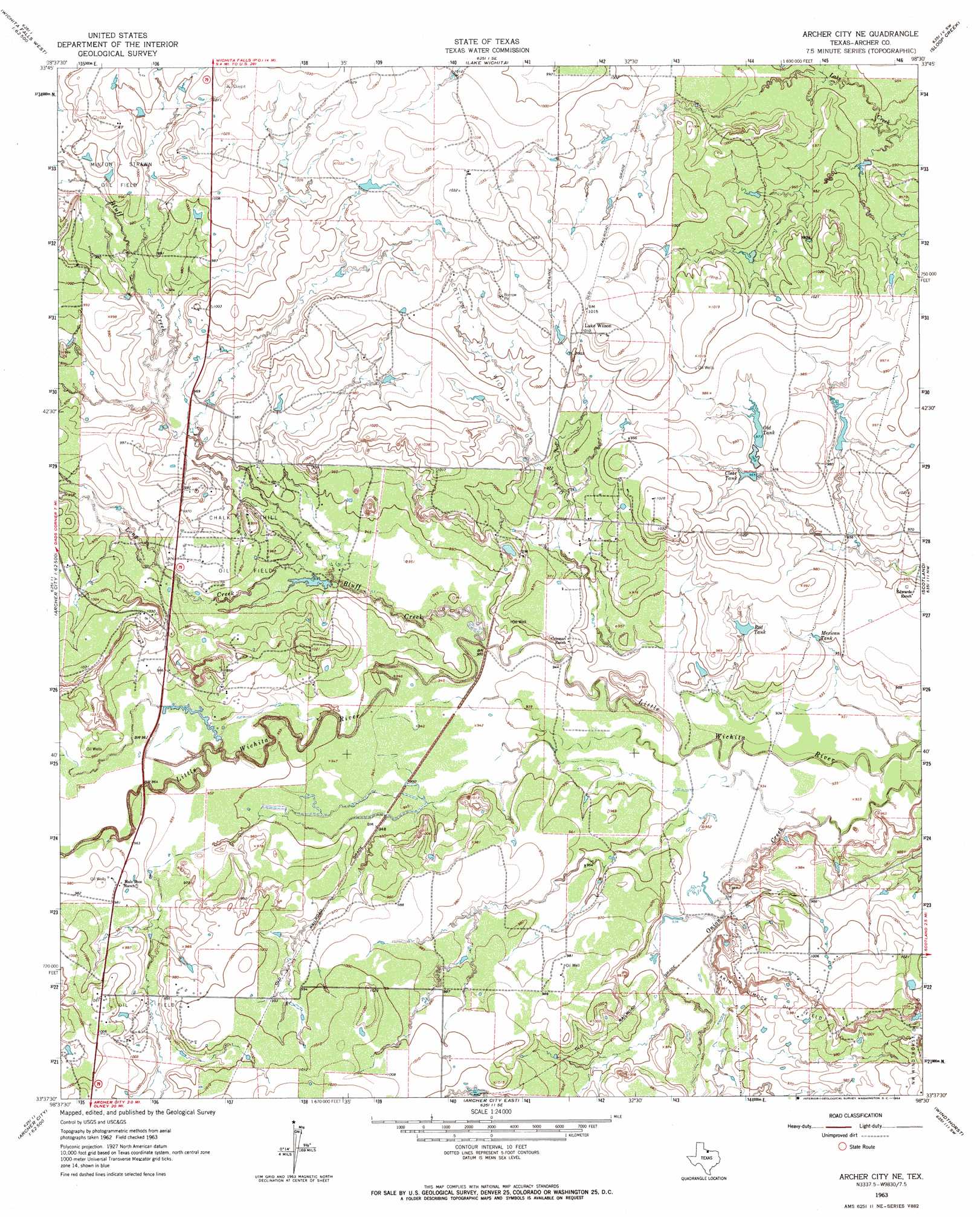
Archer City Ne Topo Map Texas
To zoom in, hover over the map of Archer City Ne
USGS Topo Quad 33098f5 - 1:24,000 scale
| Topo Map Name: | Archer City Ne |
| USGS Topo Quad ID: | 33098f5 |
| Print Size: | ca. 21 1/4" wide x 27" high |
| Southeast Coordinates: | 33.625° N latitude / 98.5° W longitude |
| Map Center Coordinates: | 33.6875° N latitude / 98.5625° W longitude |
| U.S. State: | TX |
| Filename: | o33098f5.jpg |
| Download Map JPG Image: | Archer City Ne topo map 1:24,000 scale |
| Map Type: | Topographic |
| Topo Series: | 7.5´ |
| Map Scale: | 1:24,000 |
| Source of Map Images: | United States Geological Survey (USGS) |
| Alternate Map Versions: |
Archer City NE TX 1963, updated 1964 Download PDF Buy paper map Archer City NE TX 2010 Download PDF Buy paper map Archer City NE TX 2012 Download PDF Buy paper map Archer City NE TX 2016 Download PDF Buy paper map |
1:24,000 Topo Quads surrounding Archer City Ne
Fowlkes |
Iowa Park |
Wichita Falls West |
Wichita Falls East |
Dean |
Mankins |
Holliday |
Lake Wichita |
Sloop Creek |
Jolly |
Lake Kickapoo |
Dads Corner |
Archer City Ne |
Scotland |
Deer Creek |
Dundee Se |
Archer City West |
Archer City East |
Windthorst |
Scotland Se |
Lake Olney |
Bobcat Bluff |
Prickly Pear Branch |
Darnell Branch |
Antelope |
> Back to 33098e1 at 1:100,000 scale
> Back to 33098a1 at 1:250,000 scale
> Back to U.S. Topo Maps home
Archer City Ne topo map: Gazetteer
Archer City Ne: Dams
Dillards Lake Dam elevation 306m 1003′Archer City Ne: Oilfields
Akin Dimock Oil Field elevation 293m 961′Chalk Hill Oil Field elevation 296m 971′
Minton-Strawn Oil Field elevation 305m 1000′
Northwest Windthorst Oil Field elevation 308m 1010′
Scotland-Little Wichita Oil Field elevation 301m 987′
Archer City Ne: Populated Places
Luke Wilson elevation 308m 1010′Archer City Ne: Reservoirs
Clear Tank elevation 293m 961′Dillards Lake elevation 306m 1003′
Mexican Tank elevation 290m 951′
Old Tank elevation 297m 974′
Red Tank elevation 291m 954′
Archer City Ne: Streams
Bluff Creek elevation 287m 941′Long Creek elevation 289m 948′
Onion Creek elevation 284m 931′
Archer City Ne digital topo map on disk
Buy this Archer City Ne topo map showing relief, roads, GPS coordinates and other geographical features, as a high-resolution digital map file on DVD: