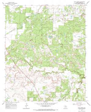
Dads Corner Topo Map Texas
To zoom in, hover over the map of Dads Corner
USGS Topo Quad 33098f6 - 1:24,000 scale
| Topo Map Name: | Dads Corner |
| USGS Topo Quad ID: | 33098f6 |
| Print Size: | ca. 21 1/4" wide x 27" high |
| Southeast Coordinates: | 33.625° N latitude / 98.625° W longitude |
| Map Center Coordinates: | 33.6875° N latitude / 98.6875° W longitude |
| U.S. State: | TX |
| Filename: | o33098f6.jpg |
| Download Map JPG Image: | Dads Corner topo map 1:24,000 scale |
| Map Type: | Topographic |
| Topo Series: | 7.5´ |
| Map Scale: | 1:24,000 |
| Source of Map Images: | United States Geological Survey (USGS) |
| Alternate Map Versions: |
Dads Corner TX 1966, updated 1968 Download PDF Buy paper map Dads Corner TX 2010 Download PDF Buy paper map Dads Corner TX 2012 Download PDF Buy paper map Dads Corner TX 2016 Download PDF Buy paper map |
1:24,000 Topo Quads surrounding Dads Corner
> Back to 33098e1 at 1:100,000 scale
> Back to 33098a1 at 1:250,000 scale
> Back to U.S. Topo Maps home
Dads Corner topo map: Gazetteer
Dads Corner: Dams
C P Burton Dam elevation 308m 1010′Cole Storage Tank Dam elevation 311m 1020′
Continental Oil Company Dam elevation 304m 997′
Oil Investment Company Dam elevation 297m 974′
Dads Corner: Oilfields
Turbeville Oil Field elevation 316m 1036′Dads Corner: Populated Places
Dads Corner elevation 313m 1026′Dads Corner: Reservoirs
Cole Storage Tank elevation 311m 1020′Continental Oil Company Reservoir elevation 304m 997′
Cp Burton Reservoir elevation 308m 1010′
Oil Investment Company Reservoir elevation 297m 974′
Windmill Tank elevation 314m 1030′
Dads Corner: Streams
Middle Fork Little Wichita River elevation 290m 951′North Fork Little Wichita River elevation 289m 948′
South Fork Little Wichita River elevation 288m 944′
Dads Corner digital topo map on disk
Buy this Dads Corner topo map showing relief, roads, GPS coordinates and other geographical features, as a high-resolution digital map file on DVD:


