Riverland Cemetery Topo Map Texas
To zoom in, hover over the map of Riverland Cemetery
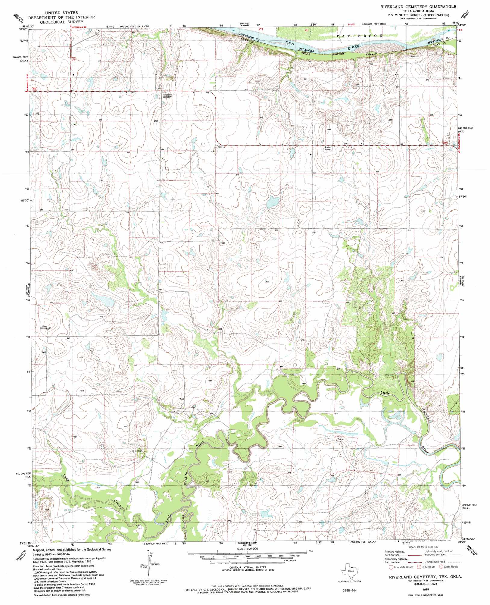
USGS Topo Quad 33098h1 - 1:24,000 scale
| Topo Map Name: | Riverland Cemetery |
| USGS Topo Quad ID: | 33098h1 |
| Print Size: | ca. 21 1/4" wide x 27" high |
| Southeast Coordinates: | 33.875° N latitude / 98° W longitude |
| Map Center Coordinates: | 33.9375° N latitude / 98.0625° W longitude |
| U.S. States: | TX, OK |
| Filename: | o33098h1.jpg |
| Download Map JPG Image: | Riverland Cemetery topo map 1:24,000 scale |
| Map Type: | Topographic |
| Topo Series: | 7.5´ |
| Map Scale: | 1:24,000 |
| Source of Map Images: | United States Geological Survey (USGS) |
| Alternate Map Versions: |
Riverland Cemetery TX 1985, updated 1985 Download PDF Buy paper map Riverland Cemetery TX 2010 Download PDF Buy paper map Riverland Cemetery TX 2013 Download PDF Buy paper map Riverland Cemetery TX 2016 Download PDF Buy paper map |
1:24,000 Topo Quads surrounding Riverland Cemetery
Taylor |
Hooper |
Waurika West |
Waurika East |
Ryan Ne |
Charlie |
Byers |
Irving |
Ryan |
Ryan Se |
Dean |
Hurnville |
Riverland Cemetery |
Terral |
Fleetwood |
Jolly |
Henrietta |
Dickworsham |
Ringgold |
Belcherville |
Deer Creek |
Bluegrove |
Bellevue |
Stoneburg |
Buzzard Roost Knob |
> Back to 33098e1 at 1:100,000 scale
> Back to 33098a1 at 1:250,000 scale
> Back to U.S. Topo Maps home
Riverland Cemetery topo map: Gazetteer
Riverland Cemetery: Dams
Edwards Ranch Lake Number 2 Dam elevation 267m 875′Lively Lake Dam elevation 264m 866′
Maddox Lake Dam elevation 271m 889′
Riverland Cemetery: Reservoirs
Edwards Ranch Lake Number 2 elevation 267m 875′Lively Lake elevation 264m 866′
Maddox Lake elevation 271m 889′
Riverland Cemetery: Streams
East Fork Little Wichita River elevation 246m 807′Long Creek elevation 247m 810′
Riverland Cemetery digital topo map on disk
Buy this Riverland Cemetery topo map showing relief, roads, GPS coordinates and other geographical features, as a high-resolution digital map file on DVD: