Fowlkes Topo Map Texas
To zoom in, hover over the map of Fowlkes
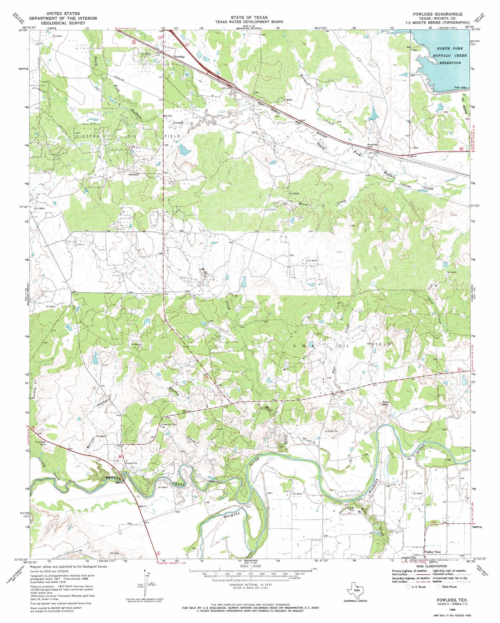
USGS Topo Quad 33098h7 - 1:24,000 scale
| Topo Map Name: | Fowlkes |
| USGS Topo Quad ID: | 33098h7 |
| Print Size: | ca. 21 1/4" wide x 27" high |
| Southeast Coordinates: | 33.875° N latitude / 98.75° W longitude |
| Map Center Coordinates: | 33.9375° N latitude / 98.8125° W longitude |
| U.S. State: | TX |
| Filename: | o33098h7.jpg |
| Download Map JPG Image: | Fowlkes topo map 1:24,000 scale |
| Map Type: | Topographic |
| Topo Series: | 7.5´ |
| Map Scale: | 1:24,000 |
| Source of Map Images: | United States Geological Survey (USGS) |
| Alternate Map Versions: |
Fowlkes TX 1916, updated 1961 Download PDF Buy paper map Fowlkes TX 1968, updated 1971 Download PDF Buy paper map Fowlkes TX 2010 Download PDF Buy paper map Fowlkes TX 2013 Download PDF Buy paper map Fowlkes TX 2016 Download PDF Buy paper map |
1:24,000 Topo Quads surrounding Fowlkes
Davidson |
Cowboy Springs |
Augar Creek |
Grandfield |
Devol |
Harrold |
Electra |
Sunshine Hill |
Clara |
Burkburnett |
Lake Electra |
Beaver Creek |
Fowlkes |
Iowa Park |
Wichita Falls West |
Franklin Bend |
Lake Diversion |
Mankins |
Holliday |
Lake Wichita |
Fulda |
Dundee |
Lake Kickapoo |
Dads Corner |
Archer City Ne |
> Back to 33098e1 at 1:100,000 scale
> Back to 33098a1 at 1:250,000 scale
> Back to U.S. Topo Maps home
Fowlkes topo map: Gazetteer
Fowlkes: Capes
Turkey Hill elevation 330m 1082′Fowlkes: Dams
Beaver Creek Lake Dam elevation 302m 990′Burnett Lake Dam elevation 328m 1076′
North Fork Buffalo Creek Dam elevation 320m 1049′
Fowlkes: Populated Places
Fowlkes elevation 332m 1089′Fowlkes: Reservoirs
Beaver Creek Lake elevation 302m 990′Burnett Lake elevation 328m 1076′
North Fork Buffalo Creek Reservoir elevation 320m 1049′
Fowlkes: Streams
Beaver Creek elevation 297m 974′Burnett Creek elevation 311m 1020′
Deer Creek elevation 297m 974′
Flat Creek elevation 296m 971′
Horse Creek elevation 310m 1017′
Turkey Creek elevation 300m 984′
Turkey Creek elevation 301m 987′
Whisky Creek elevation 301m 987′
Wolf Creek elevation 298m 977′
Fowlkes: Summits
Twin Mountain elevation 321m 1053′Fowlkes: Valleys
Bolivar Hollow elevation 304m 997′Fowlkes digital topo map on disk
Buy this Fowlkes topo map showing relief, roads, GPS coordinates and other geographical features, as a high-resolution digital map file on DVD: