Sagerton Topo Map Texas
To zoom in, hover over the map of Sagerton
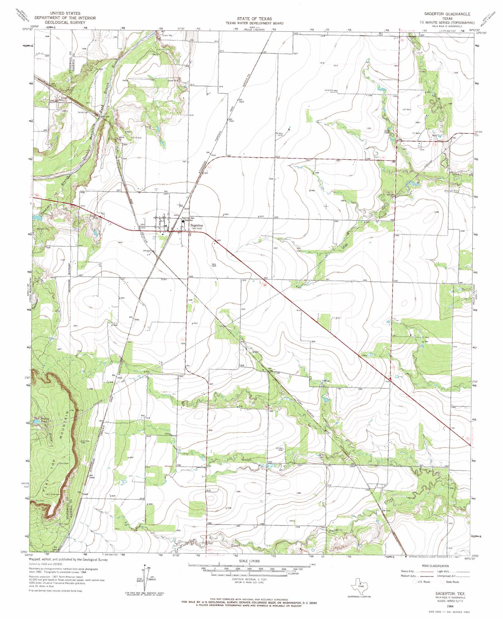
USGS Topo Quad 33099a8 - 1:24,000 scale
| Topo Map Name: | Sagerton |
| USGS Topo Quad ID: | 33099a8 |
| Print Size: | ca. 21 1/4" wide x 27" high |
| Southeast Coordinates: | 33° N latitude / 99.875° W longitude |
| Map Center Coordinates: | 33.0625° N latitude / 99.9375° W longitude |
| U.S. State: | TX |
| Filename: | o33099a8.jpg |
| Download Map JPG Image: | Sagerton topo map 1:24,000 scale |
| Map Type: | Topographic |
| Topo Series: | 7.5´ |
| Map Scale: | 1:24,000 |
| Source of Map Images: | United States Geological Survey (USGS) |
| Alternate Map Versions: |
Sagerton TX 1964, updated 1966 Download PDF Buy paper map Sagerton TX 2010 Download PDF Buy paper map Sagerton TX 2012 Download PDF Buy paper map Sagerton TX 2016 Download PDF Buy paper map |
1:24,000 Topo Quads surrounding Sagerton
Kiowa Peak Sw |
Kiowa Peak |
Jud |
Rochester |
Weinert |
Aspermont |
Old Glory |
Rule |
Pinkerton |
Haskell |
Aspermont Lake |
Frog Mountain |
Sagerton |
Dudleys Creek |
Lake Stamford West |
Hamlin Nw |
Hamlin Ne |
Tuxedo |
Stamford |
Lueders Nw |
Mccaulley |
Neinda |
Anson |
Funston |
Lueders West |
> Back to 33099a1 at 1:100,000 scale
> Back to 33098a1 at 1:250,000 scale
> Back to U.S. Topo Maps home
Sagerton topo map: Gazetteer
Sagerton: Populated Places
Sagerton elevation 498m 1633′Sagerton: Reservoirs
Salt Branch Tank elevation 531m 1742′Sagerton: Streams
Coon Creek elevation 476m 1561′Deadman Branch elevation 473m 1551′
Gyp Creek elevation 471m 1545′
Sagerton: Summits
Flat Top Mountain elevation 552m 1811′Sagerton digital topo map on disk
Buy this Sagerton topo map showing relief, roads, GPS coordinates and other geographical features, as a high-resolution digital map file on DVD: