Haskell Topo Map Texas
To zoom in, hover over the map of Haskell
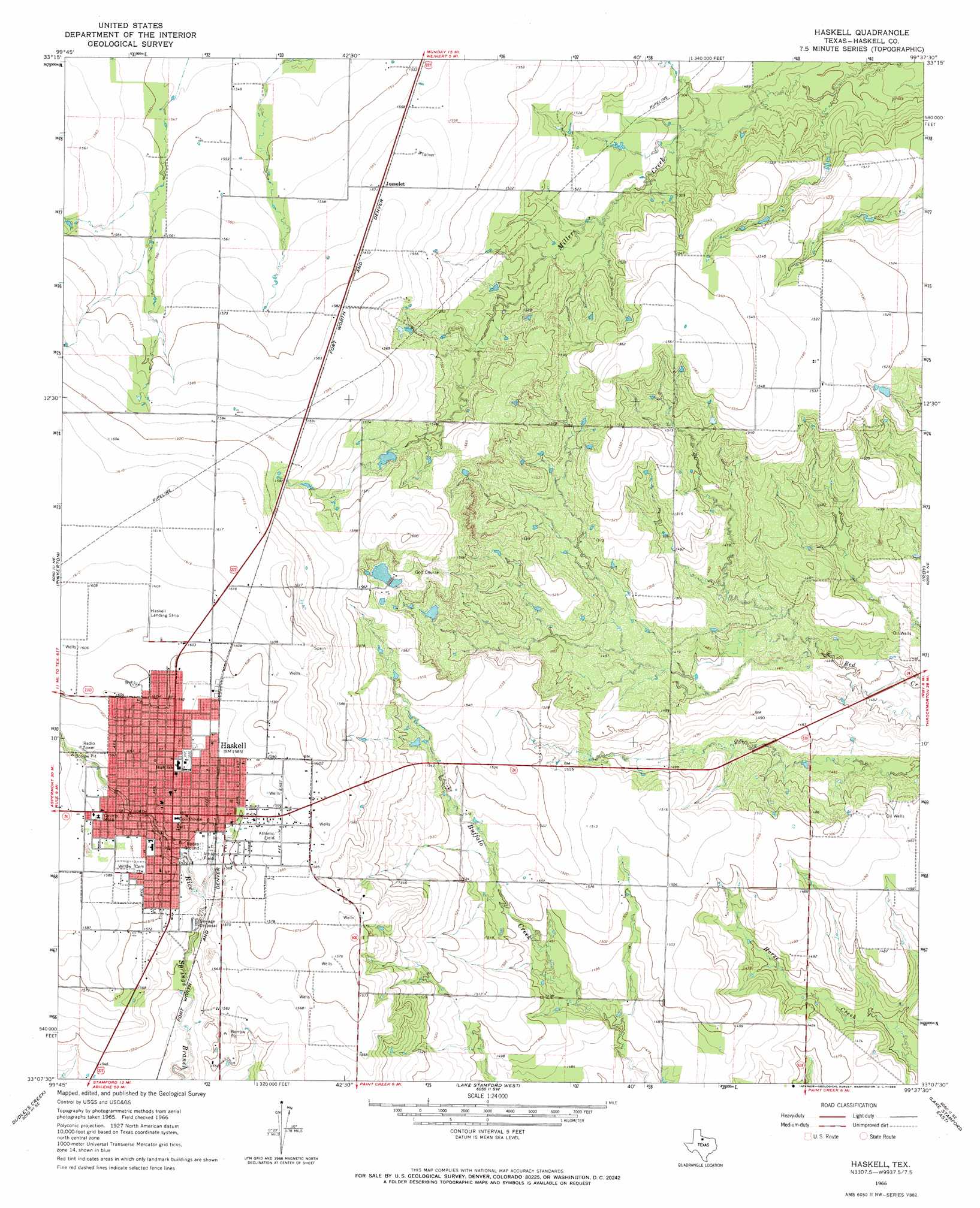
USGS Topo Quad 33099b6 - 1:24,000 scale
| Topo Map Name: | Haskell |
| USGS Topo Quad ID: | 33099b6 |
| Print Size: | ca. 21 1/4" wide x 27" high |
| Southeast Coordinates: | 33.125° N latitude / 99.625° W longitude |
| Map Center Coordinates: | 33.1875° N latitude / 99.6875° W longitude |
| U.S. State: | TX |
| Filename: | o33099b6.jpg |
| Download Map JPG Image: | Haskell topo map 1:24,000 scale |
| Map Type: | Topographic |
| Topo Series: | 7.5´ |
| Map Scale: | 1:24,000 |
| Source of Map Images: | United States Geological Survey (USGS) |
| Alternate Map Versions: |
Haskell TX 1966, updated 1968 Download PDF Buy paper map Haskell TX 2010 Download PDF Buy paper map Haskell TX 2013 Download PDF Buy paper map Haskell TX 2016 Download PDF Buy paper map |
1:24,000 Topo Quads surrounding Haskell
Knox City Nw |
Knox City |
Munday West |
Munday East |
Antelope Creek Nw |
Jud |
Rochester |
Weinert |
Mattson |
Antelope Creek Sw |
Rule |
Pinkerton |
Haskell |
Irby |
Reynolds Bend Nw |
Sagerton |
Dudleys Creek |
Lake Stamford West |
Lake Stamford East |
Hoover Mountain |
Tuxedo |
Stamford |
Lueders Nw |
Lueders Ne |
Antelope Hills |
> Back to 33099a1 at 1:100,000 scale
> Back to 33098a1 at 1:250,000 scale
> Back to U.S. Topo Maps home
Haskell topo map: Gazetteer
Haskell: Airports
Haskell Municipal Airport elevation 490m 1607′Haskell: Dams
Haskell Club Dam elevation 474m 1555′Haskell: Populated Places
Haskell elevation 482m 1581′Josselet elevation 479m 1571′
Haskell: Reservoirs
Country Club Lake elevation 474m 1555′Haskell digital topo map on disk
Buy this Haskell topo map showing relief, roads, GPS coordinates and other geographical features, as a high-resolution digital map file on DVD: