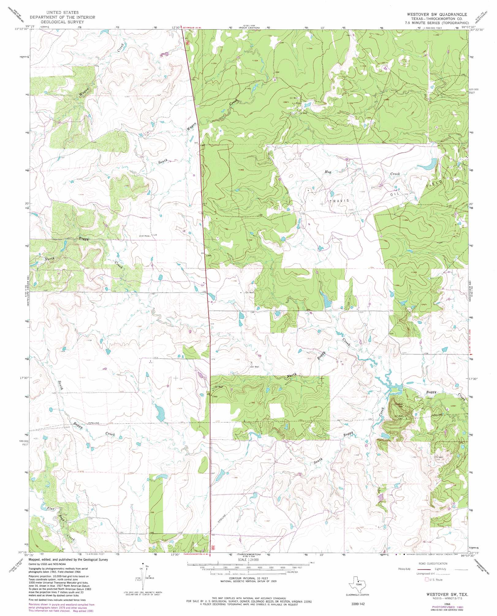
Westover Sw Topo Map Texas
To zoom in, hover over the map of Westover Sw
USGS Topo Quad 33099c2 - 1:24,000 scale
| Topo Map Name: | Westover Sw |
| USGS Topo Quad ID: | 33099c2 |
| Print Size: | ca. 21 1/4" wide x 27" high |
| Southeast Coordinates: | 33.25° N latitude / 99.125° W longitude |
| Map Center Coordinates: | 33.3125° N latitude / 99.1875° W longitude |
| U.S. State: | TX |
| Filename: | o33099c2.jpg |
| Download Map JPG Image: | Westover Sw topo map 1:24,000 scale |
| Map Type: | Topographic |
| Topo Series: | 7.5´ |
| Map Scale: | 1:24,000 |
| Source of Map Images: | United States Geological Survey (USGS) |
| Alternate Map Versions: |
Westover SW TX 1966, updated 1968 Download PDF Buy paper map Westover SW TX 1966, updated 1982 Download PDF Buy paper map Westover SW TX 2010 Download PDF Buy paper map Westover SW TX 2012 Download PDF Buy paper map Westover SW TX 2016 Download PDF Buy paper map |
1:24,000 Topo Quads surrounding Westover Sw
Bomarton |
Seymour West |
Seymour East |
Cope Branch |
Dundee Sw |
Antelope Creek Nw |
Antelope Creek Ne |
Rock Canyon |
Westover |
Megargel |
Antelope Creek Sw |
Antelope Creek Se |
Westover Sw |
Westover Se |
Padgett |
Reynolds Bend Nw |
Tonk Creek |
Throckmorton |
Throckmorton Ne |
Proffitt Crossing |
Hoover Mountain |
Reynolds Bend |
Sibley Creek |
Woodson |
Murray |
> Back to 33099a1 at 1:100,000 scale
> Back to 33098a1 at 1:250,000 scale
> Back to U.S. Topo Maps home
Westover Sw topo map: Gazetteer
Westover Sw: Dams
Texas A and M Experimental Ranch Lake Dam elevation 419m 1374′Timmons Lake Dam elevation 393m 1289′
Westover Sw: Oilfields
Travis Oil Field elevation 405m 1328′Westover Sw: Reservoirs
Texas A and M Experimental Ranch Lake elevation 419m 1374′Timmons Lake elevation 393m 1289′
Westover Sw: Streams
North Boggy Creek elevation 381m 1250′South Boggy Creek elevation 381m 1250′
Westover Sw digital topo map on disk
Buy this Westover Sw topo map showing relief, roads, GPS coordinates and other geographical features, as a high-resolution digital map file on DVD: