Antelope Creek Sw Topo Map Texas
To zoom in, hover over the map of Antelope Creek Sw
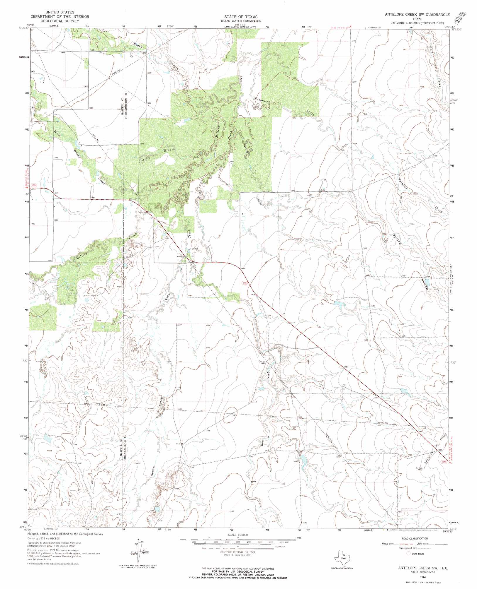
USGS Topo Quad 33099c4 - 1:24,000 scale
| Topo Map Name: | Antelope Creek Sw |
| USGS Topo Quad ID: | 33099c4 |
| Print Size: | ca. 21 1/4" wide x 27" high |
| Southeast Coordinates: | 33.25° N latitude / 99.375° W longitude |
| Map Center Coordinates: | 33.3125° N latitude / 99.4375° W longitude |
| U.S. State: | TX |
| Filename: | o33099c4.jpg |
| Download Map JPG Image: | Antelope Creek Sw topo map 1:24,000 scale |
| Map Type: | Topographic |
| Topo Series: | 7.5´ |
| Map Scale: | 1:24,000 |
| Source of Map Images: | United States Geological Survey (USGS) |
| Alternate Map Versions: |
Antelope Creek SW TX 1962, updated 1965 Download PDF Buy paper map Antelope Creek SW TX 2010 Download PDF Buy paper map Antelope Creek SW TX 2013 Download PDF Buy paper map Antelope Creek SW TX 2016 Download PDF Buy paper map |
1:24,000 Topo Quads surrounding Antelope Creek Sw
Rhineland |
Hefner |
Bomarton |
Seymour West |
Seymour East |
Munday West |
Munday East |
Antelope Creek Nw |
Antelope Creek Ne |
Rock Canyon |
Weinert |
Mattson |
Antelope Creek Sw |
Antelope Creek Se |
Westover Sw |
Haskell |
Irby |
Reynolds Bend Nw |
Tonk Creek |
Throckmorton |
Lake Stamford West |
Lake Stamford East |
Hoover Mountain |
Reynolds Bend |
Sibley Creek |
> Back to 33099a1 at 1:100,000 scale
> Back to 33098a1 at 1:250,000 scale
> Back to U.S. Topo Maps home
Antelope Creek Sw topo map: Gazetteer
Antelope Creek Sw: Dams
Big Wolf Tank Dam elevation 440m 1443′Antelope Creek Sw: Reservoirs
Big Wolf Tank elevation 440m 1443′Antelope Creek Sw: Streams
Bow Creek elevation 405m 1328′Gobbler Branch elevation 407m 1335′
Rocky Creek elevation 404m 1325′
Squaw Creek elevation 412m 1351′
Sulphur Creek elevation 406m 1332′
Wild Horse Creek elevation 412m 1351′
Antelope Creek Sw: Valleys
Spring Hollow elevation 412m 1351′Antelope Creek Sw digital topo map on disk
Buy this Antelope Creek Sw topo map showing relief, roads, GPS coordinates and other geographical features, as a high-resolution digital map file on DVD: