Rochester Topo Map Texas
To zoom in, hover over the map of Rochester
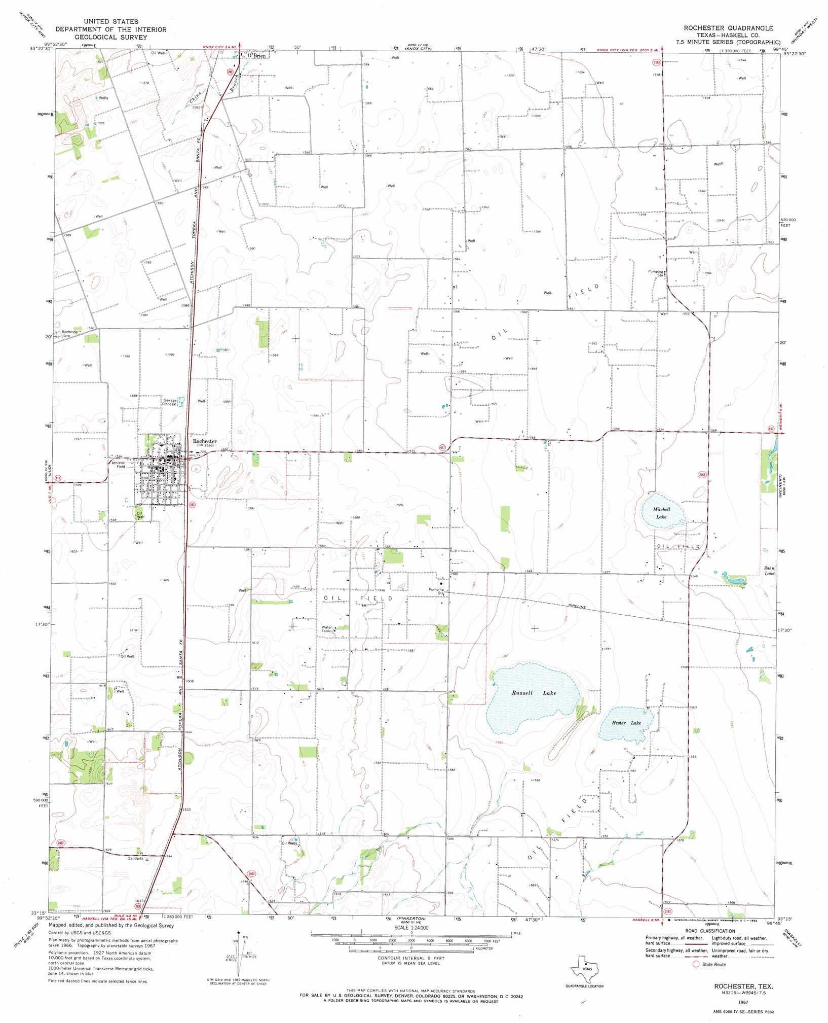
USGS Topo Quad 33099c7 - 1:24,000 scale
| Topo Map Name: | Rochester |
| USGS Topo Quad ID: | 33099c7 |
| Print Size: | ca. 21 1/4" wide x 27" high |
| Southeast Coordinates: | 33.25° N latitude / 99.75° W longitude |
| Map Center Coordinates: | 33.3125° N latitude / 99.8125° W longitude |
| U.S. State: | TX |
| Filename: | o33099c7.jpg |
| Download Map JPG Image: | Rochester topo map 1:24,000 scale |
| Map Type: | Topographic |
| Topo Series: | 7.5´ |
| Map Scale: | 1:24,000 |
| Source of Map Images: | United States Geological Survey (USGS) |
| Alternate Map Versions: |
Rochester TX 1967, updated 1969 Download PDF Buy paper map Rochester TX 2010 Download PDF Buy paper map Rochester TX 2012 Download PDF Buy paper map Rochester TX 2016 Download PDF Buy paper map |
1:24,000 Topo Quads surrounding Rochester
Buzzard Peak |
Cedar Mountain |
Benjamin |
Rhineland |
Hefner |
Kiowa Peak Ne |
Knox City Nw |
Knox City |
Munday West |
Munday East |
Kiowa Peak |
Jud |
Rochester |
Weinert |
Mattson |
Old Glory |
Rule |
Pinkerton |
Haskell |
Irby |
Frog Mountain |
Sagerton |
Dudleys Creek |
Lake Stamford West |
Lake Stamford East |
> Back to 33099a1 at 1:100,000 scale
> Back to 33098a1 at 1:250,000 scale
> Back to U.S. Topo Maps home
Rochester topo map: Gazetteer
Rochester: Lakes
Hester Lake elevation 475m 1558′Mitchell Lake elevation 471m 1545′
Russell Lake elevation 473m 1551′
Rochester: Populated Places
Rochester elevation 486m 1594′Rochester digital topo map on disk
Buy this Rochester topo map showing relief, roads, GPS coordinates and other geographical features, as a high-resolution digital map file on DVD: