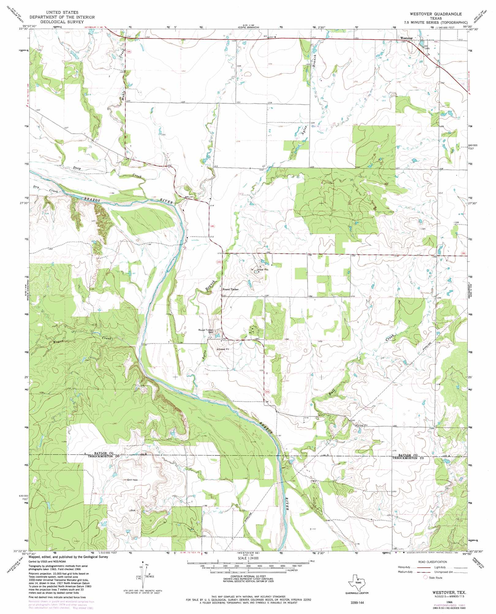
Westover Topo Map Texas
To zoom in, hover over the map of Westover
USGS Topo Quad 33099d1 - 1:24,000 scale
| Topo Map Name: | Westover |
| USGS Topo Quad ID: | 33099d1 |
| Print Size: | ca. 21 1/4" wide x 27" high |
| Southeast Coordinates: | 33.375° N latitude / 99° W longitude |
| Map Center Coordinates: | 33.4375° N latitude / 99.0625° W longitude |
| U.S. State: | TX |
| Filename: | o33099d1.jpg |
| Download Map JPG Image: | Westover topo map 1:24,000 scale |
| Map Type: | Topographic |
| Topo Series: | 7.5´ |
| Map Scale: | 1:24,000 |
| Source of Map Images: | United States Geological Survey (USGS) |
| Alternate Map Versions: |
Westover TX 1966, updated 1969 Download PDF Buy paper map Westover TX 1966, updated 1982 Download PDF Buy paper map Westover TX 2010 Download PDF Buy paper map Westover TX 2013 Download PDF Buy paper map Westover TX 2016 Download PDF Buy paper map |
1:24,000 Topo Quads surrounding Westover
Southwest Lake Kemp |
Southeast Lake Kemp |
Fulda |
Dundee |
Lake Kickapoo |
Seymour West |
Seymour East |
Cope Branch |
Dundee Sw |
Dundee Se |
Antelope Creek Ne |
Rock Canyon |
Westover |
Megargel |
Lake Olney |
Antelope Creek Se |
Westover Sw |
Westover Se |
Padgett |
Olney |
Tonk Creek |
Throckmorton |
Throckmorton Ne |
Proffitt Crossing |
Proffitt |
> Back to 33099a1 at 1:100,000 scale
> Back to 33098a1 at 1:250,000 scale
> Back to U.S. Topo Maps home
Westover topo map: Gazetteer
Westover: Populated Places
Round Timber elevation 375m 1230′Westover elevation 394m 1292′
Westover: Streams
Aytes Branch elevation 357m 1171′Bull Creek elevation 355m 1164′
Deep Creek elevation 359m 1177′
Dry Creek elevation 359m 1177′
Muhle Creek elevation 360m 1181′
Wagon Creek elevation 357m 1171′
Westover digital topo map on disk
Buy this Westover topo map showing relief, roads, GPS coordinates and other geographical features, as a high-resolution digital map file on DVD: