Munday West Topo Map Texas
To zoom in, hover over the map of Munday West
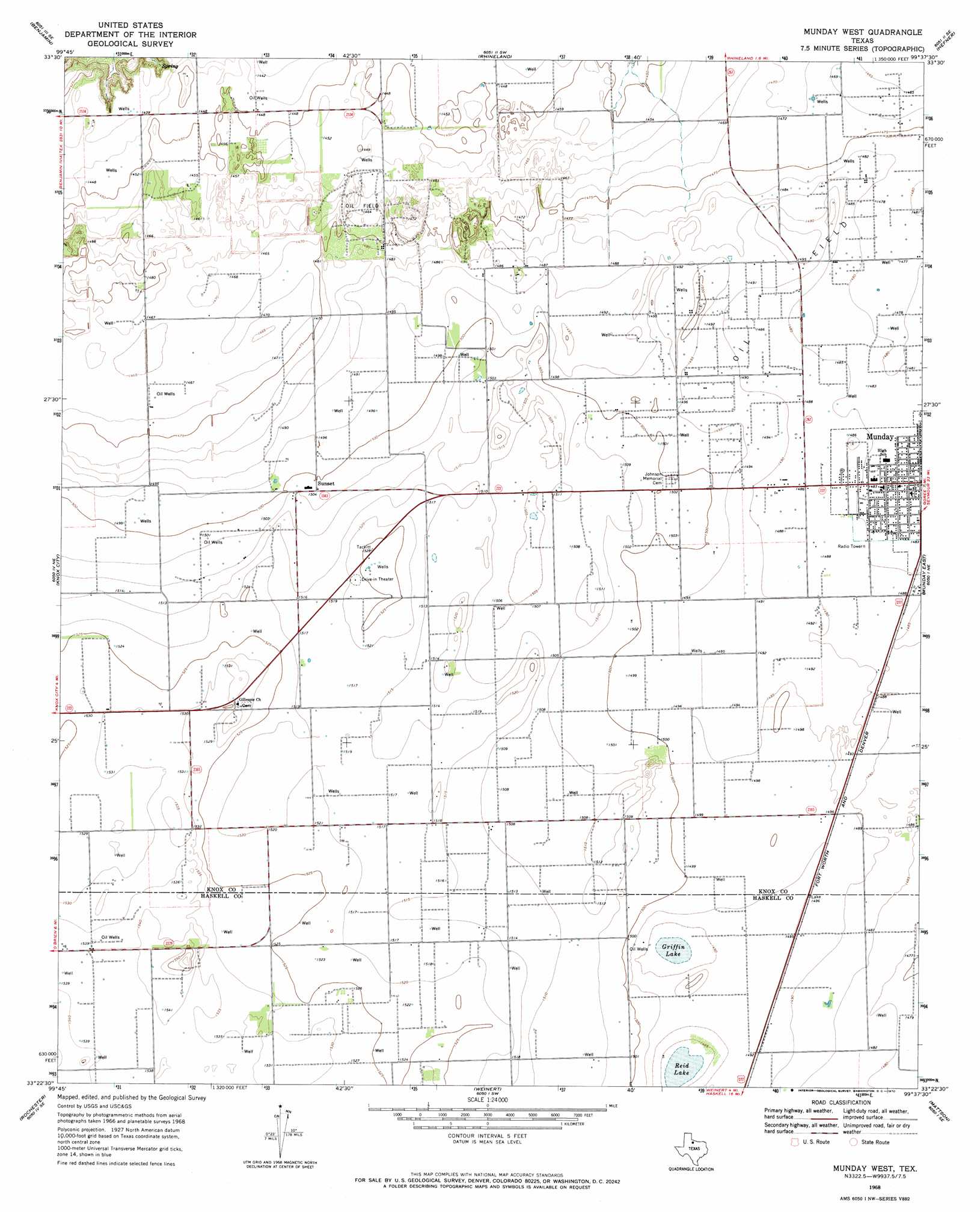
USGS Topo Quad 33099d6 - 1:24,000 scale
| Topo Map Name: | Munday West |
| USGS Topo Quad ID: | 33099d6 |
| Print Size: | ca. 21 1/4" wide x 27" high |
| Southeast Coordinates: | 33.375° N latitude / 99.625° W longitude |
| Map Center Coordinates: | 33.4375° N latitude / 99.6875° W longitude |
| U.S. State: | TX |
| Filename: | o33099d6.jpg |
| Download Map JPG Image: | Munday West topo map 1:24,000 scale |
| Map Type: | Topographic |
| Topo Series: | 7.5´ |
| Map Scale: | 1:24,000 |
| Source of Map Images: | United States Geological Survey (USGS) |
| Alternate Map Versions: |
Munday West TX 1968, updated 1970 Download PDF Buy paper map Munday West TX 2010 Download PDF Buy paper map Munday West TX 2013 Download PDF Buy paper map Munday West TX 2016 Download PDF Buy paper map |
1:24,000 Topo Quads surrounding Munday West
Maverick Flat |
Truscott South |
Gilliland |
Vera |
Soap Creek |
Cedar Mountain |
Benjamin |
Rhineland |
Hefner |
Bomarton |
Knox City Nw |
Knox City |
Munday West |
Munday East |
Antelope Creek Nw |
Jud |
Rochester |
Weinert |
Mattson |
Antelope Creek Sw |
Rule |
Pinkerton |
Haskell |
Irby |
Reynolds Bend Nw |
> Back to 33099a1 at 1:100,000 scale
> Back to 33098a1 at 1:250,000 scale
> Back to U.S. Topo Maps home
Munday West topo map: Gazetteer
Munday West: Lakes
Griffin Lake elevation 453m 1486′Reid Lake elevation 452m 1482′
Munday West: Populated Places
Sunset elevation 458m 1502′Munday West digital topo map on disk
Buy this Munday West topo map showing relief, roads, GPS coordinates and other geographical features, as a high-resolution digital map file on DVD: