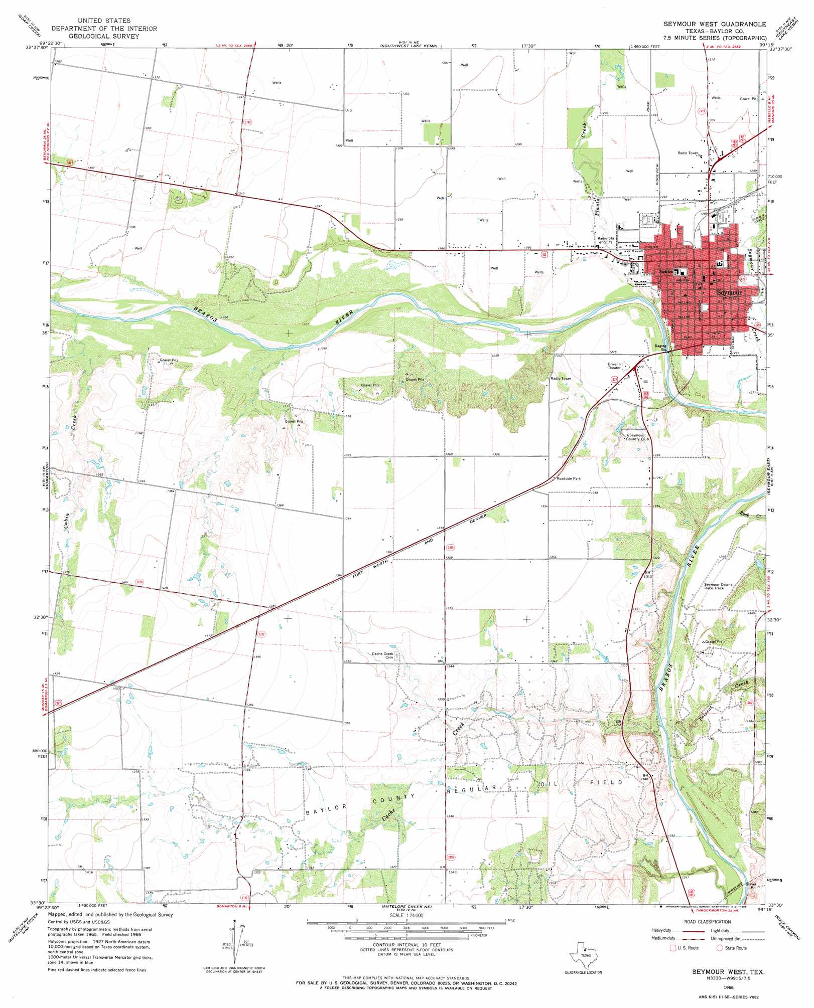
Seymour West Topo Map Texas
To zoom in, hover over the map of Seymour West
USGS Topo Quad 33099e3 - 1:24,000 scale
| Topo Map Name: | Seymour West |
| USGS Topo Quad ID: | 33099e3 |
| Print Size: | ca. 21 1/4" wide x 27" high |
| Southeast Coordinates: | 33.5° N latitude / 99.25° W longitude |
| Map Center Coordinates: | 33.5625° N latitude / 99.3125° W longitude |
| U.S. State: | TX |
| Filename: | o33099e3.jpg |
| Download Map JPG Image: | Seymour West topo map 1:24,000 scale |
| Map Type: | Topographic |
| Topo Series: | 7.5´ |
| Map Scale: | 1:24,000 |
| Source of Map Images: | United States Geological Survey (USGS) |
| Alternate Map Versions: |
Seymour West TX 1966, updated 1968 Download PDF Buy paper map Seymour West TX 2010 Download PDF Buy paper map Seymour West TX 2013 Download PDF Buy paper map Seymour West TX 2016 Download PDF Buy paper map |
1:24,000 Topo Quads surrounding Seymour West
Colwell Creek |
Santa Rosa Lake Sw |
Northwest Lake Kemp |
Northeast Lake Kemp |
Franklin Bend |
Vera |
Soap Creek |
Southwest Lake Kemp |
Southeast Lake Kemp |
Fulda |
Hefner |
Bomarton |
Seymour West |
Seymour East |
Cope Branch |
Munday East |
Antelope Creek Nw |
Antelope Creek Ne |
Rock Canyon |
Westover |
Mattson |
Antelope Creek Sw |
Antelope Creek Se |
Westover Sw |
Westover Se |
> Back to 33099e1 at 1:100,000 scale
> Back to 33098a1 at 1:250,000 scale
> Back to U.S. Topo Maps home
Seymour West topo map: Gazetteer
Seymour West: Dams
Seymour Country Club Dam elevation 400m 1312′Seymour West: Oilfields
Baylor County Regular Oil Field elevation 413m 1354′Seymour West: Populated Places
Seymour elevation 393m 1289′Seymour West: Reservoirs
Seymour Country Club Lake elevation 400m 1312′Seymour West: Springs
Buffalo Springs elevation 397m 1302′Fancher Spring elevation 405m 1328′
Seymour West: Streams
Cabin Creek elevation 386m 1266′Cache Creek elevation 374m 1227′
Plants Creek elevation 382m 1253′
Polecat Creek elevation 375m 1230′
Rock Creek elevation 378m 1240′
Seymour Creek elevation 380m 1246′
Seymour West digital topo map on disk
Buy this Seymour West topo map showing relief, roads, GPS coordinates and other geographical features, as a high-resolution digital map file on DVD: