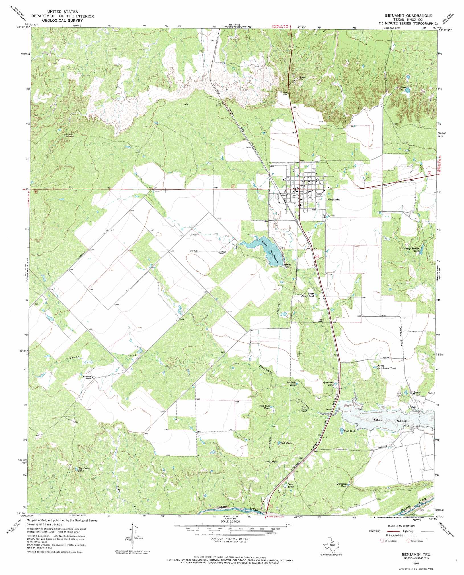
Benjamin Topo Map Texas
To zoom in, hover over the map of Benjamin
USGS Topo Quad 33099e7 - 1:24,000 scale
| Topo Map Name: | Benjamin |
| USGS Topo Quad ID: | 33099e7 |
| Print Size: | ca. 21 1/4" wide x 27" high |
| Southeast Coordinates: | 33.5° N latitude / 99.75° W longitude |
| Map Center Coordinates: | 33.5625° N latitude / 99.8125° W longitude |
| U.S. State: | TX |
| Filename: | o33099e7.jpg |
| Download Map JPG Image: | Benjamin topo map 1:24,000 scale |
| Map Type: | Topographic |
| Topo Series: | 7.5´ |
| Map Scale: | 1:24,000 |
| Source of Map Images: | United States Geological Survey (USGS) |
| Alternate Map Versions: |
Benjamin TX 1967, updated 1969 Download PDF Buy paper map Benjamin TX 2010 Download PDF Buy paper map Benjamin TX 2013 Download PDF Buy paper map Benjamin TX 2016 Download PDF Buy paper map |
1:24,000 Topo Quads surrounding Benjamin
Lowrance Mountain |
Big Four Ranch |
Truscott North |
Halsell Ranch |
Colwell Creek |
Ox Yoke Creek |
Maverick Flat |
Truscott South |
Gilliland |
Vera |
Buzzard Peak |
Cedar Mountain |
Benjamin |
Rhineland |
Hefner |
Kiowa Peak Ne |
Knox City Nw |
Knox City |
Munday West |
Munday East |
Kiowa Peak |
Jud |
Rochester |
Weinert |
Mattson |
> Back to 33099e1 at 1:100,000 scale
> Back to 33098a1 at 1:250,000 scale
> Back to U.S. Topo Maps home
Benjamin topo map: Gazetteer
Benjamin: Bridges
State Highway 16 Bridge elevation 418m 1371′Benjamin: Dams
Lake Benjamin Dam elevation 442m 1450′Benjamin: Populated Places
Benjamin elevation 450m 1476′Benjamin: Reservoirs
Deer Tank elevation 427m 1400′Flat Tank elevation 430m 1410′
Gyp Creek Tank elevation 457m 1499′
Jackson Tank elevation 436m 1430′
Jamison Tank elevation 426m 1397′
Lake Benjamin elevation 445m 1459′
North Dutchman Tank elevation 435m 1427′
Quintana Tank elevation 433m 1420′
Red Tank elevation 439m 1440′
Sheep Section Tank elevation 438m 1437′
South Jones Tank elevation 436m 1430′
West Side Tank elevation 439m 1440′
Benjamin: Streams
China Branch elevation 421m 1381′Benjamin digital topo map on disk
Buy this Benjamin topo map showing relief, roads, GPS coordinates and other geographical features, as a high-resolution digital map file on DVD: