Gant Hills Topo Map Texas
To zoom in, hover over the map of Gant Hills
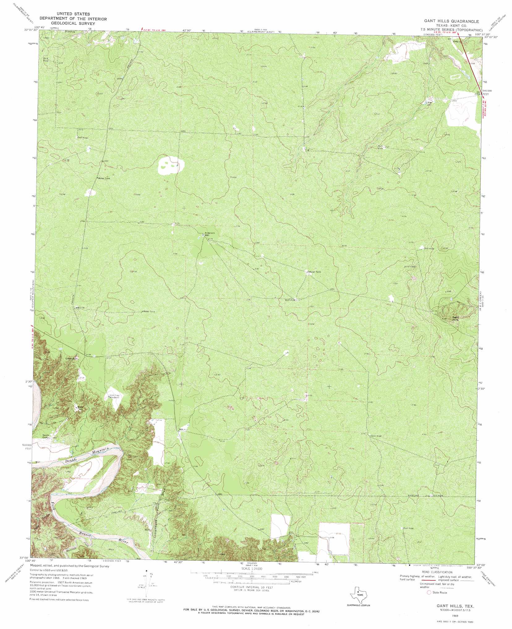
USGS Topo Quad 33100a6 - 1:24,000 scale
| Topo Map Name: | Gant Hills |
| USGS Topo Quad ID: | 33100a6 |
| Print Size: | ca. 21 1/4" wide x 27" high |
| Southeast Coordinates: | 33° N latitude / 100.625° W longitude |
| Map Center Coordinates: | 33.0625° N latitude / 100.6875° W longitude |
| U.S. State: | TX |
| Filename: | o33100a6.jpg |
| Download Map JPG Image: | Gant Hills topo map 1:24,000 scale |
| Map Type: | Topographic |
| Topo Series: | 7.5´ |
| Map Scale: | 1:24,000 |
| Source of Map Images: | United States Geological Survey (USGS) |
| Alternate Map Versions: |
Gant Hills TX 1969, updated 1972 Download PDF Buy paper map Gant Hills TX 2010 Download PDF Buy paper map Gant Hills TX 2012 Download PDF Buy paper map Gant Hills TX 2016 Download PDF Buy paper map |
1:24,000 Topo Quads surrounding Gant Hills
Spur Sw |
White Camp |
Girard |
Jayton North |
Seven Diamond L Canyon |
T-O Creek |
Clairemont West |
Clairemont East |
Jayton South |
Peacock |
Polar |
Cooper Mountain |
Gant Hills |
A B C Creek |
Double Mountains |
Mckenzie Mountains |
Maverick Creek |
Hudd |
Tige Canyon |
White Canyon |
Brand |
Lloyd Mountain |
Camp Springs |
Hobbs |
Rotan |
> Back to 33100a1 at 1:100,000 scale
> Back to 33100a1 at 1:250,000 scale
> Back to U.S. Topo Maps home
Gant Hills topo map: Gazetteer
Gant Hills: Streams
Maverick Creek elevation 582m 1909′Gant Hills: Summits
Gant Hills elevation 665m 2181′Gant Hills: Valleys
Cottonwood Pens Draw elevation 582m 1909′Eagle Canyon elevation 588m 1929′
Gant Hills: Wells
Anderson Well elevation 664m 2178′Gant Hills digital topo map on disk
Buy this Gant Hills topo map showing relief, roads, GPS coordinates and other geographical features, as a high-resolution digital map file on DVD: