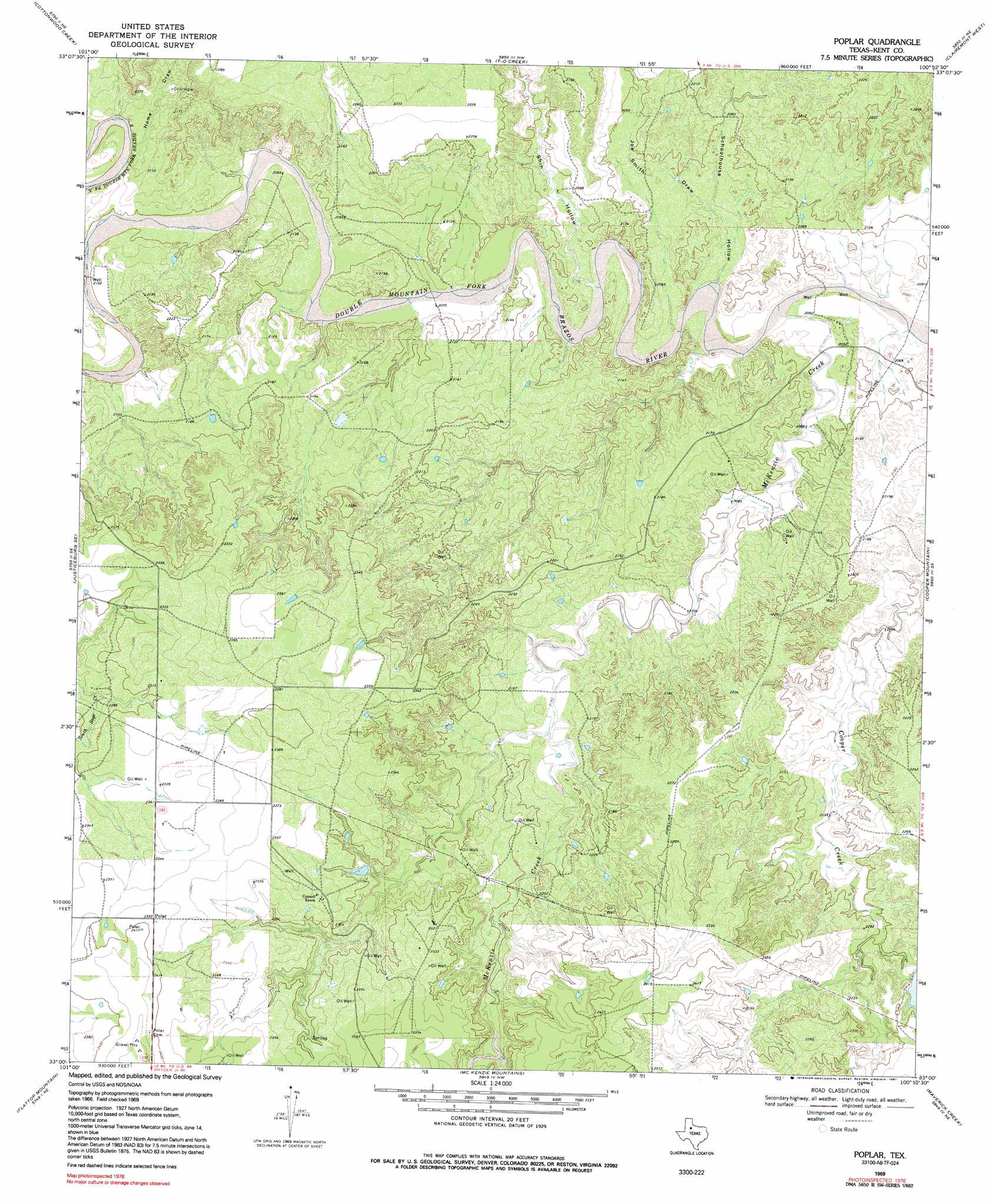
Polar Topo Map Texas
To zoom in, hover over the map of Polar
USGS Topo Quad 33100a8 - 1:24,000 scale
| Topo Map Name: | Polar |
| USGS Topo Quad ID: | 33100a8 |
| Print Size: | ca. 21 1/4" wide x 27" high |
| Southeast Coordinates: | 33° N latitude / 100.875° W longitude |
| Map Center Coordinates: | 33.0625° N latitude / 100.9375° W longitude |
| U.S. State: | TX |
| Filename: | o33100a8.jpg |
| Download Map JPG Image: | Polar topo map 1:24,000 scale |
| Map Type: | Topographic |
| Topo Series: | 7.5´ |
| Map Scale: | 1:24,000 |
| Source of Map Images: | United States Geological Survey (USGS) |
| Alternate Map Versions: |
Polar TX 1969, updated 1972 Download PDF Buy paper map Poplar TX 1969, updated 1991 Download PDF Buy paper map Polar TX 1969, updated 1999 Download PDF Buy paper map Polar TX 2010 Download PDF Buy paper map Polar TX 2012 Download PDF Buy paper map Polar TX 2016 Download PDF Buy paper map |
1:24,000 Topo Quads surrounding Polar
Verbena |
Twomile Creek |
Spur Sw |
White Camp |
Girard |
Justiceburg Nw |
Cottonwood Creek |
T-O Creek |
Clairemont West |
Clairemont East |
Justiceburg |
Justiceburg Se |
Polar |
Cooper Mountain |
Gant Hills |
Fluvanna |
Flat Top Mountain |
Mckenzie Mountains |
Maverick Creek |
Hudd |
Arah |
Dermott |
Brand |
Lloyd Mountain |
Camp Springs |
> Back to 33100a1 at 1:100,000 scale
> Back to 33100a1 at 1:250,000 scale
> Back to U.S. Topo Maps home
Polar topo map: Gazetteer
Polar: Dams
Cogdell Ranch Lake Dam elevation 686m 2250′Polar: Populated Places
Polar elevation 729m 2391′Polar: Reservoirs
Cogdell Ranch Lake elevation 686m 2250′Polar: Streams
McKenzie Creek elevation 622m 2040′Polar: Valleys
Home Draw elevation 645m 2116′Joe Smith Draw elevation 628m 2060′
Schoolhouse Hollow elevation 622m 2040′
Shin Hollow elevation 628m 2060′
Polar digital topo map on disk
Buy this Polar topo map showing relief, roads, GPS coordinates and other geographical features, as a high-resolution digital map file on DVD: