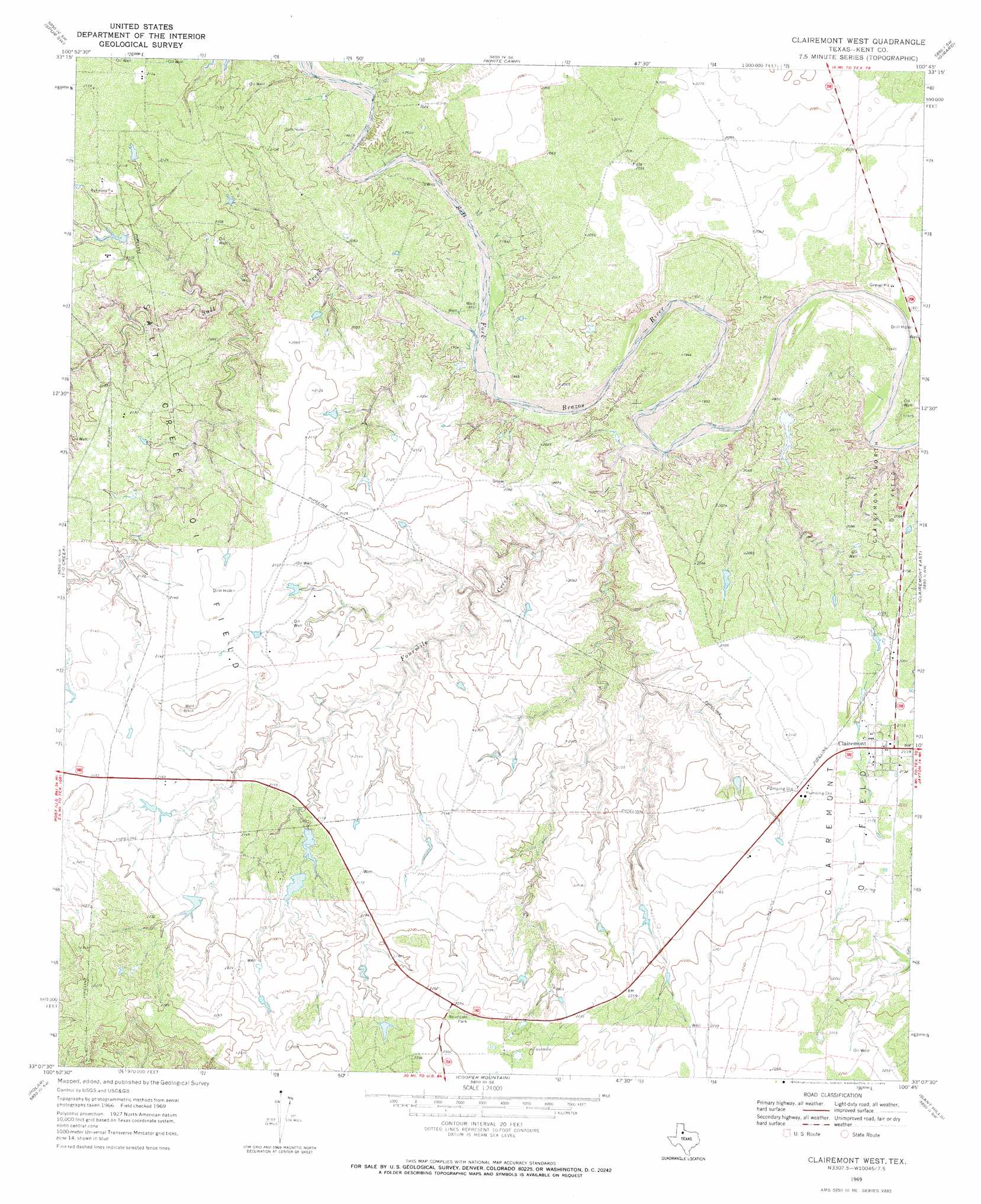
Clairemont West Topo Map Texas
To zoom in, hover over the map of Clairemont West
USGS Topo Quad 33100b7 - 1:24,000 scale
| Topo Map Name: | Clairemont West |
| USGS Topo Quad ID: | 33100b7 |
| Print Size: | ca. 21 1/4" wide x 27" high |
| Southeast Coordinates: | 33.125° N latitude / 100.75° W longitude |
| Map Center Coordinates: | 33.1875° N latitude / 100.8125° W longitude |
| U.S. State: | TX |
| Filename: | o33100b7.jpg |
| Download Map JPG Image: | Clairemont West topo map 1:24,000 scale |
| Map Type: | Topographic |
| Topo Series: | 7.5´ |
| Map Scale: | 1:24,000 |
| Source of Map Images: | United States Geological Survey (USGS) |
| Alternate Map Versions: |
Clairemont West TX 1969, updated 1972 Download PDF Buy paper map Clairemont West TX 2010 Download PDF Buy paper map Clairemont West TX 2012 Download PDF Buy paper map Clairemont West TX 2016 Download PDF Buy paper map |
1:24,000 Topo Quads surrounding Clairemont West
Smith Tank |
Spur Nw |
Spur |
Gilpin |
Pursley House |
Twomile Creek |
Spur Sw |
White Camp |
Girard |
Jayton North |
Cottonwood Creek |
T-O Creek |
Clairemont West |
Clairemont East |
Jayton South |
Justiceburg Se |
Polar |
Cooper Mountain |
Gant Hills |
A B C Creek |
Flat Top Mountain |
Mckenzie Mountains |
Maverick Creek |
Hudd |
Tige Canyon |
> Back to 33100a1 at 1:100,000 scale
> Back to 33100a1 at 1:250,000 scale
> Back to U.S. Topo Maps home
Clairemont West topo map: Gazetteer
Clairemont West: Oilfields
Clairemont Oil Field elevation 653m 2142′Salt Creek Oil Field elevation 629m 2063′
Clairemont West: Populated Places
Clairemont elevation 648m 2125′Clairemont West: Streams
Fourmile Creek elevation 591m 1938′Salt Creek elevation 596m 1955′
T-O Creek elevation 610m 2001′
Clairemont West digital topo map on disk
Buy this Clairemont West topo map showing relief, roads, GPS coordinates and other geographical features, as a high-resolution digital map file on DVD: