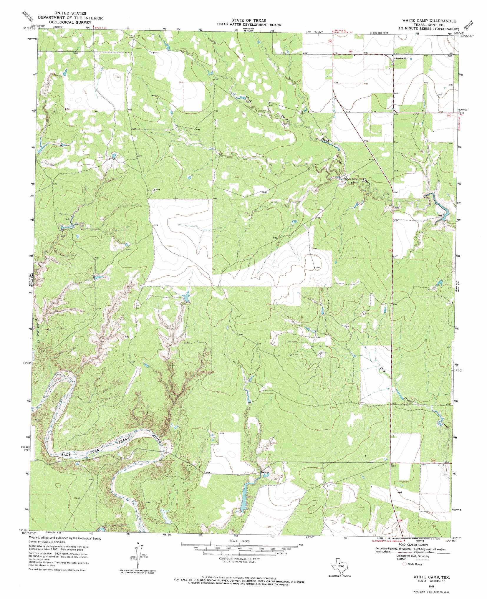
White Camp Topo Map Texas
To zoom in, hover over the map of White Camp
USGS Topo Quad 33100c7 - 1:24,000 scale
| Topo Map Name: | White Camp |
| USGS Topo Quad ID: | 33100c7 |
| Print Size: | ca. 21 1/4" wide x 27" high |
| Southeast Coordinates: | 33.25° N latitude / 100.75° W longitude |
| Map Center Coordinates: | 33.3125° N latitude / 100.8125° W longitude |
| U.S. State: | TX |
| Filename: | o33100c7.jpg |
| Download Map JPG Image: | White Camp topo map 1:24,000 scale |
| Map Type: | Topographic |
| Topo Series: | 7.5´ |
| Map Scale: | 1:24,000 |
| Source of Map Images: | United States Geological Survey (USGS) |
| Alternate Map Versions: |
White Camp TX 1968, updated 1970 Download PDF Buy paper map White Camp TX 2010 Download PDF Buy paper map White Camp TX 2012 Download PDF Buy paper map White Camp TX 2016 Download PDF Buy paper map |
1:24,000 Topo Quads surrounding White Camp
Bunker Hill |
Foreman Chapel |
Dickens South |
Croton Camp |
Pitchfork Ranch |
Smith Tank |
Spur Nw |
Spur |
Gilpin |
Pursley House |
Twomile Creek |
Spur Sw |
White Camp |
Girard |
Jayton North |
Cottonwood Creek |
T-O Creek |
Clairemont West |
Clairemont East |
Jayton South |
Justiceburg Se |
Polar |
Cooper Mountain |
Gant Hills |
A B C Creek |
> Back to 33100a1 at 1:100,000 scale
> Back to 33100a1 at 1:250,000 scale
> Back to U.S. Topo Maps home
White Camp topo map: Gazetteer
White Camp: Dams
Hagins Panther Canyon Lake Dam elevation 633m 2076′Mrs J H Brown Lake Dam elevation 626m 2053′
Pouroff Lake Dam elevation 628m 2060′
White Camp: Reservoirs
Hagins Panther Canyon Lake elevation 633m 2076′Mrs J H Brown Lake elevation 626m 2053′
Pouroff Lake elevation 628m 2060′
White Camp digital topo map on disk
Buy this White Camp topo map showing relief, roads, GPS coordinates and other geographical features, as a high-resolution digital map file on DVD: