J Y Ranch Topo Map Texas
To zoom in, hover over the map of J Y Ranch
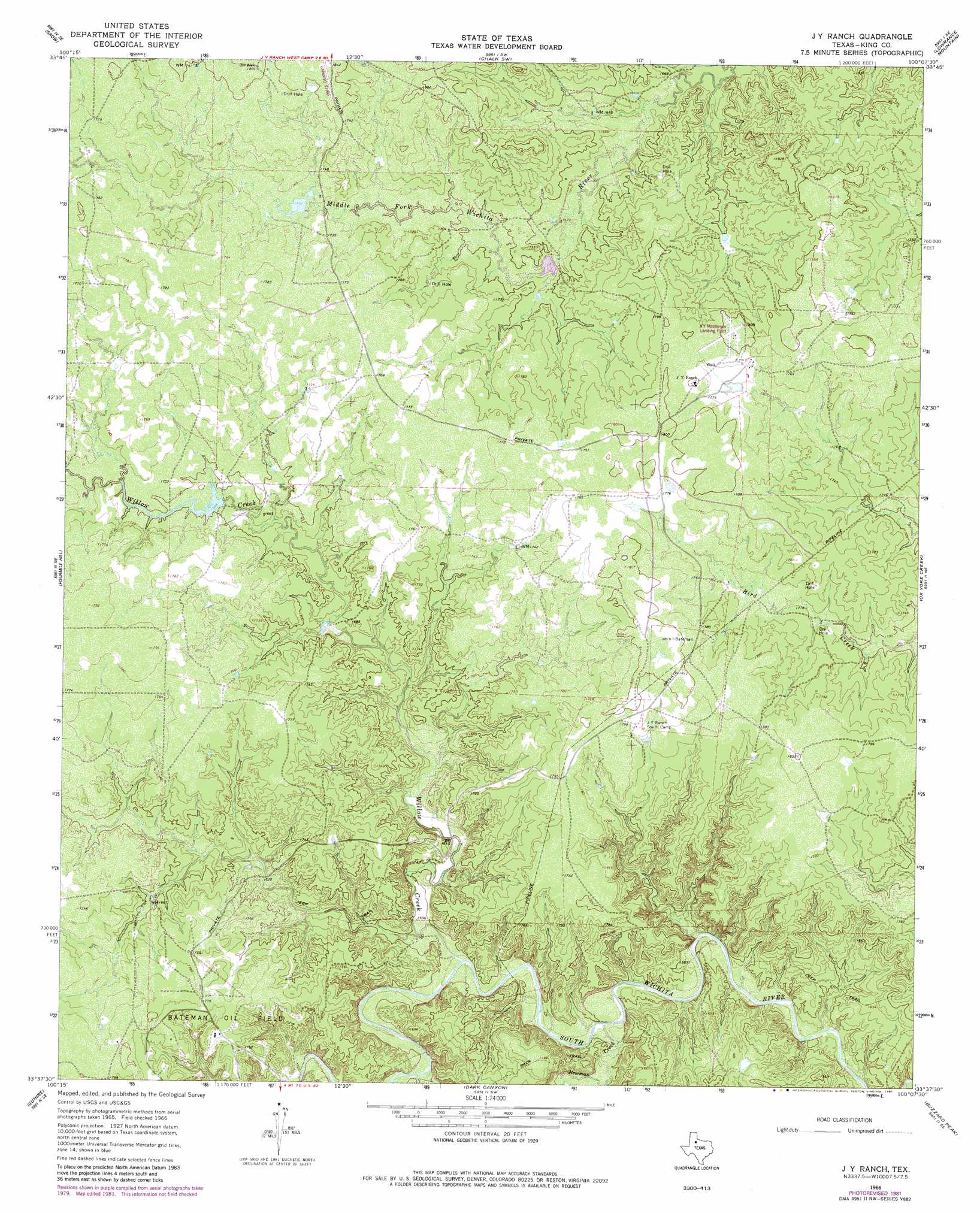
USGS Topo Quad 33100f2 - 1:24,000 scale
| Topo Map Name: | J Y Ranch |
| USGS Topo Quad ID: | 33100f2 |
| Print Size: | ca. 21 1/4" wide x 27" high |
| Southeast Coordinates: | 33.625° N latitude / 100.125° W longitude |
| Map Center Coordinates: | 33.6875° N latitude / 100.1875° W longitude |
| U.S. State: | TX |
| Filename: | o33100f2.jpg |
| Download Map JPG Image: | J Y Ranch topo map 1:24,000 scale |
| Map Type: | Topographic |
| Topo Series: | 7.5´ |
| Map Scale: | 1:24,000 |
| Source of Map Images: | United States Geological Survey (USGS) |
| Alternate Map Versions: |
J Y Ranch TX 1966, updated 1969 Download PDF Buy paper map J Y Ranch TX 1966, updated 1981 Download PDF Buy paper map J Y Ranch TX 2010 Download PDF Buy paper map J Y Ranch TX 2012 Download PDF Buy paper map J Y Ranch TX 2016 Download PDF Buy paper map |
1:24,000 Topo Quads surrounding J Y Ranch
Grow Nw |
Ginsite |
Chalk |
Y Ranch |
Boiling Spring |
Buffalo Creek |
Grow |
Chalk Sw |
Lowrance Mountain |
Big Four Ranch |
Guthrie Nw |
Fourmile Hill |
J Y Ranch |
Ox Yoke Creek |
Maverick Flat |
Pitchfork Flats |
Guthrie |
Dark Canyon |
Buzzard Peak |
Cedar Mountain |
Southerland Canyon |
Bob Creek |
Kiowa Peak Nw |
Kiowa Peak Ne |
Knox City Nw |
> Back to 33100e1 at 1:100,000 scale
> Back to 33100a1 at 1:250,000 scale
> Back to U.S. Topo Maps home
J Y Ranch topo map: Gazetteer
J Y Ranch: Airports
J Y Ranch-R B Masterson III Estate Airport elevation 551m 1807′J Y Ranch: Oilfields
Bateman Oil Field elevation 539m 1768′J Y Ranch: Streams
Newman Creek elevation 476m 1561′Willow Creek elevation 481m 1578′
J Y Ranch digital topo map on disk
Buy this J Y Ranch topo map showing relief, roads, GPS coordinates and other geographical features, as a high-resolution digital map file on DVD: