Chalk Sw Topo Map Texas
To zoom in, hover over the map of Chalk Sw
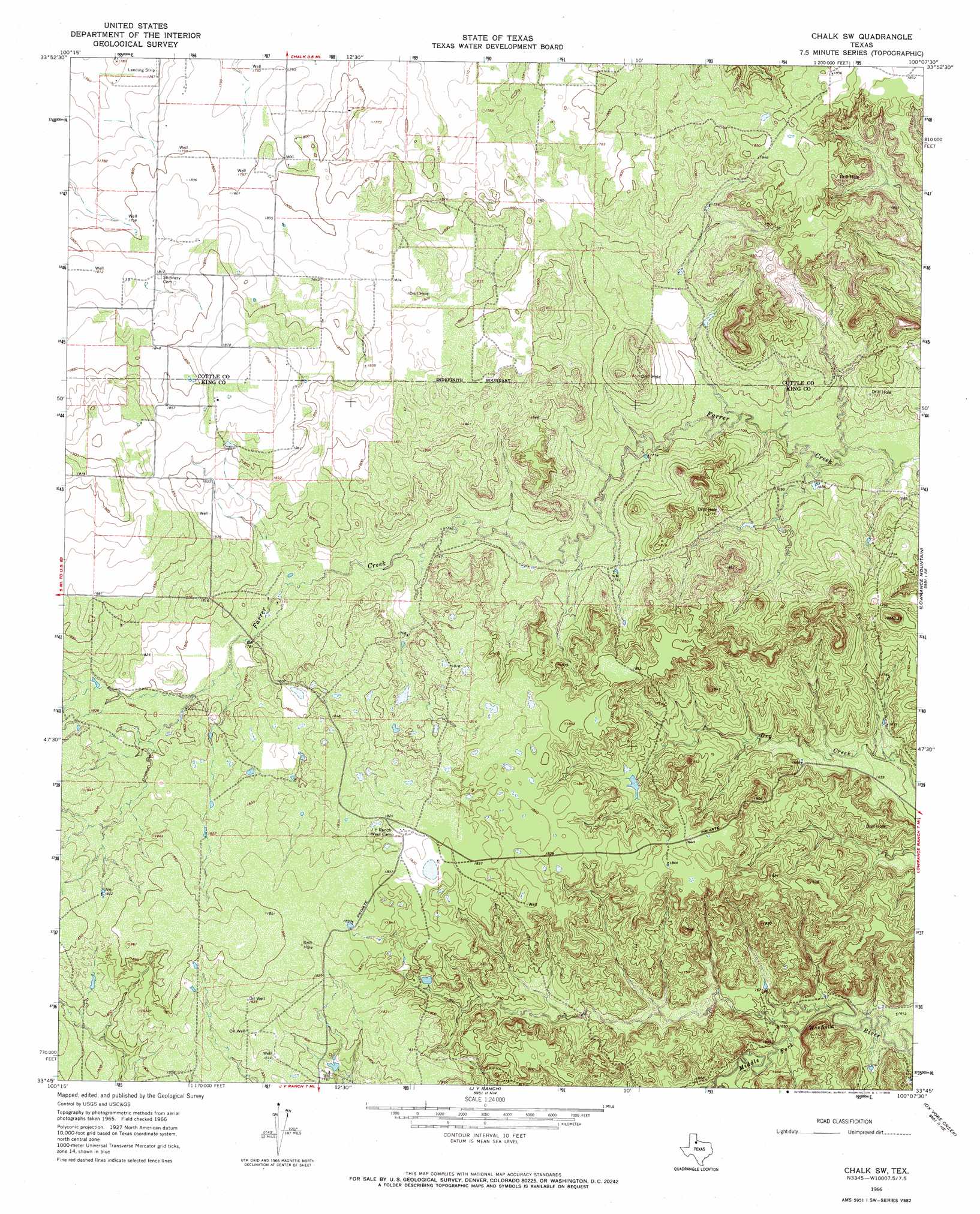
USGS Topo Quad 33100g2 - 1:24,000 scale
| Topo Map Name: | Chalk Sw |
| USGS Topo Quad ID: | 33100g2 |
| Print Size: | ca. 21 1/4" wide x 27" high |
| Southeast Coordinates: | 33.75° N latitude / 100.125° W longitude |
| Map Center Coordinates: | 33.8125° N latitude / 100.1875° W longitude |
| U.S. State: | TX |
| Filename: | o33100g2.jpg |
| Download Map JPG Image: | Chalk Sw topo map 1:24,000 scale |
| Map Type: | Topographic |
| Topo Series: | 7.5´ |
| Map Scale: | 1:24,000 |
| Source of Map Images: | United States Geological Survey (USGS) |
| Alternate Map Versions: |
Chalk SW TX 1966, updated 1969 Download PDF Buy paper map Chalk SW TX 2010 Download PDF Buy paper map Chalk SW TX 2012 Download PDF Buy paper map Chalk SW TX 2016 Download PDF Buy paper map |
1:24,000 Topo Quads surrounding Chalk Sw
Devils Canyon |
Paducah |
Moons Camp |
Triangle Ranch |
Vivian |
Grow Nw |
Ginsite |
Chalk |
Y Ranch |
Boiling Spring |
Buffalo Creek |
Grow |
Chalk Sw |
Lowrance Mountain |
Big Four Ranch |
Guthrie Nw |
Fourmile Hill |
J Y Ranch |
Ox Yoke Creek |
Maverick Flat |
Pitchfork Flats |
Guthrie |
Dark Canyon |
Buzzard Peak |
Cedar Mountain |
> Back to 33100e1 at 1:100,000 scale
> Back to 33100a1 at 1:250,000 scale
> Back to U.S. Topo Maps home
No gazetteer data is available for the Chalk Sw topo map sheet.
Chalk Sw digital topo map on disk
Buy this Chalk Sw topo map showing relief, roads, GPS coordinates and other geographical features, as a high-resolution digital map file on DVD: