New Lynn Topo Map Texas
To zoom in, hover over the map of New Lynn
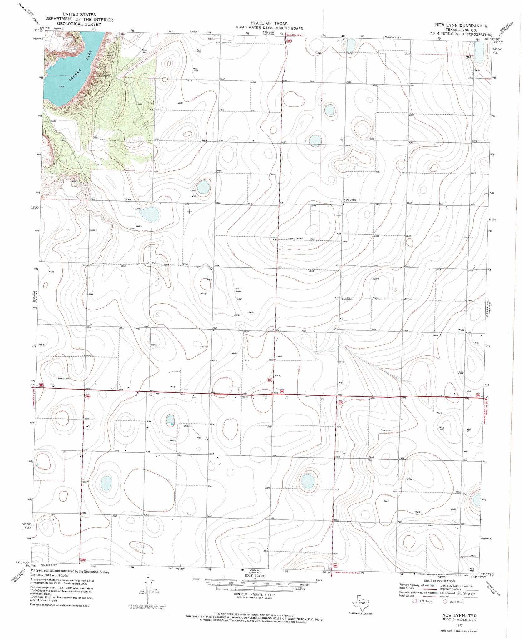
USGS Topo Quad 33101b6 - 1:24,000 scale
| Topo Map Name: | New Lynn |
| USGS Topo Quad ID: | 33101b6 |
| Print Size: | ca. 21 1/4" wide x 27" high |
| Southeast Coordinates: | 33.125° N latitude / 101.625° W longitude |
| Map Center Coordinates: | 33.1875° N latitude / 101.6875° W longitude |
| U.S. State: | TX |
| Filename: | o33101b6.jpg |
| Download Map JPG Image: | New Lynn topo map 1:24,000 scale |
| Map Type: | Topographic |
| Topo Series: | 7.5´ |
| Map Scale: | 1:24,000 |
| Source of Map Images: | United States Geological Survey (USGS) |
| Alternate Map Versions: |
New Lynn TX 1970, updated 1971 Download PDF Buy paper map New Lynn TX 2010 Download PDF Buy paper map New Lynn TX 2012 Download PDF Buy paper map New Lynn TX 2016 Download PDF Buy paper map |
1:24,000 Topo Quads surrounding New Lynn
Slide |
Woodrow |
Slaton |
Slaton Ne |
Cap Rock |
New Home |
New Home Se |
Wilson |
Southland |
South Dokegood Creek |
Double Lakes |
Tahoka |
New Lynn |
Grassland |
Post West |
Tahoka Sw |
Skeen Lake |
Draw |
Grassland Se |
Middle Creek |
Gooch Lake |
O'Donnell |
Indian Canyon Nw |
Indian Canyon Ne |
Beal Hollow |
> Back to 33101a1 at 1:100,000 scale
> Back to 33100a1 at 1:250,000 scale
> Back to U.S. Topo Maps home
New Lynn topo map: Gazetteer
New Lynn: Lakes
Tahoka Lake elevation 909m 2982′New Lynn: Populated Places
New Lynn elevation 936m 3070′New Lynn digital topo map on disk
Buy this New Lynn topo map showing relief, roads, GPS coordinates and other geographical features, as a high-resolution digital map file on DVD: