Double Lakes Topo Map Texas
To zoom in, hover over the map of Double Lakes
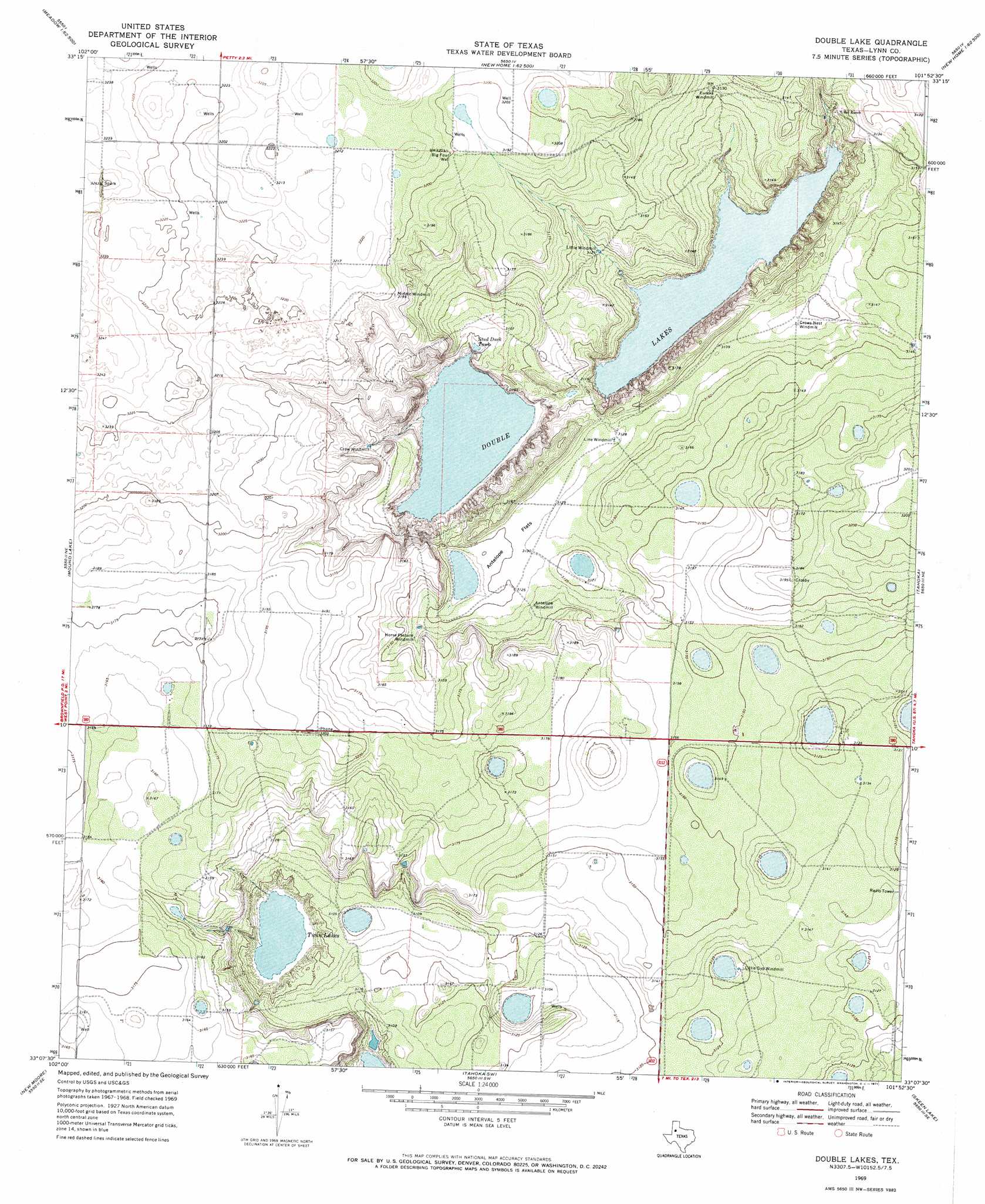
USGS Topo Quad 33101b8 - 1:24,000 scale
| Topo Map Name: | Double Lakes |
| USGS Topo Quad ID: | 33101b8 |
| Print Size: | ca. 21 1/4" wide x 27" high |
| Southeast Coordinates: | 33.125° N latitude / 101.875° W longitude |
| Map Center Coordinates: | 33.1875° N latitude / 101.9375° W longitude |
| U.S. State: | TX |
| Filename: | o33101b8.jpg |
| Download Map JPG Image: | Double Lakes topo map 1:24,000 scale |
| Map Type: | Topographic |
| Topo Series: | 7.5´ |
| Map Scale: | 1:24,000 |
| Source of Map Images: | United States Geological Survey (USGS) |
| Alternate Map Versions: |
Double Lakes TX 1969, updated 1971 Download PDF Buy paper map Double Lakes TX 2010 Download PDF Buy paper map Double Lakes TX 2012 Download PDF Buy paper map Double Lakes TX 2016 Download PDF Buy paper map |
1:24,000 Topo Quads surrounding Double Lakes
Ropesville |
Busterville |
Slide |
Woodrow |
Slaton |
Meadow |
Meadow Se |
New Home |
New Home Se |
Wilson |
Brownfield East |
Mound Lake |
Double Lakes |
Tahoka |
New Lynn |
Union School |
New Moore |
Tahoka Sw |
Skeen Lake |
Draw |
Welch West |
Welch East |
Gooch Lake |
O'Donnell |
Indian Canyon Nw |
> Back to 33101a1 at 1:100,000 scale
> Back to 33100a1 at 1:250,000 scale
> Back to U.S. Topo Maps home
Double Lakes topo map: Gazetteer
Double Lakes: Flats
Antelope Flats elevation 953m 3126′Double Lakes: Lakes
Double Lakes elevation 941m 3087′Twin Lakes elevation 935m 3067′
Double Lakes: Reservoirs
Stud Duck Tank elevation 945m 3100′Double Lakes: Wells
Big Four Well elevation 976m 3202′Double Lakes digital topo map on disk
Buy this Double Lakes topo map showing relief, roads, GPS coordinates and other geographical features, as a high-resolution digital map file on DVD: