Twomile Creek Topo Map Texas
To zoom in, hover over the map of Twomile Creek
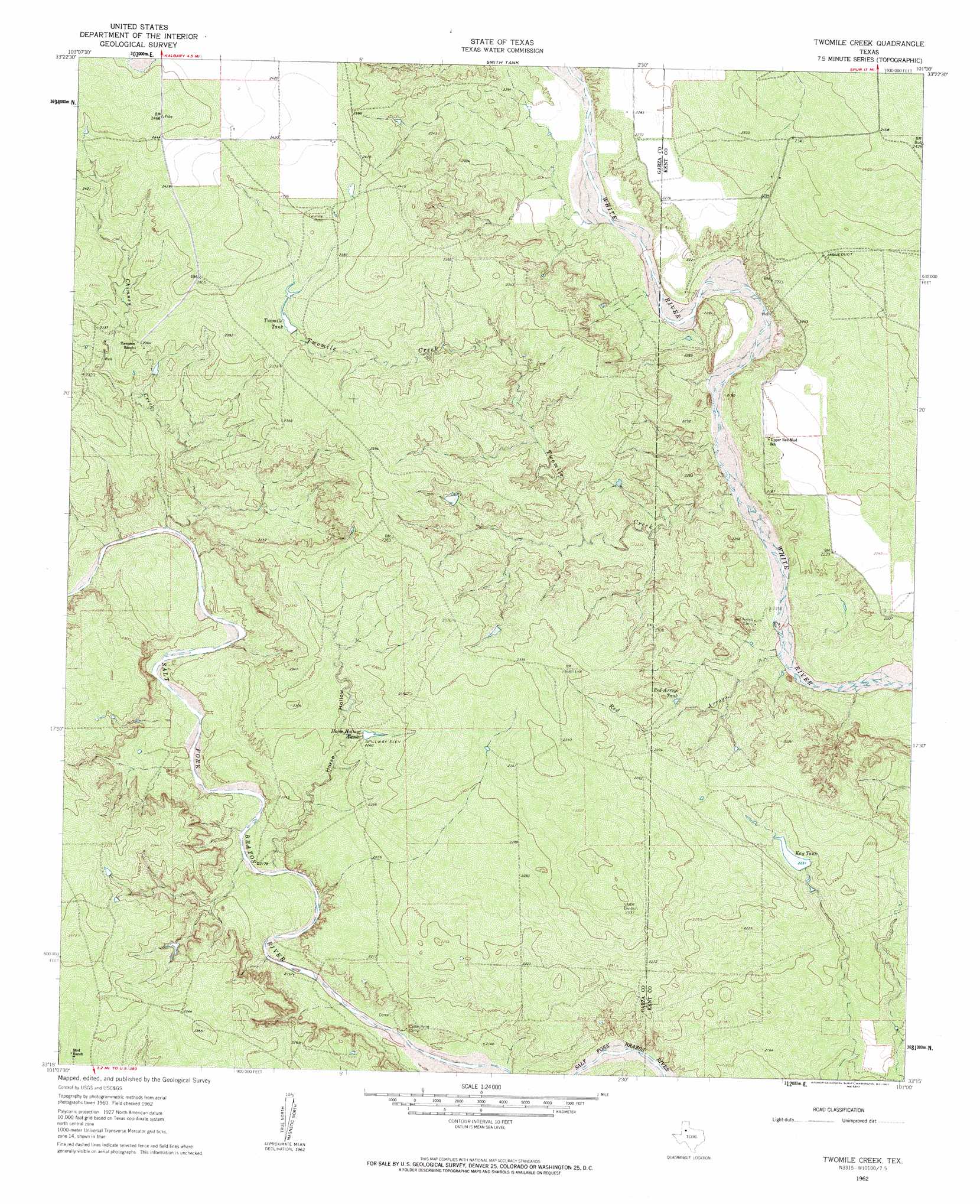
USGS Topo Quad 33101c1 - 1:24,000 scale
| Topo Map Name: | Twomile Creek |
| USGS Topo Quad ID: | 33101c1 |
| Print Size: | ca. 21 1/4" wide x 27" high |
| Southeast Coordinates: | 33.25° N latitude / 101° W longitude |
| Map Center Coordinates: | 33.3125° N latitude / 101.0625° W longitude |
| U.S. State: | TX |
| Filename: | o33101c1.jpg |
| Download Map JPG Image: | Twomile Creek topo map 1:24,000 scale |
| Map Type: | Topographic |
| Topo Series: | 7.5´ |
| Map Scale: | 1:24,000 |
| Source of Map Images: | United States Geological Survey (USGS) |
| Alternate Map Versions: |
Twomile Creek TX 1962, updated 1963 Download PDF Buy paper map Twomile Creek TX 2010 Download PDF Buy paper map Twomile Creek TX 2012 Download PDF Buy paper map Twomile Creek TX 2016 Download PDF Buy paper map |
1:24,000 Topo Quads surrounding Twomile Creek
Ralls Se |
Collett Springs |
Bunker Hill |
Foreman Chapel |
Dickens South |
Canyon Valley |
Kalgary |
Smith Tank |
Spur Nw |
Spur |
Cap Rock Se |
Verbena |
Twomile Creek |
Spur Sw |
White Camp |
Post East |
Justiceburg Nw |
Cottonwood Creek |
T-O Creek |
Clairemont West |
Cooper Creek |
Justiceburg |
Justiceburg Se |
Polar |
Cooper Mountain |
> Back to 33101a1 at 1:100,000 scale
> Back to 33100a1 at 1:250,000 scale
> Back to U.S. Topo Maps home
Twomile Creek topo map: Gazetteer
Twomile Creek: Reservoirs
Horse Hollow Tank elevation 689m 2260′Kay Tank elevation 680m 2230′
Twomile Tank elevation 719m 2358′
Twomile Creek: Streams
Chimney Creek elevation 671m 2201′Twomile Creek elevation 660m 2165′
Twomile Creek: Valleys
Horse Hollow elevation 663m 2175′Red Arroyo elevation 655m 2148′
Twomile Creek digital topo map on disk
Buy this Twomile Creek topo map showing relief, roads, GPS coordinates and other geographical features, as a high-resolution digital map file on DVD: